When people say “Everything’s bigger in Texas,” they’re not kidding.
Texas isn’t just a state—it’s a massive chunk of land that could leave your jaw on the floor when you really think about how it compares to other places.
Ever wondered how Texas stacks up next to some of the smallest U.S. states?
Or maybe you’re curious about how it holds up against entire countries?
These maps will completely change the way you see the Lone Star State.
Get ready to explore 23 fascinating maps that put Texas’s size into a whole new perspective—you won’t believe some of these!
1. Texas Compared To Alaska

This map shows the size difference between Texas and Alaska, showing how Alaska, the largest state in the U.S., is bigger than Texas in total area.
While Texas is massive on its own, Alaska is more than twice its size, which puts Texas in second place for the biggest state by land area.
2. El Paso Is Closer To San Diego Than Houston
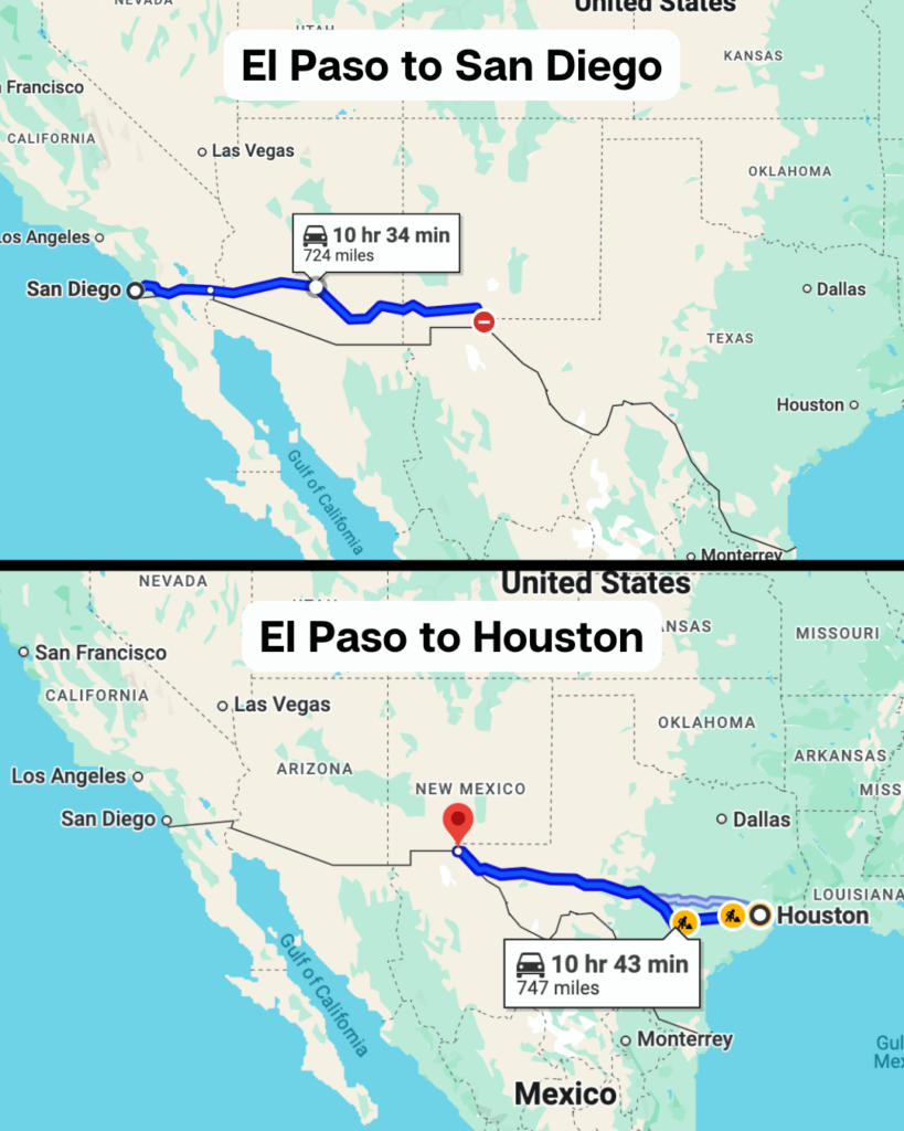
This map shows the surprising distance between cities in Texas, showing that El Paso is geographically closer to San Diego, California, than it is to Houston.
It’s a reminder of Texas’s enormous width, stretching over 800 miles from west to east.
3. Texas Compared To Rhode Island

This map compares Texas with tiny Rhode Island, the smallest state in the U.S.
You could fit Rhode Island into Texas more than 200 times, which really drives home just how enormous Texas is in comparison.
4. Texas Compared To Western Europe
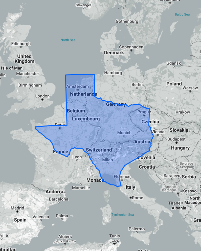
This map shows how Texas stacks up against countries in Western Europe, revealing that Texas is comparable in size to nations like France or Spain.
It’s a reminder of just how vast Texas is, fitting multiple European countries within its borders.
5. How Long It Takes To Walk Across Texas

This map shows approximately how long it would take to walk across Texas from east to west.
At roughly 832 miles, it could take over a month of non-stop walking—proof of just how massive the state really is.
6. Texas Compared To United Kingdom
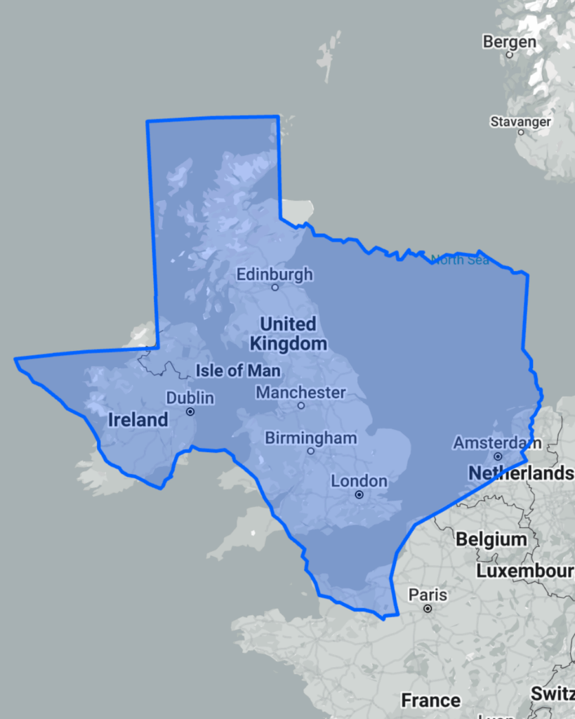
This map places Texas on top of the United Kingdom, showing that Texas is more than two and a half times larger.
It’s amazing to think the entire UK, with all its history and dense population, could easily fit inside the Lone Star State.
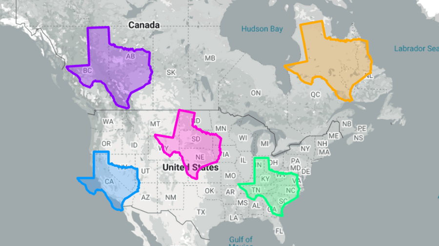
7. How Many States Fit In Texas
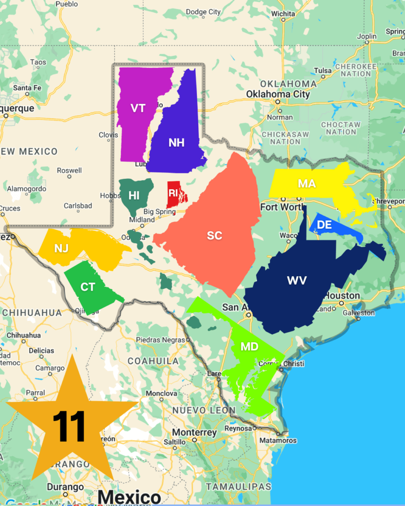
This map demonstrates how several smaller U.S. states could fit within Texas’s borders.
From states like Connecticut and Delaware to even larger ones like South Carolina, Texas can hold at least 11 of them combined!
8. Texas Compared To California
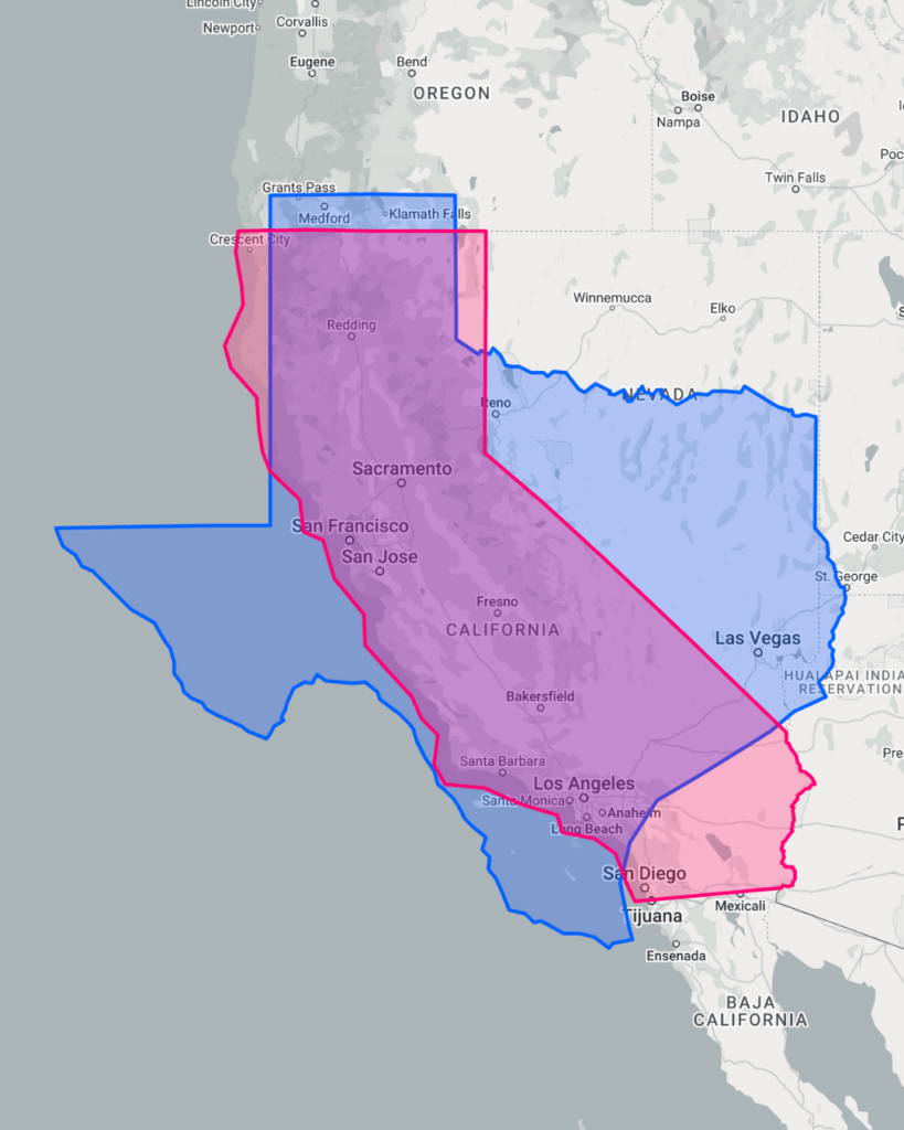
This map compares Texas to California, the third-largest state in the U.S., showing that Texas is still significantly bigger.
While California is long and narrow, Texas spreads out wider, giving it nearly 100,000 more square miles of land.
9. How Many Rhode Islands Fit Inside Texas
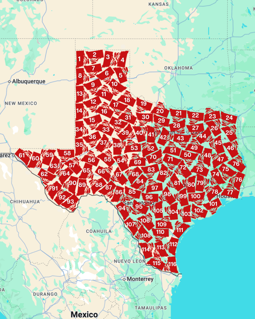
This map breaks down how many Rhode Islands could fit within Texas, we managed to fit 116 but apparently you can fit 221 if you use up all those empty spaces!
It’s a fun way to visualize just how massive Texas is compared to the smallest state in the country.
10. Texas Has A Single Ranch Bigger Than Rhode Island
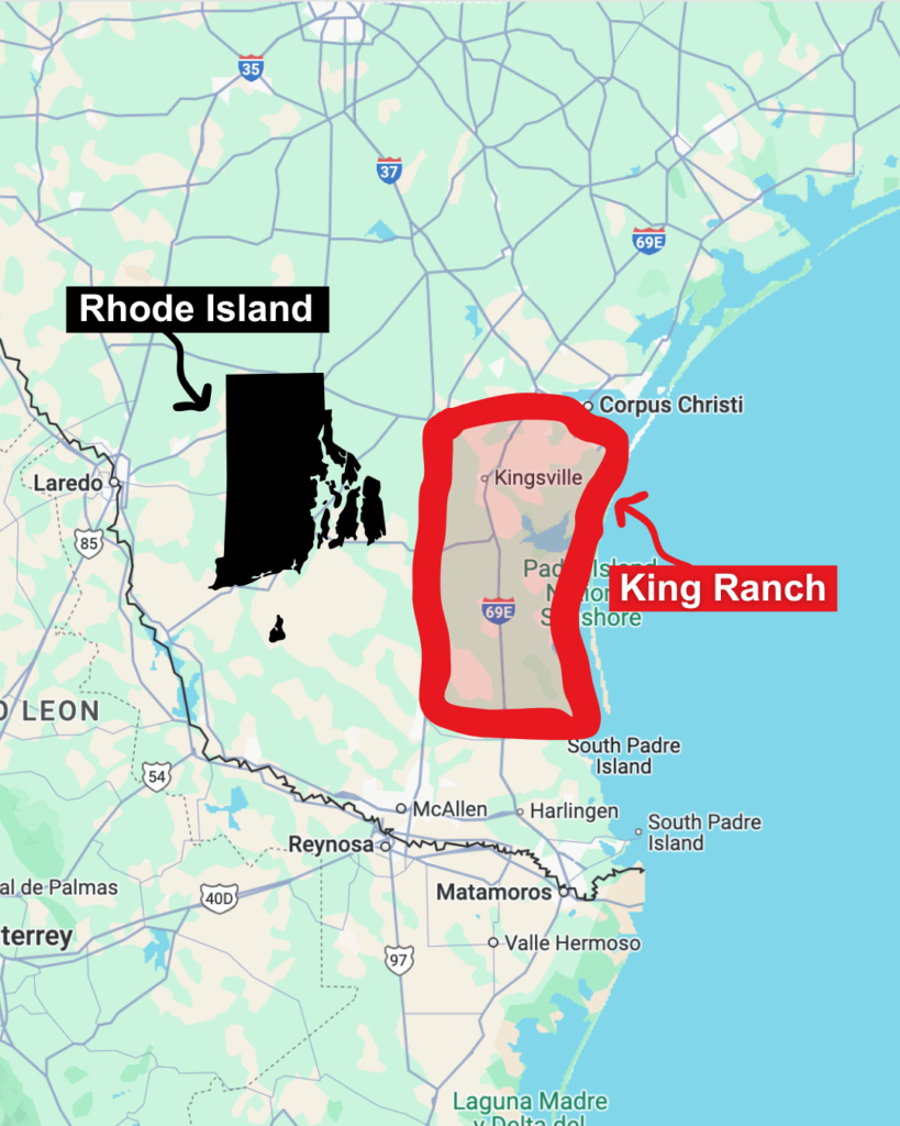
This map highlights a jaw-dropping fact: one single ranch in Texas, the King Ranch, is larger than the entire state of Rhode Island.
Spanning over 800,000 acres, this iconic ranch proves just how vast and wide-open Texas really is.
11. Texas Compared To Russia
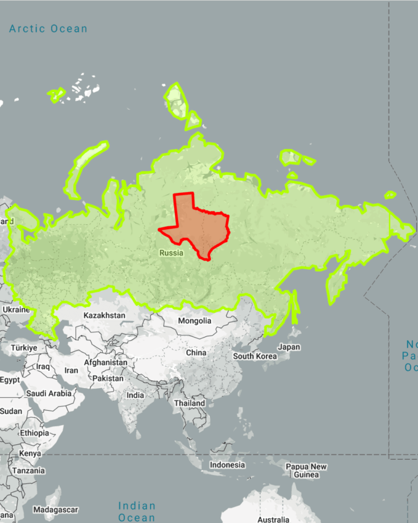
This map shows how Texas measures up to Russia, the largest country in the world.
While Texas is enormous, Russia is in a league of its own, covering an area more than 25 times larger than the Lone Star State.
12. Texas Compared To Mexico

This map compares Texas to its southern neighbor, Mexico, highlighting that Texas is about one-fifth the size of the entire country.
Despite being smaller, Texas’s size and proximity to Mexico have contributed to a deep cultural and historical connection between the two.
13. How Long It Takes To Drive Texas From Top To Bottom
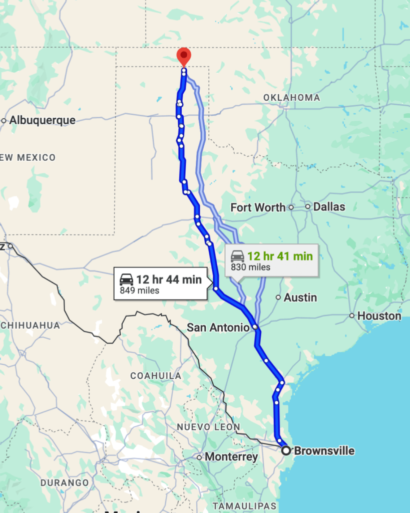
This map calculates the time it takes to drive the 800+ miles from Texas’s northern Panhandle to its southernmost tip.
At roughly 12-13 hours without stopping, it’s a road trip that really shows off the state’s towering height.
14. Texas Compared To Brazil

This map places Texas within Brazil, showing that the Lone Star State is significantly smaller than the largest country in South America.
In fact, you could fit Texas into Brazil more than eight times!
15. Dallas-Fort Worth International Airport Compared To Paris
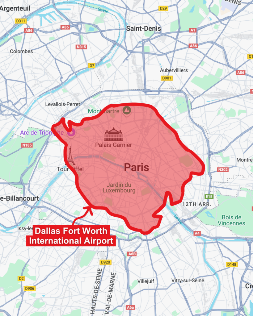
This map compares the huge Dallas-Fort Worth International Airport to the entire city of Paris, France.
Shockingly, the airport alone is almost as big as Paris, proving just how much room everything takes up in Texas—even its airports!
16. How Many European Countries Fit In Texas

This map shows how Texas can hold multiple European countries within its borders, including nations like the Netherlands, Austria and Hungary.
Depending on their size, you could fit 10 or more European countries into Texas!
17. Texas Compared To India

This map stacks Texas within India, showing that while Texas is huge, it’s only about one-fifth the size of India.
Despite the size difference, both are known for their diverse landscapes and a big sense of pride in their identities!
18. Texas Compared To Greenland
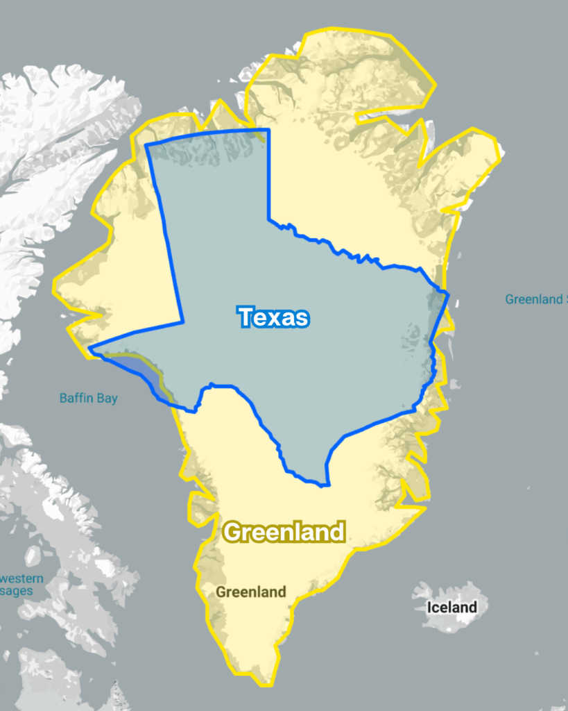
This map compares Texas to Greenland, showcasing how Greenland’s massive size dwarfs Texas.
However, much of Greenland’s size is due to map distortion—it’s still about three times larger than Texas, but the comparison isn’t as extreme as it seems on a globe.
19. Texas Compared To Egypt

This map places Texas on top of Egypt, showing that the two are surprisingly close in size.
While Egypt is slightly larger, Texas’s land area rivals this iconic North African nation known for its deserts and ancient wonders.
20. Dallas-Fort Worth Compared To Oahu
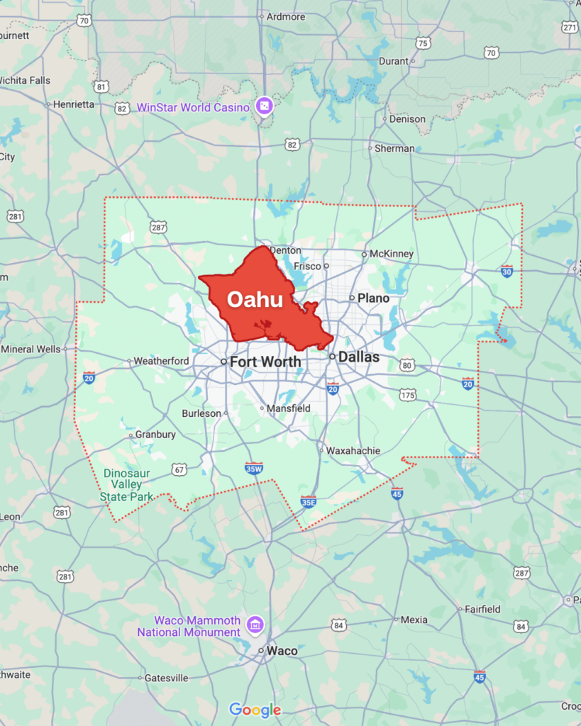
This map compares the Dallas-Fort Worth metropolitan area to the Hawaiian island of Oahu, revealing that DFW is significantly larger.
You could fit Oahu, home to Honolulu and famous beaches, several times within the space covered by DFW.
21. Texas Compared To The U.S.

This map shows how Texas measures up against the entire United States, with Texas taking up about 7% of the country’s total land area.
Its size is a testament to why Texans proudly say, “Everything’s bigger in Texas!”
22. Texas Compared To Eastern Europe
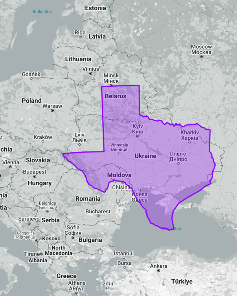
This map lines up Texas with countries in Eastern Europe, demonstrating that Texas can rival the size of multiple nations combined.
For instance, Texas is larger than Ukraine, the biggest country entirely in Europe, and could hold several smaller nations like Romania and Bulgaria within its borders.
23. Texas Compared To Korea
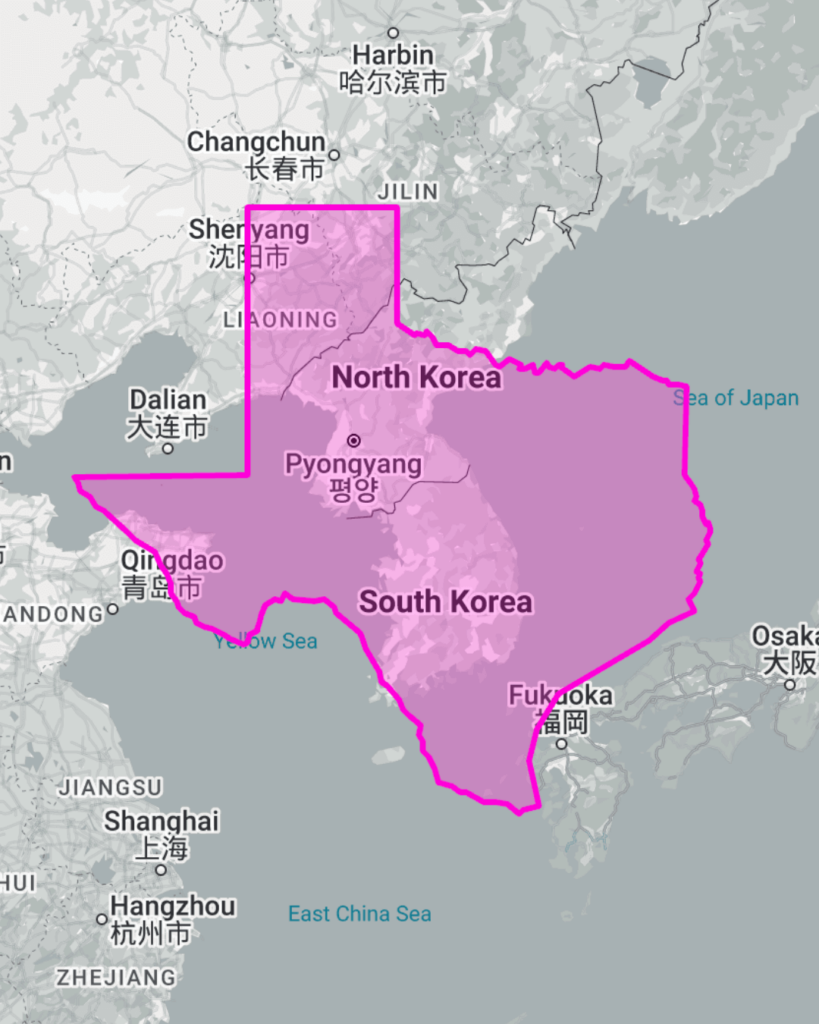
This map compares Texas with the Korean Peninsula, showing that Texas is over six times larger than South Korea and still significantly bigger even when including North Korea.
The comparison highlights the vast difference in land area, despite Korea’s dense population and global influence.
Related Posts