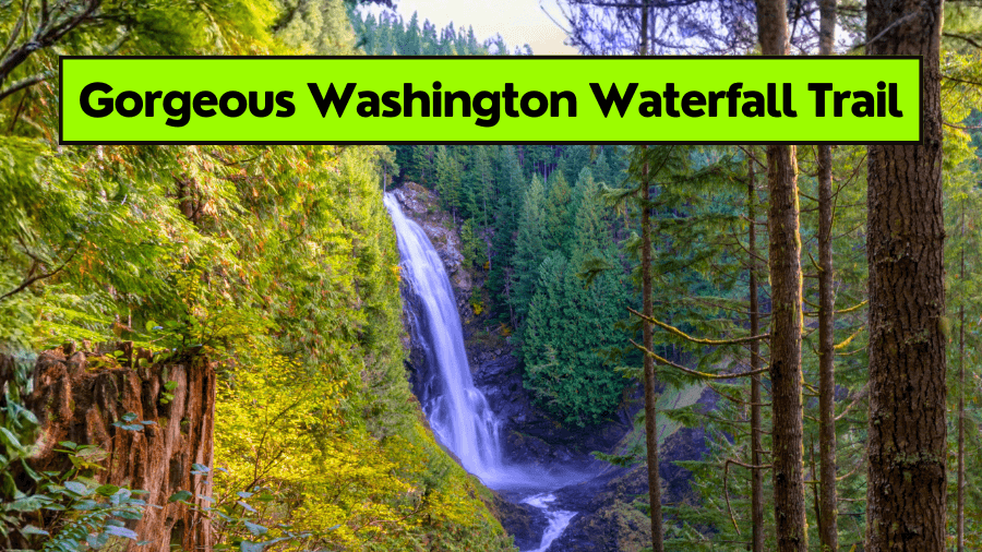
If you think you have to hike for hours just to see something amazing in Washington, think again.
There’s a trail out there that’s short, simple, and totally jaw-dropping.
We’re talking massive cliffs, a peaceful forest, and a lake so still it reflects the sky like glass.
This trail is perfect for beginners, families, or anyone who just wants an easy win with big-time views.
It’s the kind of place that feels hidden, but still easy to find if you know where to look.
So grab your hiking shoes and keep reading, because this might just be your new favorite trail in Washington.
Where Is It?
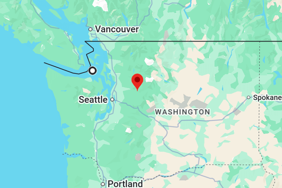
Barclay Lake is in the Mount Baker-Snoqualmie National Forest in Washington, just off Highway 2 near the tiny town of Baring.
It’s about a 1.5-hour drive from Seattle, depending on traffic, and just under 2 hours from Tacoma.
You’ll take Highway 2 east, then turn onto Barclay Creek Road (FS Road 6024), which is gravel but usually passable with a regular car when conditions are good.
About
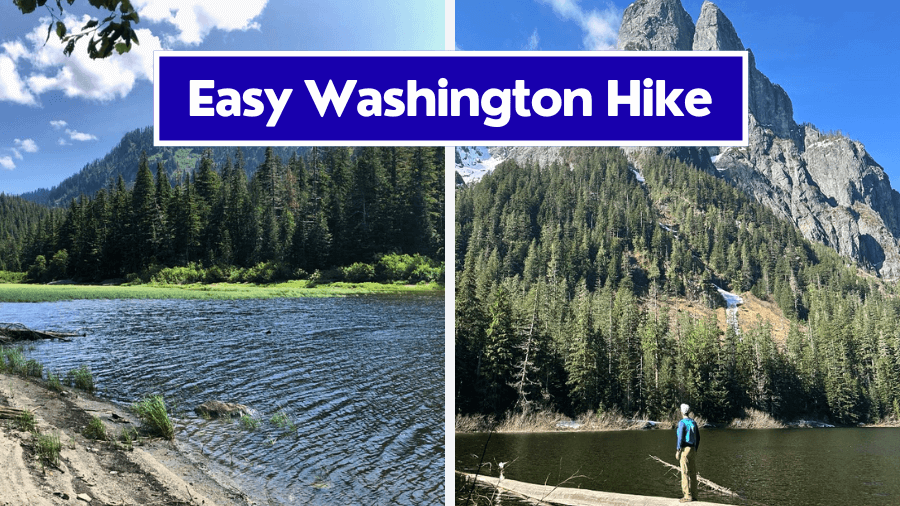
Barclay Lake is one of those Washington hikes that proves you don’t need to break a sweat for jaw-dropping views.
This trail is tucked into the wild beauty of the Central Cascades and is known for its peaceful forest vibes, easy trail, and epic views of Mount Baring towering right over the lake.
It’s part of the Mount Baker-Snoqualmie National Forest and has become a go-to spot for beginner hikers, families with kids, and anyone looking for a quick but scenic escape into nature.
The trail is about 4.4 miles round trip with roughly 500 feet of elevation gain, so it’s definitely on the easier side.
Most people can finish it in 2 to 3 hours, depending on how long you hang out at the lake.
It’s rated as easy and well-maintained, which makes it super popular during summer weekends, especially when the weather’s nice.
Barclay Lake isn’t just a day hike either. It’s also a great spot for first-time backpackers since there are primitive campsites right by the water.
So whether you’re hiking in for a quick afternoon or planning to sleep under the stars, this trail totally delivers.
What To Expect
The trail to Barclay Lake starts off nice and easy, winding through mossy forest with soft dirt underfoot and plenty of shade from tall evergreens.
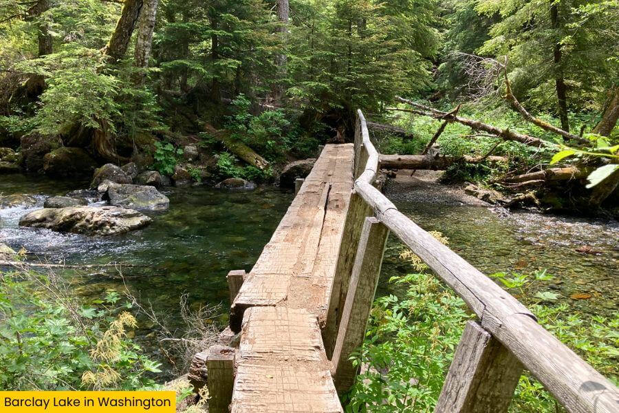
You’ll cross a sturdy wooden bridge over Barclay Creek, which usually has a good flow of water, especially in spring and early summer.
Expect some roots and rocks along the way, but nothing too tricky.
There are a few small ups and downs, but no steep climbs, so it’s friendly for younger kids and folks who don’t want to huff and puff their way up a mountain.
If it’s rained recently, parts of the trail can get muddy and puddly, so waterproof shoes or hiking boots are a smart move.
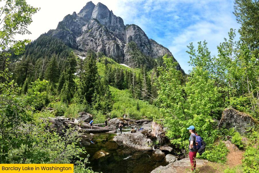
You’ll hear the creek for most of the hike, and there are little side spots where you can peek through the trees and see the water rushing by.
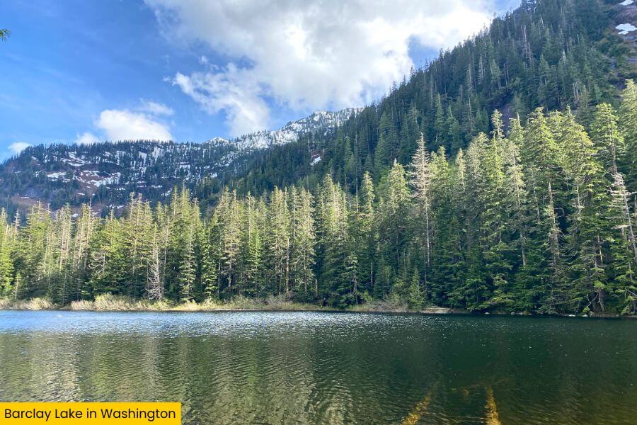
Once you get closer to the lake, the trail opens up and boom, there it is.
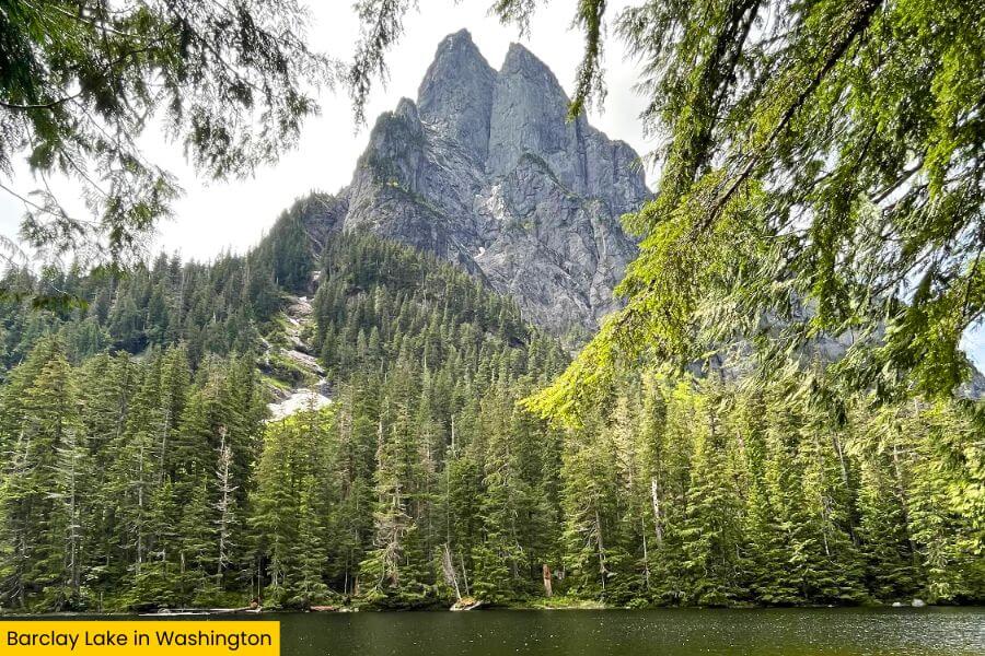
Barclay Lake sits in a bowl surrounded by mountains, with Mount Baring stealing the show at over 6,000 feet tall.
It rises straight up behind the lake like a massive stone wall, and if the water’s calm, you’ll get that perfect mirror reflection.
 (1)")
There’s a rocky shoreline, some driftwood to sit on, and wide open views across the lake.
Bring snacks or lunch, because you’re absolutely going to want to chill here for a while.
If you’re into photography, this spot lights up beautifully in the late afternoon when the sun hits the cliffs just right.
Know Before You Go
The best time to hike Barclay Lake is late spring through early fall, usually from April to October.
Snow can stick around into late spring, and the road to the trailhead sometimes doesn’t fully open until mid to late May, depending on the snowpack.
Summer is the sweet spot for dry trails, warm temps, and those epic mountain reflections on the lake.
Fall is also gorgeous if you catch the changing leaves, but bring layers because it gets chilly fast.
To get there, take Highway 2 east from Seattle toward Stevens Pass.
Just past the town of Baring, you’ll turn onto Barclay Creek Road (Forest Service Road 6024).
It’s a gravel road for over 4 miles, with some potholes, but most cars can make it if you take it slow.
The trailhead has a small parking area with a pit toilet, but no water, so bring plenty to drink.
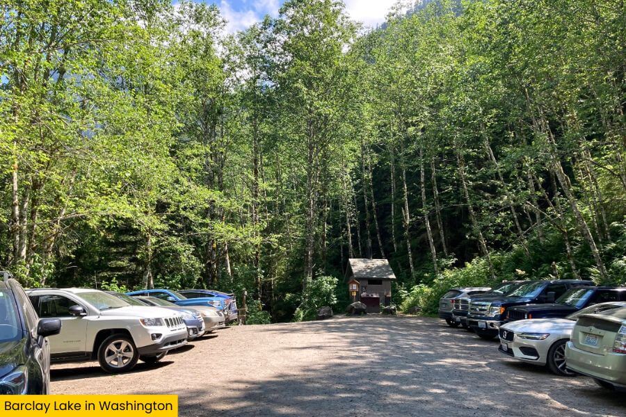
You’ll also need a Northwest Forest Pass to park here. You can grab one online or at ranger stations and some local stores along Highway 2.
If you’re looking to stretch your day, there are more hikes nearby like Eagle Lake or the Beckler Peak Trail, which is steeper and more of a workout but offers huge views at the top.
Want something chill after your hike? Stop by Zeke’s Drive-In in Gold Bar for a post-hike burger.
Also, heads up: there’s no cell service near the trail, so download your maps ahead of time and don’t count on Google to save you out there.
Related Posts