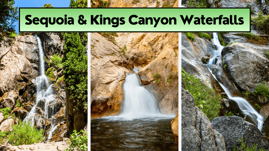
This road trip will take you to 8 waterfalls in northern California and you DO NOT want to miss it.
One of these waterfalls is one of the most beautiful in the ENTIRE country.
Number 8 is a special type of waterfall of which there are only 3 in the whole of the continental United States!
And you can actually walk through a cave BEHIND one of the waterfalls for a unique perspective.
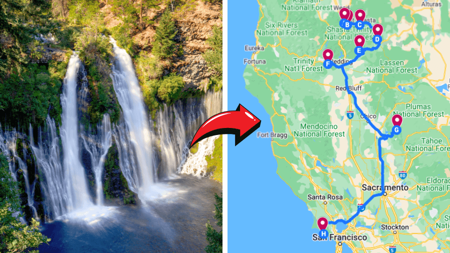
Here’s what the overall road trip would look like…

You’ll be starting in the Mount Shasta area and ending up near San Francisco at Point Reyes National Seashore.
You can hit as many or as little of the waterfalls on this list as you like.
There’s a bunch of little towns on the route that you can stop at whenever you feel like too.
The total drive from top to bottom is around 830km and just over 11 hours of driving time, but do this trip as quickly or as slowly as you like.
1. Faery Falls
Faery Falls, near Mount Shasta, is known for its captivating 50-foot cascade.
Easily accessible, it’s ideal for families and visitors of all ages.

Location and Access
Situated in Ney Springs Canyon, a short drive from Mount Shasta, visitors can park at the Ney Springs Creek trailhead.
- Parking area co-ordinates: 41.26582155616056, -122.32580852328084
The falls are a brief walk from this point, offering easy access.
Be careful if the weather has been bad recently as the dirt road can be difficult for cars with low clearance.
Hiking Details
The hike to Faery Falls is a 1.5-mile round trip and is considered easy.
It’s a well-marked trail through a forested area, suitable for beginners.
Best Time to Visit
Late spring and early summer are ideal for visiting, with the waterfall’s flow at its fullest.
Safety
While generally safe, the area around the waterfall can be slippery.
Staying on marked trails and wearing proper footwear is advised for safety.
Extra Information:
2. Hedge Creek Falls
Hedge Creek Falls, near Dunsmuir, is renowned for its charming, small waterfall with a unique feature: a path that allows visitors to walk behind the cascade, offering a distinctive perspective.
Its waterfall is about 30-35 feet high.

Location and Access
Located just off Interstate 5 in Dunsmuir, Hedge Creek Falls is easily accessible.
Visitors can park at the small lot near Hedge Creek Falls trailhead, which is well-signposted.
- Parking lot co-ordinates: 41.23638157432347, -122.26934153117583
Hiking Details
The trail to Hedge Creek Falls is a short and easy 0.6-mile round trip, making it suitable for all ages and fitness levels.
The path, offering scenic views and a close encounter with the waterfall, is a highlight of the visit.
Best Time to Visit
The waterfall flows year-round, but the best time to visit is in the spring when the water volume is higher.
Summer also offers a pleasant experience, especially with the shaded trail.
Safety
The trail and area around the waterfall are generally safe.
However, visitors should be cautious as the path can be slippery, especially after rain.
Appropriate footwear is recommended.
Extra Information:
3. McCloud Falls
McCloud Falls, divided into three distinct cascades known as Lower, Middle, and Upper Falls, is a must-visit destination near McCloud in Northern California.
Each section offers its unique charm and beauty, making it a diverse waterfall experience.

Location and Access
The falls are located off Highway 89 east of the town of McCloud.
Visitors can park at one of the three separate parking areas designated for each section of the falls.
Parking area co-ordinates:
- Lower Falls parking lot: 41.24024393165011, -122.02472802903418
- Middle Falls parking lot: 41.24448336524388, -122.00853997545477
- Upper Falls parking lot: 41.23868828175754, -122.00903355879295
The Lower Falls has the most accessible parking area, close to the falls.
You can just drive between them all or choose to hike so it’s suitable for different fitness levels.
Hiking Details
A well-maintained trail connects all three falls, spanning about 3.5 miles round trip.
The hike is considered moderate, with some steep sections.
Visitors can also choose to visit each fall individually, with shorter walks from each parking area.
Best Time to Visit
Spring and early summer are ideal for witnessing the falls at their most vigorous.
However, the falls are attractive year-round, with each season offering a different perspective.
This place does get busy on the weekends, so go on a weekday to avoid it getting too busy.
Safety
The trail is safe but can be challenging in places with steep and uneven sections.
Visitors should wear appropriate hiking shoes and be cautious near the edges of the falls, as rocks can be slippery.
Lower, Middle, and Upper McCloud Falls each provide a unique experience, from the ease of access at Lower Falls to the more secluded and natural setting of Upper Falls.
Extra Information:
4. Burney Falls
Burney Falls, located in McArthur-Burney Falls Memorial State Park, is celebrated for its impressive 129-foot cascade and the substantial volume of water flowing year-round.
In fact, the flow rate is around 379 million liters PER DAY!
Its most striking feature is the water that seems to burst from the middle of the cliff face, in addition to the main falls.

Location and Access
The falls are in Northern California, northeast of Redding.
Parking is available within McArthur-Burney Falls Memorial State Park, with an entrance fee.
The falls are a short, easy walk from the parking area.
- Parking area co-ordinates: 41.01277308874219, -121.6505107863888
Hiking Details
The hike to view Burney Falls is a gentle, 0.3-mile downhill walk on a paved path, making it accessible for most visitors.
For those looking for more, a 1.3-mile loop trail around the falls offers additional views and a moderate hike.
Best Time to Visit
Burney Falls is a year-round destination, with spring and early summer offering the most voluminous water flow.
Summer is popular but can be crowded.
Safety
The area around Burney Falls is well-maintained and generally safe.
The main overlook is easily accessible.
Visitors on the loop trail should wear good walking shoes and be cautious on uneven terrain.
Extra Information:
5. Potem Falls
Potem Falls, a hidden gem near the Pit River in Shasta National Forest, features a stunning 70-foot drop into a picturesque swimming hole.
It’s known for its serene and somewhat secluded location, making it a delightful escape into nature.
Location and Access
Located in the remote regions of Northern California, reaching Potem Falls requires a drive to Fenders Ferry Road which is an easy-to-miss dirt road that lasts for around 6 miles.
Make sure your car is suitable for this.
Fenders Ferry Road is just off Highway 299 between Montgomery Creek and Round Mountain.
Parking is available in a pullout parking area on the side of the road.
There isn’t space for many cars here though, maybe about 5 cars worth.
- Parking area co-ordinates: 40.83883994088082, -122.02687322471121
Then you have to hike about 0.3 miles to the falls.
It’s not too long.
Hiking Details
The hike to Potem Falls is relatively short and easy, covering just over a half-mile round trip.
The path descends to the base of the falls, where visitors can enjoy the view and even swim in the pool below the falls.
Best Time to Visit
The best time to visit Potem Falls is in late spring or early summer when the water flow is robust and the weather is pleasant for swimming.
The area can be less accessible during the winter months due to snow.
Be careful in summer as there’s not a lot of shade in the area.
Safety
The trail to Potem Falls is generally safe, but caution is advised as the path can be steep and slippery, especially near the water.
Visitors should be cautious when swimming and aware of their surroundings.
Be careful of summer heat as there’s little shade and watch out for ticks.
Extra Information:
6. Whiskeytown Falls
Whiskeytown Falls, located in the Whiskeytown National Recreation Area, was a hidden secret until 2004.
This impressive 220-foot waterfall is known for its multi-tiered cascades and lush surroundings.
Location and Access

Situated west of Redding, California, Whiskeytown Falls can be accessed from the Whiskeytown-Shasta-Trinity National Recreation Area.
Parking is available at the James K. Carr Trailhead just off Crystal Creek Road, with a short walk to the start of the trail.
- Parking area co-ordinates: 40.638285146922826, -122.6760390011402
Hiking Details
The hike to Whiskeytown Falls is about 3.4 miles round trip and is rated as moderate and it can be tiring.
The James K. Carr Trail trail winds through a dense forest and includes some steep sections, particularly as it nears the falls.
Best Time to Visit
Spring and early summer are ideal for visiting, with the falls at their most spectacular due to snowmelt.
The area is also beautiful in autumn with changing foliage, but the water flow may be less.
Safety
While the trail is well-maintained, its steep sections require good hiking shoes and caution.
It’s important to stay on the trail and be mindful of slippery areas, especially near the waterfall.
The fires of 2018 did a lot of damage in the area so check out conditions beforehand if you want to explore more of the area.
Extra Information:
7. Feather Falls
🚨 DISCLAIMER: At the time of last updating (March 2024) this area is currently closed due to damage from forest fires and the need for repairs. The Forest Service has indicated that the closure will be in place until at least March 29, 2024.
See the forest service for updates before making plans to travel:
Now let’s move on to the info you’ll want for when you do end up going here...
Feather Falls, near Oroville in the Sierra Nevada foothills, stands out as one of California’s tallest waterfalls.
With a drop of over 400 feet, it offers a breathtaking spectacle, especially in the spring when the water flow is at its peak.

Location and Access
Located in the Plumas National Forest, the waterfall is accessible via the Feather Falls Scenic Trail.
Visitors can park at the trailhead off Lumpkin Road, which has ample parking space and basic facilities.
- Parking area co-ordinates: 39.6141381375207, -121.26653153814333
Hiking Details
The hike to Feather Falls is a loop of about 9 miles and is considered moderately challenging.
It starts off as a single trail then about ⅓ mile into the route the trail forks into the upper or lower trail.
Hikers can choose between the shorter, steeper Upper Trail or the longer, more scenic Lower Trail to reach the falls.
Best Time to Visit
The ideal time to visit Feather Falls is in the spring when the water volume is high.
Summer visits are also popular, but the flow might be less.
Winter conditions can make the trail difficult to navigate.
Safety
Due to its length and some steep sections, the hike requires good physical condition and appropriate footwear.
It’s essential to carry water and stay on marked trails for safety, as the area has steep drop-offs and uneven terrain.
8. Alamere Falls
Now this one is unique.
Alamere Falls is a rare and striking “tidefall,” a waterfall that flows directly into the ocean.
There are only 3 of these tidefalls in the continental US.
Located in Point Reyes National Seashore, this 40-foot waterfall offers a unique blend of freshwater cascading over a cliff onto the sandy Wildcat Beach.

Location and Access
To reach Alamere Falls, the NPS recommends that you start from Wildcat Campground and walk south about 1.1 miles (1.7 km) on Wildcat Beach.
To get to the Wildcat Campground you can hike from one of the following trailheads:
- Bear Valley Trailhead via Bear Valley, Glen, and Stewart Trails (6.3 miles)
- Palomarin Trailhead via the Coast Trail (5.5 miles)
- Five Brooks Trailhead via the Stewart Trail (6.7 miles)
Each of these trailheads has a parking lot but they can get busy on weekdays in the summer, or weekends throughout the year.
Parking area co-ordinates:
- Bear Valley Trailhead: 38.03967135506068, -122.79972203321351
- Palomarin Traihead: 37.93430323017229, -122.74713256107822
- Five Brooks Trailhead: 37.997321998505825, -122.75765308853504
Palomarin trailhead can get particularly busy so arrive early on busy days or you might be turned away.
Here’s some more information about reaching the falls.
Hiking Details
The hike to Alamere Falls depends on which trailhead you park at.
Once you get to the Wildcat Campground you walk around 1.1 miles south during low tide to reach the falls.
So if you take the longest trail the round trip to the falls and back ends up being just over 15 miles.
Always check the tide and surf conditions beforehand to not be disappointed.
The different trails take you through diverse landscapes, including coastal scrub and Douglas fir forests, before descending to the beach area.
Best Time to Visit
You can generally visit Alamere Falls all year round and there are different pros and cons to each season.
The best time to visit Alamere Falls, if you want to see it gushing, is during the spring or winter when the water flow is most robust.
But at the same time, you’ll have to consider if there’s been recent rainfall as the trails can get quite muddy.
Summer is also popular, but fog can sometimes obscure views.
In general, the beach will have the most walkable sand in the summer or fall months so that’s worth considering too.
Always check the current weather conditions and tides beforehand.
Safety
The hike to Alamere Falls requires careful planning and preparation.
The final descent to the beach is steep and can be hazardous, especially during wet conditions.
It’s important to check tide schedules to avoid being cut off by high tides and to wear appropriate hiking shoes.
Extra Information:
Honorable Mention
Another popular northern California waterfall that people visit that didn’t make the list is Mossbrae Falls (very close to Hedge Creek Falls).
The reason we didn’t include it is that you technically can’t go there legally (at the time of writing) and people have been hurt making their way there in the past.
This is because you have to walk alongside an active railroad track which is private property.
If you do still want to go there are plenty of guides on the internet on how to get there.