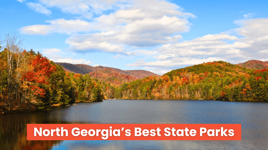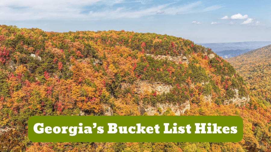
Georgia is packed with hikes that’ll make you say “wow” at every turn, from mountain peaks with sweeping views to secret waterfalls hiding deep in the woods.
You’ll find trails winding through rainbow-colored canyon walls, climb to rocky outcrops with epic views, and cross boardwalks buzzing with wildlife.
Some of these hikes are easy for a Sunday afternoon adventure, while others will leave your legs feeling like jelly but every single one is worth it.
Get ready to explore 12 of the coolest, most unforgettable hikes in Georgia that you HAVE to check off your bucket list at least once!
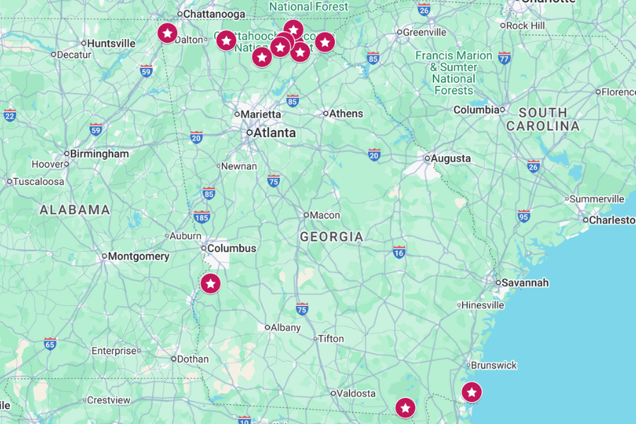
1. Brasstown Bald
Length: 0.6 miles one way
Difficulty Rating: Moderate
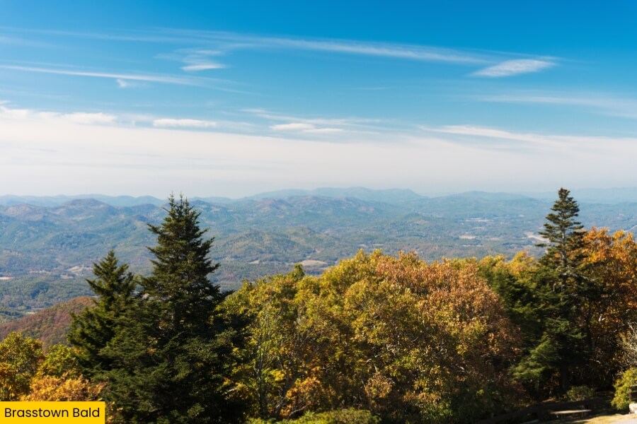
Brasstown Bald is Georgia’s tallest mountain at 4,784 feet, and it stands in the Chattahoochee-Oconee National Forest about 17 miles north of Helen.
Getting there means hiking the steep but short Brasstown Bald Summit Trail, which climbs 450 feet to an epic observation deck.
From the top (on a clear day), you can see Georgia, North Carolina, South Carolina, and Tennessee, plus stunning views of the Blue Ridge Mountains.
You’ll find a visitor center up there with a museum covering the area’s history, stories of the Cherokee, and maybe even wildlife like black bears and wild turkeys.
2. Raven Cliff Falls
Length: 5 miles round-trip
Difficulty Rating: Moderate
 (1)")
Next up is Raven Cliff Falls, a waterfall straight out of an adventure movie, hidden about 8 miles north of Helen in the Chattahoochee National Forest.
You’ll tackle the Raven Cliff Falls Trail, a hike that zigzags along Dodd Creek past mini waterfalls, mossy rocks, and shady forest.
As you make your way, keep an eye out for salamanders and bright wildflowers like pink lady’s slipper orchids, which bloom in spring and early summer.
At the end, you’ll reach the 40-foot waterfall that cuts through a massive cliff, spilling through a crack.
3. Tallulah Gorge State Park
Length: 3 miles round-trip for North and South Rim Trails, about 2.5 miles round-trip for Gorge Floor Trail
Difficulty Rating: Moderate to Strenuous
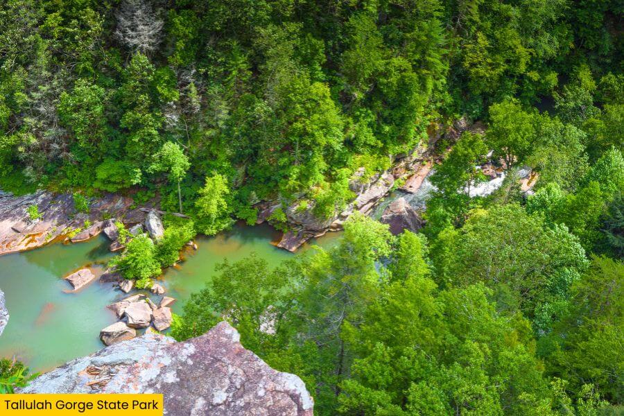
Want to feel tiny? Head to Tallulah Gorge State Park, located about a mile north of Tallulah Falls along Highway 441.
This place is home to Tallulah Gorge, a canyon nearly 1,000 feet deep and around 2 miles long, with the Tallulah River roaring through it.
With a free permit (limited to 100 daily), you can hike the Gorge Floor Trail to scramble over giant boulders.
You can also take the North and South Rim Trails for easier views of the suspension bridge swaying 80 feet above the river.
Don’t miss the Jane Hurt Yarn Interpretive Center, where you can learn the gorge’s history, including stories of people who walked a tightrope across it!
4. Cloudland Canyon State Park
Length: 2 miles round-trip for Waterfalls Trail, 5 miles round-trip for West Rim Loop Trail
Difficulty Rating: Moderate to Strenuous
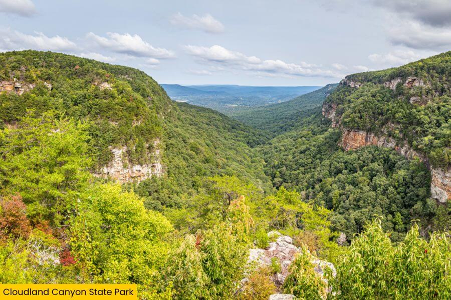
Cloudland Canyon State Park might fool you into thinking you’re at the Grand Canyon, but it’s actually in northwest Georgia near Rising Fawn.
The park’s big stars are Cherokee Falls (dropping 60 feet) and Hemlock Falls (tumbling 90 feet), both reached by the Waterfalls Trail with about 600 metal steps.
You can also hit the West Rim Loop Trail, with crazy-good views of the 1,000-foot-deep canyon carved by Sitton Gulch Creek.
Bring your camera to capture the park’s sandstone cliffs and lush forests, which look even better in the fall when the leaves turn red, orange, and yellow.
5. Fort Mountain State Park
Length: 0.8 miles out-and-back for West Overlook Trail, 8.2 miles round-trip for Gahuti Trail
Difficulty Rating: Easy to Moderate for West Overlook Trail, Strenuous for Gahuti Trail
")
Fort Mountain State Park is located in the Cohutta Mountains near Chatsworth, about 94 miles north of Atlanta.
The park’s coolest feature is an 855-foot-long ancient rock wall at the top of the 2,850-foot mountain.
It was built by Native Americans over 1,000 years ago, and you can check it out on the West Overlook Trail.
If you’re craving views, the Gahuti Trail circles the park with sweeping Blue Ridge Mountain panoramas and leads past mossy boulders and streams.
You can even climb the 38-foot stone fire tower at the summit for a 360-degree view that’ll make you feel like the ruler of the mountains.
6. Blood Mountain
Length: 5 miles out-and-back
Difficulty Rating: Strenuous
 (1)")
Looking for a true challenge? Blood Mountain delivers at 4,458 feet which makes it the highest peak on Georgia’s stretch of the Appalachian Trail.
You’ll conquer it via the Byron Reece and Appalachian Trail Loop, with a calf-burning climb that rewards you with rolling Blue Ridge Mountain views.
At the summit, you’ll find the iconic Blood Mountain Shelter, a stone hut built in 1934 by the Civilian Conservation Corps.
Fun fact: The mountain’s name comes from a legendary battle between the Cherokee and Creek tribes, so you’ll be hiking through a piece of Georgia’s history.
7. Mount Yonah
Length: 4.2 miles out-and-back
Difficulty Rating: Strenuous
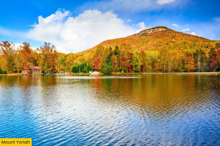
Just 6 miles south of Helen sits Mount Yonah, the perfect place when you want a hike that’s short, steep, and ends with a view that’ll knock your socks off.
The Mount Yonah Trail gains a tough 1,500 feet, leading you over granite outcrops and through forest tunnels to an exposed summit.
At the top, you’ll enjoy unforgettable views of the Chattahoochee National Forest and distant peaks like Brasstown Bald.
There’s also a massive rock face where you might spot rock climbers dangling like spiders.
8. Amicalola Falls State Park
Length: 2.4-mile loop
Difficulty Rating: Moderate to Strenuous
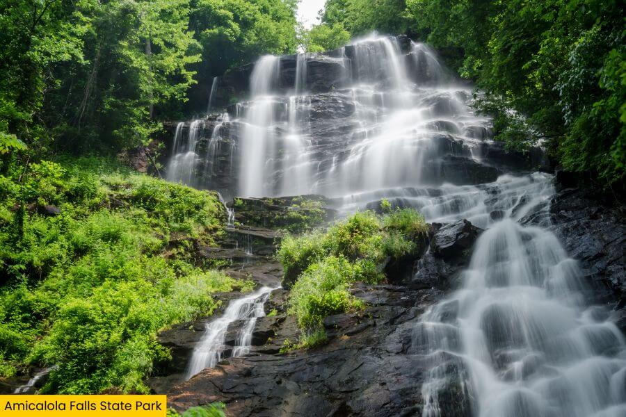
Amicalola Falls State Park near Dawsonville is home to Georgia’s tallest waterfall, falling a dramatic 729 feet.
You can tackle the Amicalola Falls Loop Trail, where over 600 stairs lead you right alongside the roaring falls, so you’ll feel the mist on your face as you go.
Don’t miss the mountaintop lodge with panoramic views of the rolling North Georgia mountains, perfect for relaxing after your climb.
This park also marks the official start of the 8.5-mile Approach Trail that stretches to Springer Mountain, the southern terminus of the Appalachian Trail.
9. Providence Canyon State Park
Length: 2.5 miles
Difficulty Rating: Easy to Moderate
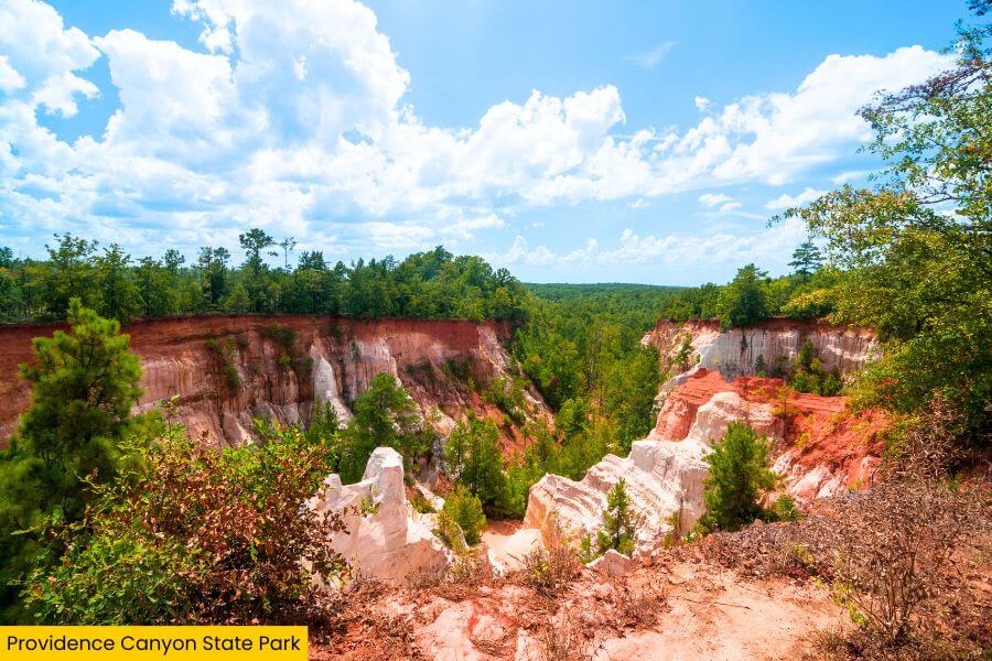
Providence Canyon State Park is Georgia’s “Little Grand Canyon,” featuring 150-foot cliffs in pink, orange, and red (yep, kind of like a rainbow).
You can follow the Canyon Loop Trail that drops you right into the canyon floor, weaving through gullies and sandy washes as you take in the views.
This place was actually formed by poor farming practices in the 1800s that caused massive erosion, turning it into one of the state’s must-see landscapes.
Bring your camera as the shifting sunlight makes the canyon glow differently every hour, and you’ll want a shot of those iconic bright clay layers.
10. Preachers Rock
Length: 1.9 miles out-and-back
Difficulty Rating: Moderate
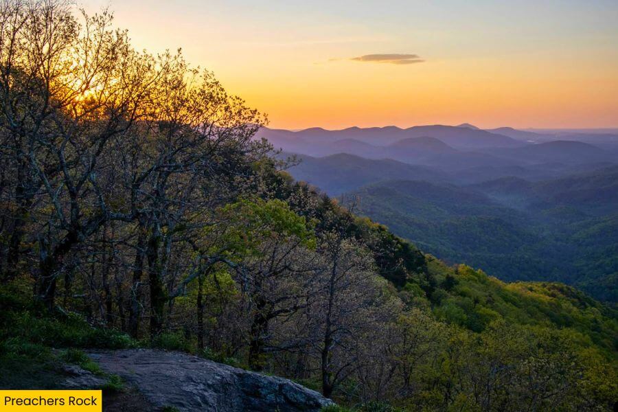
Preachers Rock is your go-to for a quick, awesome hike with beautiful views, located near Suches on the Appalachian Trail section from Woody Gap.
You’ll follow the Appalachian Trail north with a moderate 439-foot climb, ideal if you want big scenery without an all-day commitment.
Standing on the rocky outcrop, you’ll catch breathtaking views of Big Cedar Mountain and the Blue Ridge Mountains stretching far beyond.
This spot is magical at sunrise, when the morning fog creeps through the valleys below and makes you feel like you’re standing above the clouds.
11. Cumberland Island National Seashore
Length: 4.3 miles
Difficulty Rating: Easy to Moderate
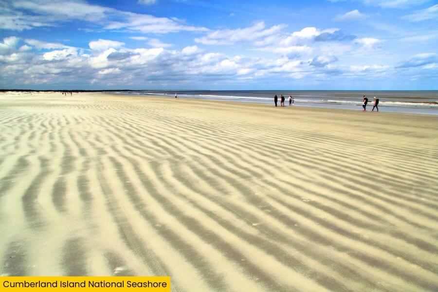
Along Georgia’s southern coast, Cumberland Island National Seashore is like a wild dream with miles of untouched beaches, moss-draped oaks, and roaming horses.
You’ll explore the Southend Loop Trail that winds through maritime forests, past the eerie ruins of Dungeness Mansion, and straight to empty, wide beaches.
The island is only accessible by ferry from St. Marys, making it feel like your own secret paradise.
Don’t forget to pack plenty of water and snacks, because there are no restaurants or stores out here — just raw, beautiful wilderness.
12. Okefenokee Swamp
Length: 0.66 miles from the boardwalk to Owl’s Roost Tower
Difficulty Rating: Easy
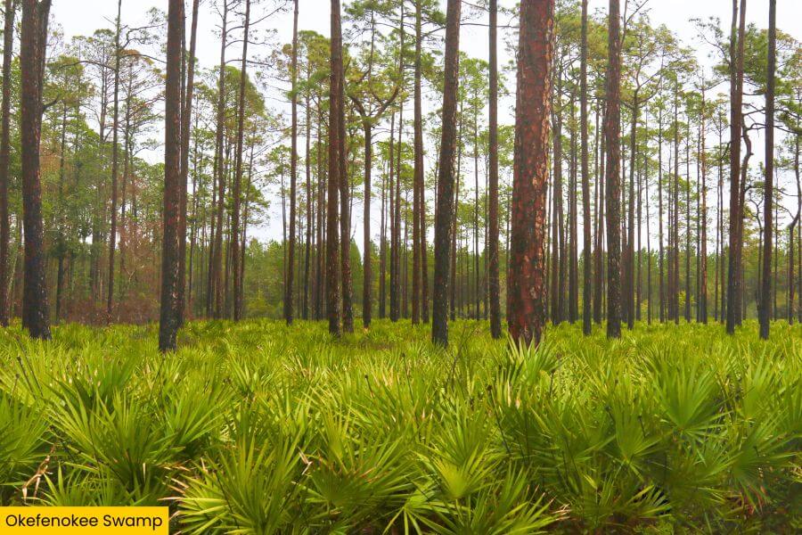
Okefenokee Swamp is Georgia’s ultimate wild side, spanning 700 square miles of blackwater filled with old cypress trees, Spanish moss, and countless alligators.
You can hike the boardwalk to Owl’s Roost Tower for a bird’s-eye view of flooded prairies, or rent a kayak to paddle winding channels like the Suwannee Canal.
This swamp is home to over 200 species of birds, including sandhill cranes and red-shouldered hawks.
It also has turtles, otters, and carnivorous plants like pitcher plants and sundews.
Start your adventure at the Suwannee Canal Recreation Area near Folkston, where you can pick up a map, hit the trails, or hop on a boat tour.
Related Posts