If you think Texas is all flat highways and wide open ranch land, this trail is about to prove you very wrong.
Out in far West Texas, there’s a hike that takes you high above the desert floor and the landscape suddenly opens up around you.
It’s the kind of place where you stop mid-step because your brain needs a second to catch up with what your eyes are seeing.
The best part is that you do not need ropes, climbing gear, or expert skills to get there, just a few steady miles of uphill effort.
If you are putting together a Texas hiking bucket list, this one deserves a bold star and a circle around it.
Where Is It?
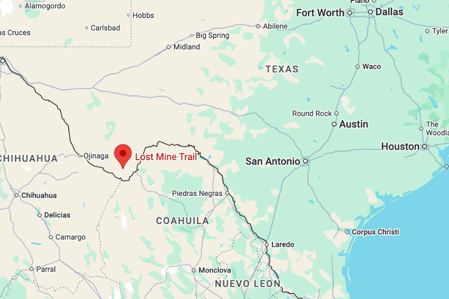
The Lost Mine Trail is located in Big Bend National Park in West Texas, tucked into the Chisos Mountains just off the main road into the Chisos Basin area.
It’s about a five-hour drive from El Paso, 6.5 hours from San Antonio, 7.5 hours from Austin, and roughly 8.5 hours from Dallas.
This is one of those epic road trips where the wide-open desert views begin long before the hike does.
About
The Lost Mine Trail is one of the most popular and scenic hikes in Big Bend National Park, and once you see where it’s located, it makes perfect sense.
The trail sits in the Chisos Mountains, the only mountain range in the United States fully contained within a single national park.
It’s particularly special because you’re hiking through a rare sky island ecosystem of lush mountain forests that rise out of the surrounding Chihuahuan Desert.
Big Bend itself spans 801,163 acres, making it one of the largest national parks in the lower 48 states, which makes Lost Mine even more surprising.
")
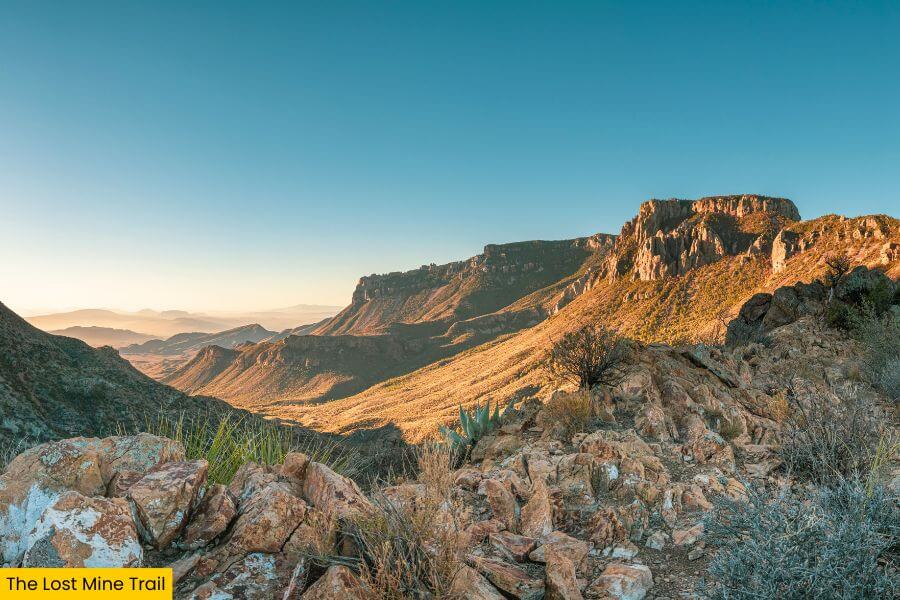
It’s considered a bucket-list hike because it delivers sweeping views of Juniper Canyon, Casa Grande Peak, and the Chihuahuan Desert around you.
And honestly, not many Texas hikes offer this kind of experience all in one trail.
Fun fact: Lost Mine Trail’s name comes from an old legend that Spanish explorers once uncovered silver deposits somewhere near the peak above the trail.
Supposedly, workers were blindfolded as they were led to and from the mine to keep its location secret, adding a little Wild West mystery to the hike.
What To Expect
 (1)")
After all that hype, here’s what it actually looks like when you put boots on dirt and do the thing.
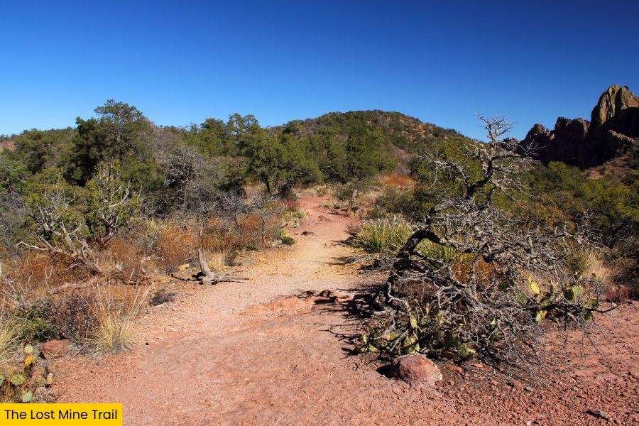
You start at the signed Lost Mine Trailhead along Basin Junction Road, and the climb kicks in fast.
The hike is about 4.8 miles round trip, and it gains over 1,100 feet, so it’s short enough to fit into a half day but steep enough to make you earn every view.
Most people rate it as moderate to strenuous, and that mostly comes down to the steady uphill and the thin, dry air at higher elevation.
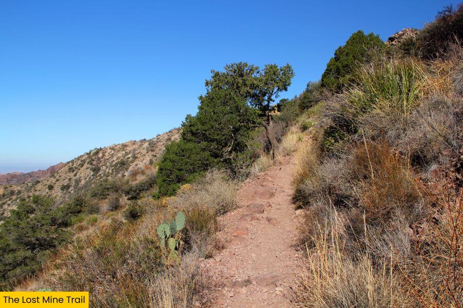
The first stretch follows rocky switchbacks, then winds through juniper, oak, and pine forest.
Along the way, the trail stays well-defined, with a mix of packed dirt, loose sand, and short sections of stone steps.
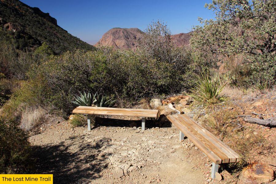
You’ll even find a couple of benches where you can pause, sip water, and soak in the views.
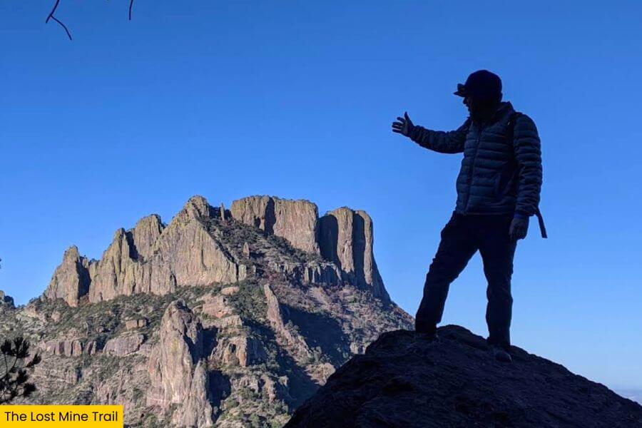
As you climb higher, the trail works through a few more switchbacks before reaching a ridgeline where the landscape suddenly opens up with big views in every direction.
 (1)")
This is your big scenic payoff, so take a moment to stretch and soak in the deep canyon cuts that make Big Bend feel so massive.
If you go early, you might have the overlook mostly to yourself for a few minutes, and the light is usually better for photos.
Know Before You Go
 (1)")
Parking
Before you lace up, let’s talk timing, because the biggest logistical hurdle is often parking.
Lost Mine Trail is wildly popular, and the small parking lot along Basin Junction Road fills quickly, so arriving early makes a big difference.
Park Hours and Fees
Big Bend National Park stays open year-round, 24 hours a day.
Entrance fees are about $30 per vehicle for a 7-day pass, $25 per motorcycle, or $15 per person if you’re walking or biking in.
If you think you’ll visit several national parks this year, the $80 America the Beautiful Annual Pass is often worth it.
Best Time to Visit
October through April offers the most comfortable hiking weather, with daytime temperatures in Big Bend typically ranging from the mid-60s to the low-80s.
If you visit in spring, you’ll catch blooming wildflowers like bluebonnets and desert marigolds, but you’ll also share the trail with bigger crowds.
Come summer, things heat up fast, with May through September regularly topping 90 degrees Fahrenheit, and that exposed climb feeling even hotter.
For fewer crowds, a weekday in late fall or early winter is a quieter sweet spot.
Trail Tips and What to Bring
- Cell service is extremely limited once you enter the park, so download offline maps before you start.
- Bring more water than you think you need, because the climb plus the dry air can sneak up on you.
- Sun protection is non-negotiable, and a hat and sunglasses are worth their weight in gold on the exposed stretches.
- Footing can be a little loose in places, so shoes with solid tread make the uphill and downhill way more comfortable.
- Don’t use up everything on the way up, as the downhill is faster but can still be rough on your knees.
What to Do After Your Hike
If you’re not quite ready to leave, there’s no shortage of incredible places to visit inside Big Bend National Park.
")
You can swing by the Chisos Basin Visitor Center to check out the exhibits on local plants and wildlife or browse for souvenirs.
Up for more adventure?
Follow the 1.7-mile round-trip Santa Elena Canyon Trail, which winds between massive 1,500-foot limestone cliffs.
End your day at Sotol Vista Overlook along Ross Maxwell Scenic Drive, where you can watch the sun sink behind the mountains in a blaze of orange.
Related Posts