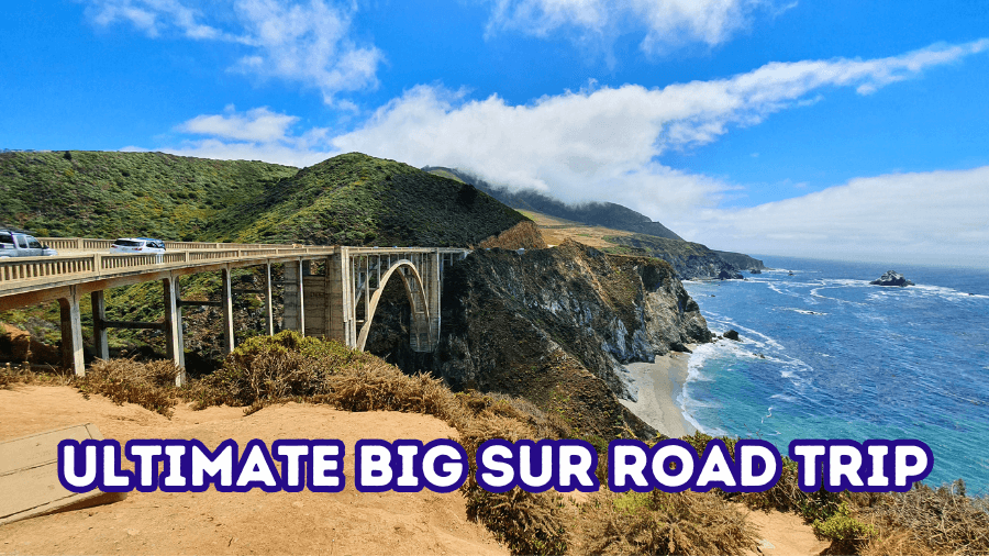
There’s a stretch of California coastline where the road twists along cliffs, waves crash hundreds of feet below, and every turn somehow tops the last.
This Big Sur road trip is packed with hidden beaches, epic ocean viewpoints, towering redwood groves, and a few stops where you’ll definitely want to grab a bite with a view.
You’ll walk through tunnels carved into rock and find places that don’t even look real until you’re standing right there.
If you’re ready for a day filled with nonstop views, cool stops, and just enough adventure to keep things exciting, you’re going to want to see what’s coming next.
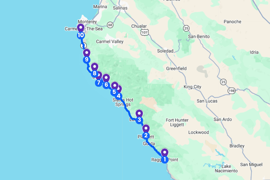
1. Ragged Point
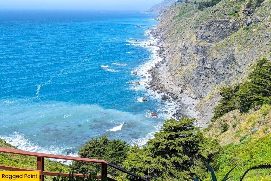
Ragged Point, along Highway 1, is just 20 minutes from San Simeon and marks the southern gateway to Big Sur, with jaw-dropping views from a 300-foot bluff above the ocean.
You’ll find the famous Ragged Point Inn here, complete with a cliffside restaurant, a small gas station, and one of the best photo stops on the entire drive.
The short but steep Ragged Point Cliffside Trail drops about 400 feet to a quiet black sand beach where waves crash against rocky coves.
Keep your eyes on the water because gray whales pass by during migration season, and on clear days you can see miles of rugged coastline stretching north toward Big Sur.
2. Sand Dollar Beach
 (1)")
Drive 30 minutes up Highway 1 and you’ll hit Sand Dollar Beach, which is the largest sandy shoreline in Big Sur, stretching about 0.5 miles along a crescent-shaped cove backed by steep cliffs.
You’ll park at the Sand Dollar Beach day-use lot and take a short trail down to the sand, where the real highlight is the waves that make this one of the best surf spots in the area.
At low tide, you can wander through tide pools filled with sea stars and anemones, or search for the beach’s famous sand dollars that sometimes wash up along the shore.
If you stick around for sunset, the cliffs glow orange, the waves roll in steady sets, and it easily becomes one of those spots where you lose track of time without even trying.
3. Limekiln State Park
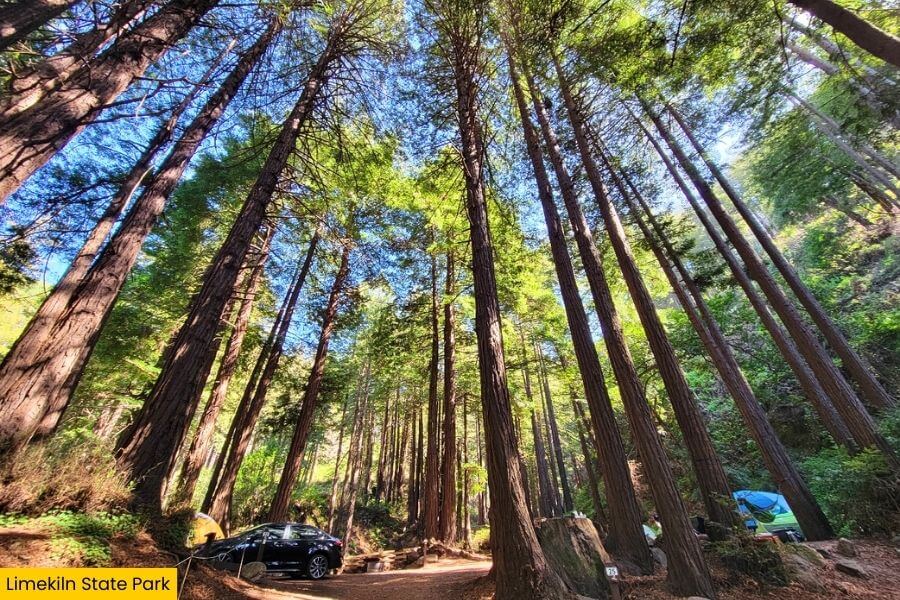
Just 15 minutes up the coast is Limekiln State Park, where redwood groves meet the ocean across 716 acres of protected land.
The park gets its name from four massive lime kilns built in the 1880s, which still stand hidden among the trees along a short 0.5-mile walk from the parking area.
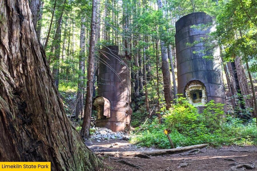
Right across Highway 1, Limekiln Beach gives you a completely different scene with dark sand and waves crashing against rocky outcrops.
If you’re camping, the park’s 29 campsites sit under towering redwoods and along Limekiln Creek, and falling asleep to the sound of rushing water and ocean waves is hard to beat.
Please note that at the time of writing, the park is open for day-use activities only, and the campground at Limekiln State Park is currently closed due to ongoing renovation and is expected to reopen in late spring or early summer 2026. It’s best to check the official website before visiting.
4. McWay Falls (Julia Pfeiffer Burns State Park)
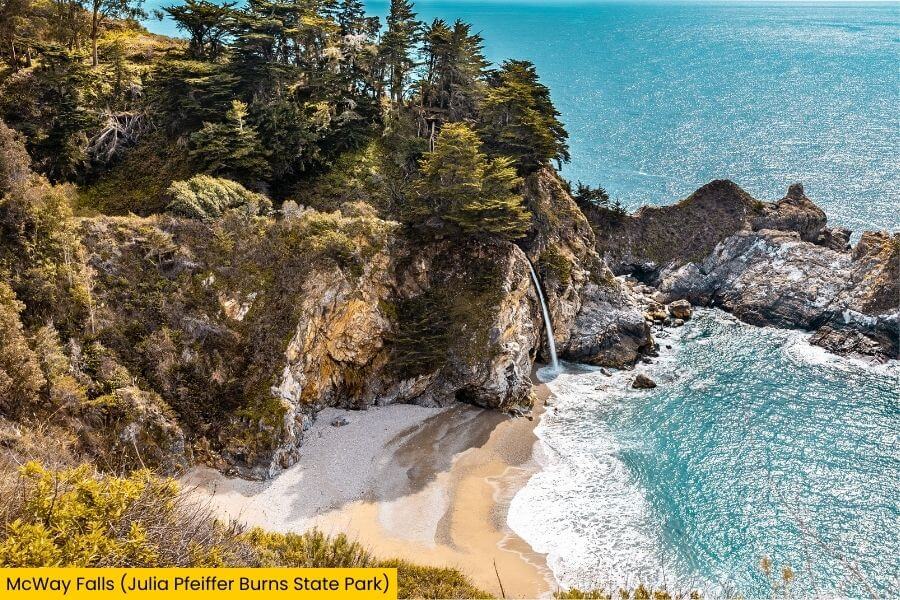
A 25-minute drive from Limekiln State Park brings you to McWay Falls in Julia Pfeiffer Burns State Park, where an 80-foot waterfall pours straight onto a small sandy cove along the bright blue Pacific.
The best view comes from the easy 0.5-mile McWay Falls Overlook Trail, which takes you through a tunnel under Highway 1 and out to a perfectly framed viewpoint.
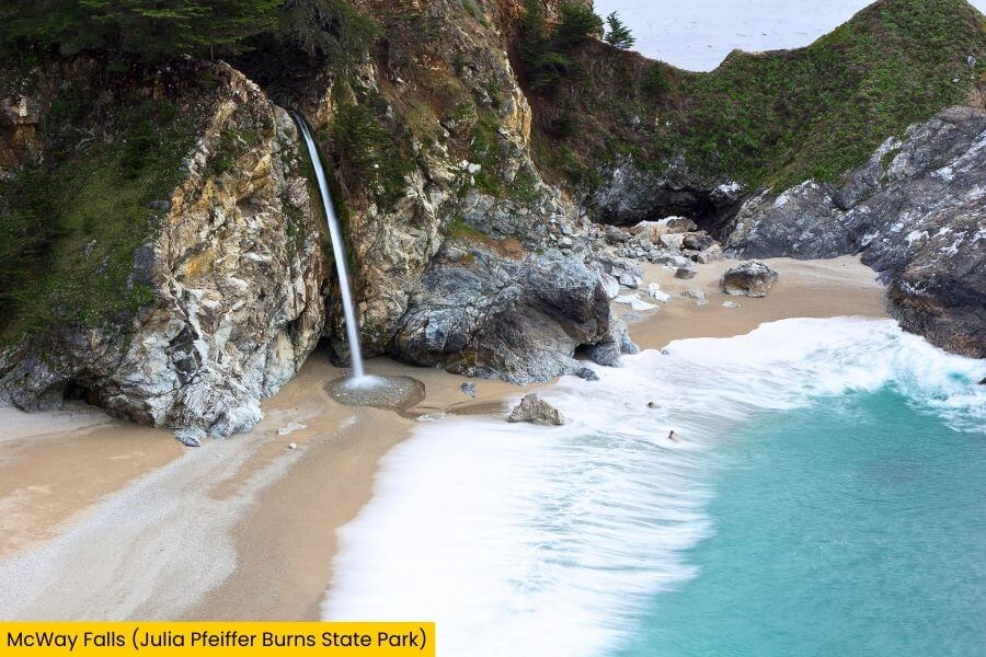
You can’t access the beach itself, but honestly, the elevated angle makes the view even better.
This spot was once part of a private estate owned by Lathrop and Helen Hooper Brown, and the old stone house ruins still sit above the cove, adding a cool historic touch to one of Big Sur’s most photographed stops.
Please note that at the time of writing, the primary trail leading to the viewpoint of McWay Falls is closed due to retaining wall repairs but you can get a great view of the falls from the highway.
5. Partington Cove
 (1)")
Just when you think Big Sur can’t surprise you anymore, Partington Cove sneaks in with one of the most unique short hikes on the entire drive.
The 1-mile round trip Partington Cove Trail drops nearly 300 feet through a quiet forest before leading you through a hand-carved tunnel that opens right onto a narrow rocky shoreline.
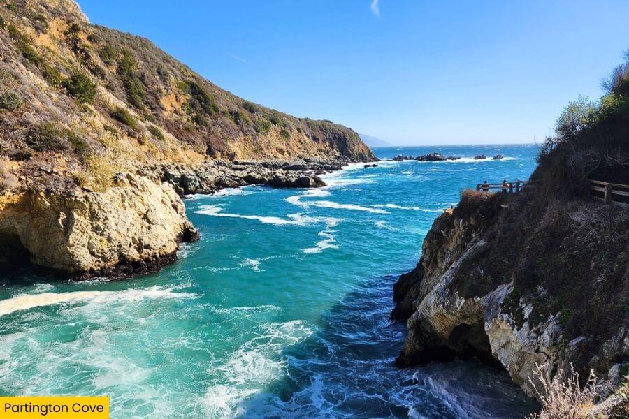
Instead of a wide sandy beach, you’ll find a small cove surrounded by steep and rocky cliffs, with waves crashing into a tight inlet that feels totally hidden from the outside world.
If you take the side path, you’ll reach Partington Creek Bridge, a wooden bridge perched above the water, giving you a second viewpoint that most people completely miss.
6. Nepenthe Restaurant
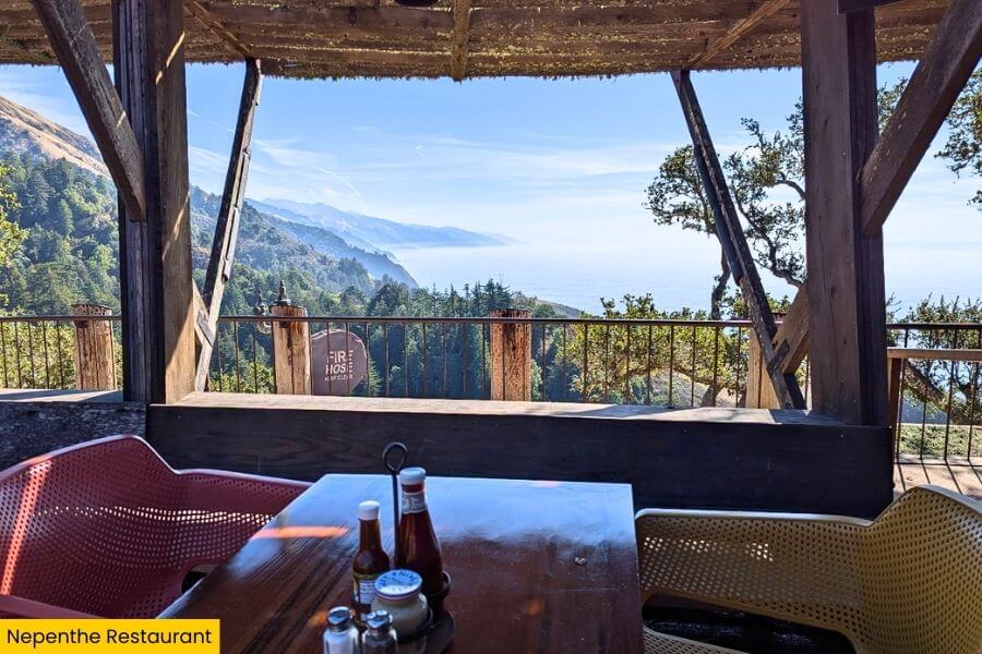
After all that exploring, Nepenthe Restaurant is the perfect excuse to slow down and soak in one of the best views on the entire Big Sur coastline.
Perched about 800 feet above the ocean, this iconic spot has been serving up food since 1949, with its open-air terrace looking straight out over the Santa Lucia Mountains and the Pacific.
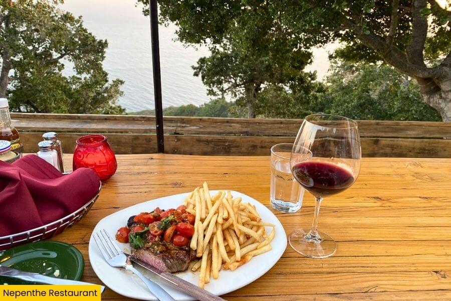
You’ve got to try the famous Ambrosia Burger or grab a glass of local wine and claim a seat right along the edge.
Fun fact, the restaurant was built by Bill and Lolly Fassett from locally sourced redwood!
7. Pfeiffer Beach
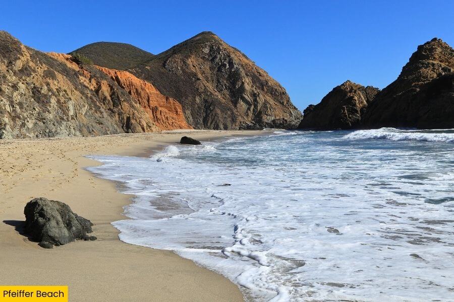
Just a short drive from the restaurant, Pfeiffer Beach feels like a hidden detour that totally pays off once you see that famous purple sand up close.
The beach gets its color from garnet deposits washed down from the surrounding hills, creating streaks of deep violet mixed into the sand, especially after rain.
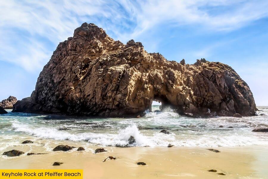
The star of the show is Keyhole Rock, a massive natural arch where, during sunset in the winter months, the sun lines up perfectly and shoots a glowing beam of light straight through the opening.
Waves crash hard here and swimming isn’t safe, but walking the shoreline, snapping photos, and watching the light change over the rocks easily makes it worth visiting.
8. Andrew Molera State Park
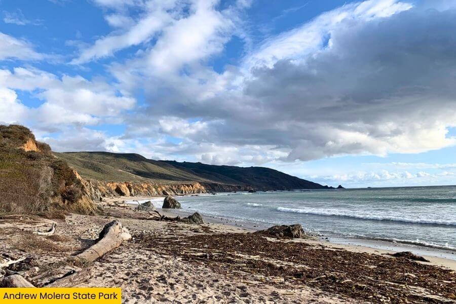
Less than 20 minutes from Pfeiffer Beach, you’ll find Andrew Molera State Park, the largest state park in Big Sur, covering over 4,700 acres of wide meadows, coastal bluffs, and rolling hills.
The 3.4-mile round trip Bluffs Trail is the go-to route here, leading you across the Big Sur River and out to a quiet beach where you might spot harbor seals resting along the shore.
 (1)")
This place feels wide open, with long stretches of trail where you can walk for miles without seeing many people.
If you’re lucky, California condors with wingspans up to 9.5 feet soar overhead.
9. Bixby Creek Bridge
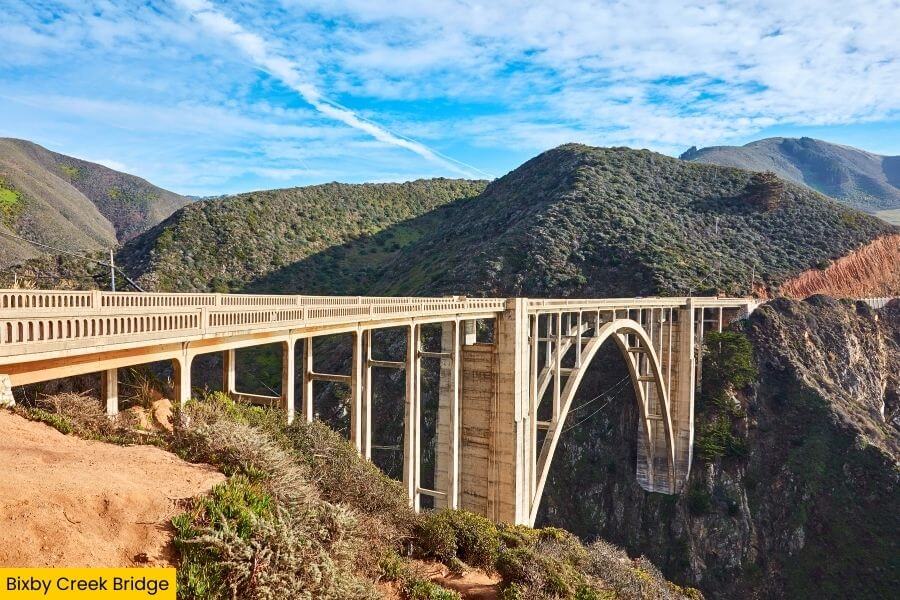
Just up the road, Bixby Creek Bridge steals the spotlight as one of the most photographed spots on the entire Big Sur drive.
Built in 1932, this concrete arch bridge stretches 714 feet across a deep canyon and stands about 280 feet above Bixby Creek.
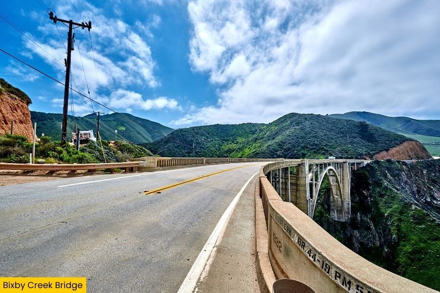
You’ll find multiple pullouts on both sides of Highway 1, but the classic viewpoint is just north of the bridge where you can see the full curve of the arch with waves crashing far below.
Show up early in the morning or right before sunset for the best light, when the cliffs glow golden and the bridge looks like it’s floating above the coastline.
10. Point Lobos State Natural Reserve
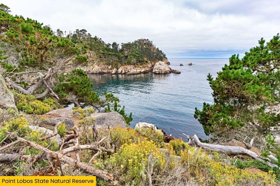
Finally, Point Lobos State Natural Reserve wraps up your road trip and this place seriously delivers with some of the most dramatic coastal scenery in California.
The 0.8-mile round trip Cypress Grove Trail is a must, looping past twisted Monterey cypress trees and opening up to views of turquoise coves like China Cove that look almost unreal in bright sunlight.
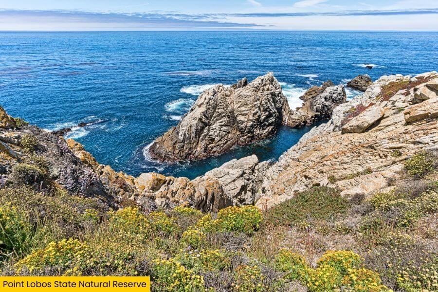
Head over to Sea Lion Point and you’ll hear barking before you even see them, with dozens of sea lions piled onto rocky outcrops and harbor seals floating in the water below.
If you’ve still got energy, a walk along the trails that line the cliffs, gives you nonstop ocean views and a perfect grand finale to your Big Sur adventure.
Related Posts