California is easily one of the most beautiful places in the world.
From colossal mountains to rugged coastlines and serene beaches, California has a diverse variety of landscapes to suit every traveler.
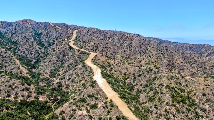
There are actually so many places to see in California that can only be reached following a good old hike!
But with so many amazing hiking trails to choose from, which is right for you?
That’s why, in this guide, we’re revealing the top 12 best hikes in the whole of California that will absolutely take your breath away.
There’s something for everyone on this list from beginner-friendly trails that’ll take less than half an hour to epic long-distance trails that’ll take 10 days to complete.
Without wasting any more time, let’s jump into the best hikes in California that you definitely have to experience.
1. John Muir Trail
The John Muir Trail (JMT) is a famous hiking path in California that stretches more than 210 miles through the beautiful Sierra Nevada mountains.
It starts in the breathtaking Yosemite National Park, winds through the Ansel Adams Wilderness, Sequoia & Kings Canyon National Park and ends at Mount Whitney, the highest peak in the continental United States.
This trail is like a long journey through some of the most stunning natural landscapes you can imagine, with tall mountains, sparkling lakes and lush forests.
Hikers on the JMT will see amazing sights like towering granite cliffs, clear blue skies and fields of wildflowers.
The trail is pretty tough though as it involves a lot of walking and some parts are very steep.
Plus, the high altitude can make it harder to breathe, especially near Mount Whitney. If you’re thinking about hiking the JMT, you should plan carefully.
You’ll need to get some permits before you go, carry enough food and water and have good hiking gear.
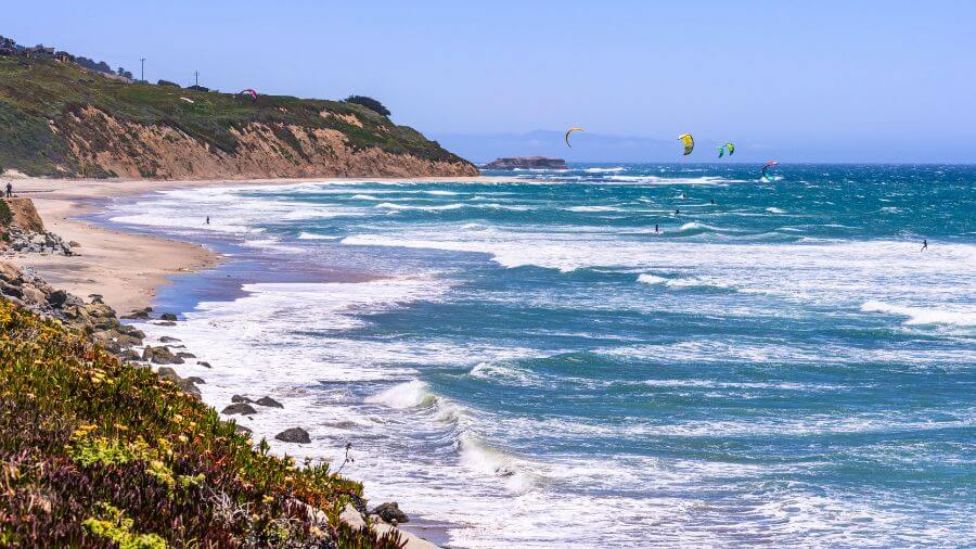
2. Lost Coast Trail
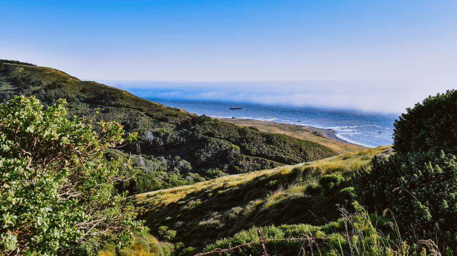
The Lost Coast Trail is a unique hiking trail that takes you along a rugged and remote section of the coastline where few people live.
It’s located in the King Range National Conservation Area, which is in the northern part of California, far away from the big cities.
This trail is famous because it offers stunning views of the Pacific Ocean, untouched beaches and beautiful natural landscapes.
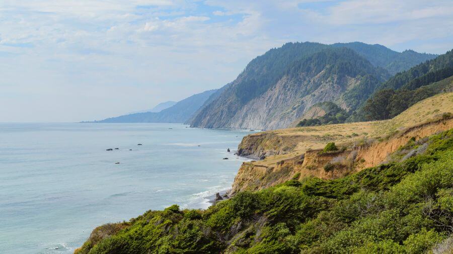
The trail stretches for about 25 miles and hikers can see wild animals, like sea lions, bobcats, elephant seals and river otters, along the way.
Walking on the Lost Coast Trail can be tough because the sand and pebbles make it hard to walk and there are parts where you have to watch the tide to make sure you can pass.
It’s really important to check the tide charts before you begin so you don’t get stuck in a dangerous spot. It’s also recommended that you bring a tide table with you.
People who hike this trail should be prepared with good hiking boots, plenty of water and camping gear if they plan to stay overnight.
Since there are no stores nearby, you will need to bring all your food and supplies with you. There are, however, many water sources along the trail.
The trail is considered moderately difficult because of the uneven terrain and the need to be careful with the tides.
3. Mount Whitney Trail
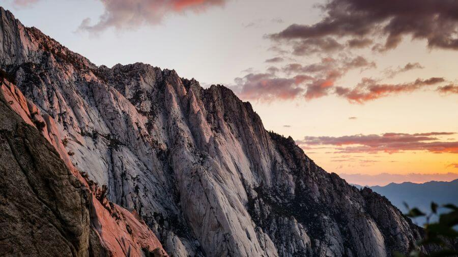
The Mount Whitney Trail is a popular hiking trail that leads to the top of Mount Whitney, the highest peak in the lower 48 states of the United States.
This trail is located in the eastern part of California, in the Sierra Nevada mountains.
The trail itself is about 22 miles round trip, starting from Whitney Portal and it takes most hikers around 12 hours to complete. There are camping options available.
As you hike, you’ll see breathtaking views of rugged mountains, alpine lakes and wildflowers.
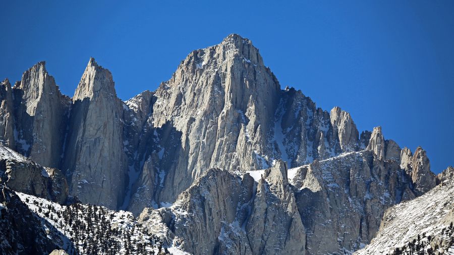
The trail leads you through beautiful areas, and if you’re lucky, you might even spot some wildlife like deer or marmots.
Hiking Mount Whitney can be challenging because of the steep climbs and the high altitude, which can make breathing difficult.
To hike this trail, you need a permit, so it’s important to plan ahead and get one early, as they can be hard to get during the busy summer months.

Tips for hikers include starting early in the morning to avoid afternoon thunderstorms, bringing plenty of water and snacks and wearing layers since the weather can change quickly.
It’s also a good idea to spend some time acclimating to the altitude before you start your hike to reduce the risk of altitude sickness.
Completing the Mount Whitney Trail is a big achievement because of its difficulty and the amazing views from the top which makes it a truly unforgettable experience.
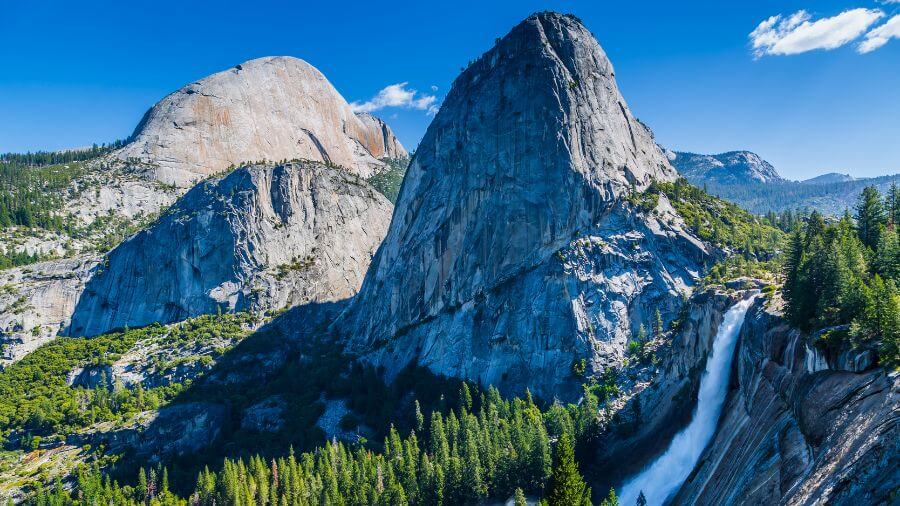
4. Half Dome Hike
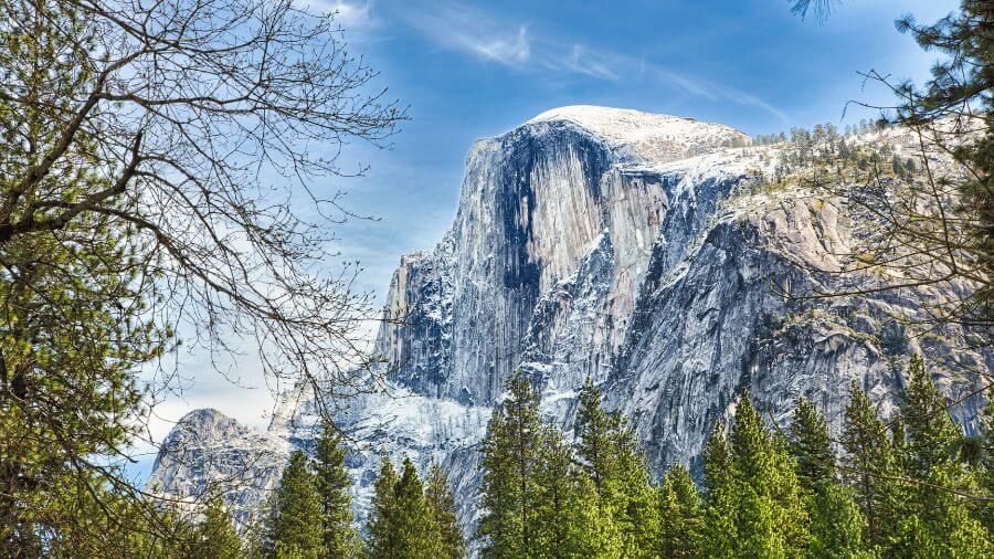
The Half Dome Hike is a famous trail in Yosemite National Park.
This trail takes you to the top of Half Dome, a huge rock formation that looks like a giant dome cut in half. It rises nearly 5,000ft above Yosemite Valley.
The hike is about 14 to 16 miles round trip, depending on the path you take, and it usually takes around 10 to 12 hours to complete.

Along the way, you’ll see stunning waterfalls, vast forests and panoramic views of the park.
The most thrilling part of the hike is the final ascent as you’ll get to climb up the steep granite dome using cables to pull yourself up.
This part can be a little scary but it’s also really fun and gives you a big sense of achievement.
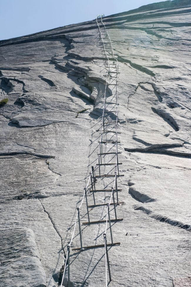
To hike Half Dome, you need a special permit because it’s so popular, so make sure to plan ahead and apply for one.
It’s important to bring lots of water, snacks and good hiking boots. I’d also recommend starting early in the morning to avoid the crowds and the heat.
The hike is very challenging, especially the last part, so it’s best for those who are in good shape and have some hiking experience.
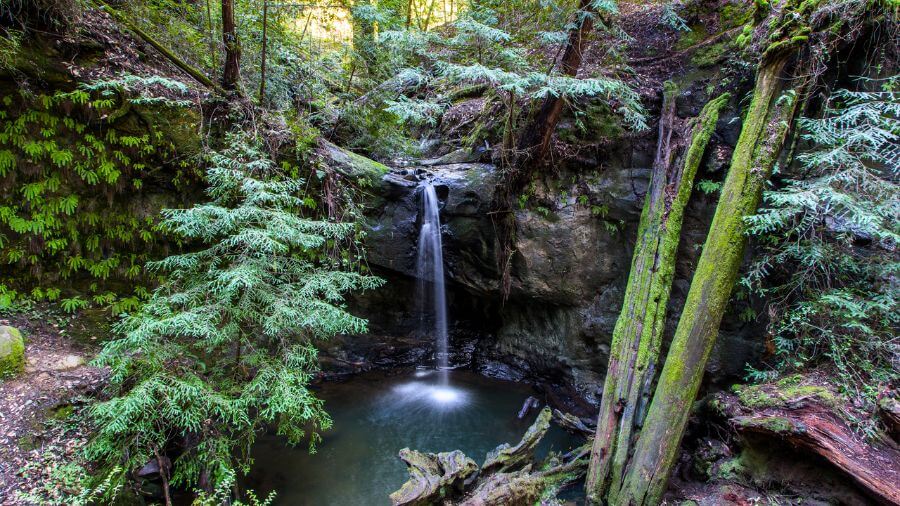
5. Skyline-to-the-Sea Trail
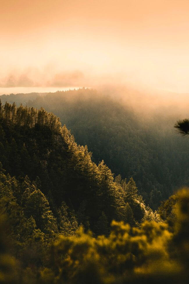
The Skyline-to-the-Sea Trail is a special hiking trail that takes you from the mountains to the ocean.
This trail starts in the Santa Cruz Mountains, specifically at Castle Rock State Park, and ends at the Pacific Ocean, at Waddell Beach.
It’s about 30 miles long, which means hikers usually take two to three days to complete the whole journey.
As you walk, you’ll go through cool, shady redwood forests, see beautiful waterfalls and enjoy views of the ocean as you get closer to the end.
The trail is well-marked, which makes it easy to follow, but you’ll still feel like you’re on an adventure in the wild.
Along the way, there are campgrounds where you can spend the night so it’s important to bring camping gear and reserve your spot ahead of time.
One tip for hikers is to pack light but bring enough food and water, as well as layers of clothing because the temperature can change from the mountains to the sea.
The Skyline-to-the-Sea Trail is considered moderate in difficulty so it’s good for hikers with a bit of experience as well as beginners who are up for a challenge.
Remember to leave no trace, keeping the trail clean for animals and other hikers.
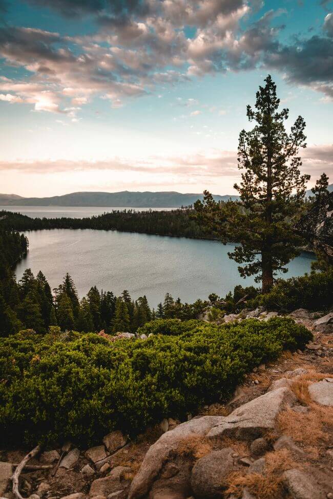
6. Tahoe Rim Trail
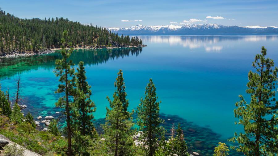
The Tahoe Rim Trail is an amazing loop trail that goes all around Lake Tahoe, which is the largest alpine lake in North America.
This trail is about 165 miles long and it offers some of the most stunning views of the lake, nearby mountains and beautiful wildflowers.
Hikers can see vast forests, clear streams, hidden lakes and even encounter wildlife like birds and deer along the way.
The trail has several sections so you can choose to hike a part of it for a day trip or take on the challenge of hiking the entire loop which usually takes about 10 to 15 days.
The terrain varies from easy, flat paths to more challenging, steep areas which makes it suitable for hikers of all levels.
It’s important to prepare well for the hike, bringing plenty of water, snacks and sunscreen, and to wear good hiking shoes.

Hikers need to be aware of the rules for camping and fires along the trail to protect the environment.
One of the best tips is to start your hike early in the morning to enjoy the peace and quiet and to have the best chance of seeing wildlife.
7. Deep Creek Hot Springs Trail
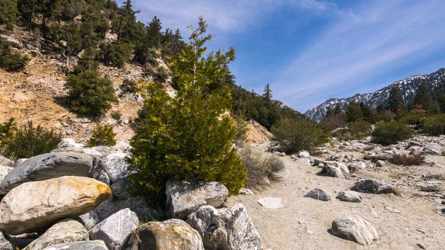
The Deep Creek Hot Springs Trail is a cool hike in Southern California that leads to natural hot springs.
This trail is located in the San Bernardino National Forest, not too far from the city of Apple Valley.
It’s about a 2 to 6 mile hike, depending on where you start, and it can take a couple of hours to get to the hot springs.
The path takes you through a desert landscape with impressive views of mountains and the creek running alongside the trail.
When you get to the hot springs, you’ll find several warm pools where you can relax and enjoy the warm water.
The hot springs are in a beautiful setting, surrounded by nature, making it a perfect spot to chill out.

Since the trail goes through a desert area, it’s really important to bring a lot of water, wear sunscreen and have good hiking shoes.
The hike is considered moderate because of the steep and rough parts of the trail.
Also, the area around the hot springs is a natural place so hikers should remember to keep it clean and respect the environment.
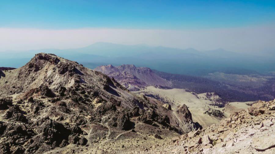
8. Lassen Peak Trail
The Lassen Peak Trail is an exciting hike located in Lassen Volcanic National Park in Northern California.
This trail leads to the top of Lassen Peak, which is one of the largest plug dome volcanoes in the world.
The hike is about 5 miles round trip and it takes most people 4 to 5 hours to complete.

As you climb up the trail, you’ll see amazing views of the surrounding mountains and volcanic landscape.
The path is steep and rocky in places but the incredible scenery at the top makes it all worth it.
From the summit, you can see far across the park including other volcanic features and beautiful lakes.
It’s important to start the hike early in the morning to avoid afternoon thunderstorms which are common in the area.
Hikers should bring plenty of water, wear sunscreen and dress in layers since the weather can change quickly.
The trail is considered challenging because of the steep climb and high altitude so it’s a good idea to be in reasonable shape before attempting it.
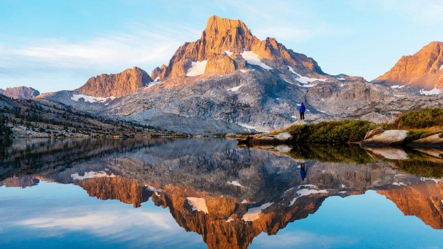
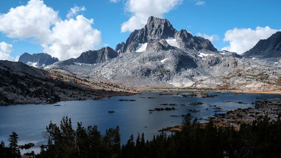
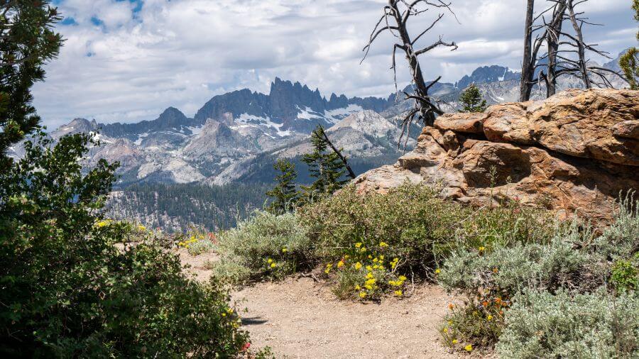
9. Minaret Lake Trail
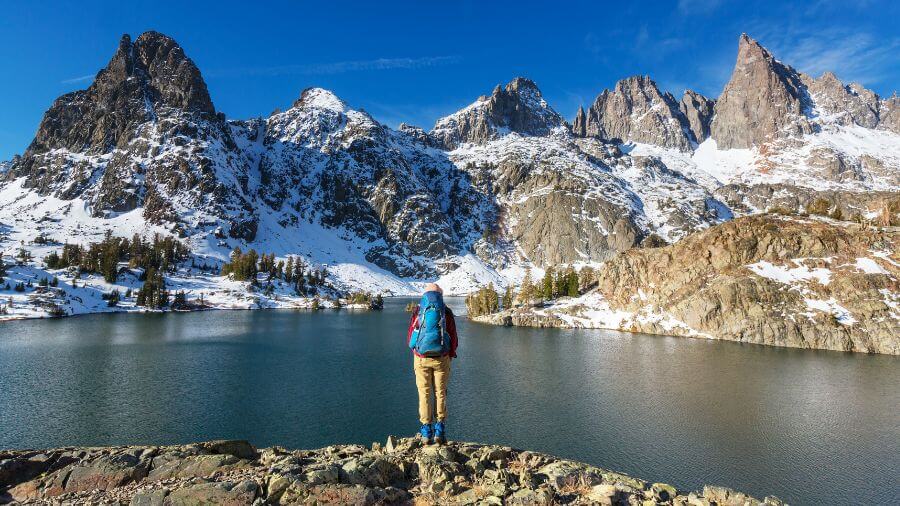
The Minaret Lake Trail is a stunning hike located in the Eastern Sierra, part of the Ansel Adams Wilderness in California.
This trail leads you to Minaret Lake, known for its crystal-clear waters and the dramatic Minarets, which are tall, jagged rock formations that tower over the lake.
The hike is about 7 miles one way, making it a challenging but rewarding day hike or an overnight trip. There are camping grounds in the area.

As you walk, you’ll pass through beautiful forests, cross streams and see wildflowers, with the Minarets in the distance getting closer as you go.
The trail starts at the Devil’s Postpile area, near the town of Mammoth Lakes, and gradually climbs up, offering amazing views of the Sierra Nevada mountains.
One of the best parts of this hike is the breathtaking scenery at Minaret Lake. It’s the perfect spot for a rest or a swim on a warm day.
It’s important to bring plenty of water, snacks and to wear good hiking boots because the trail can be rocky and steep in places.
Since the area is wilderness, hikers should practice Leave No Trace principles to keep it beautiful for others.
The trail is considered moderate to difficult due to its length and elevation gain.
This is a seasonal trail that closes during the winter months. Check the latest information here.
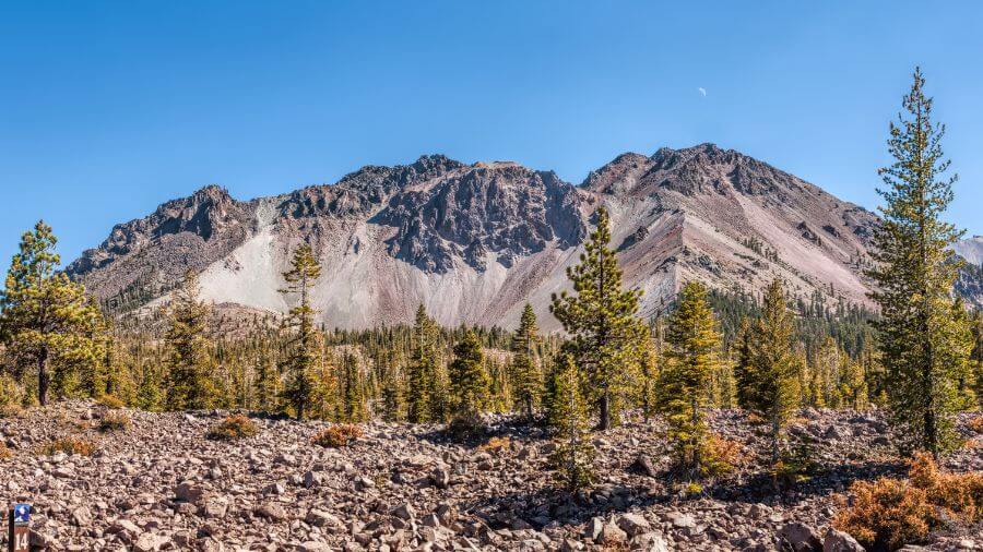
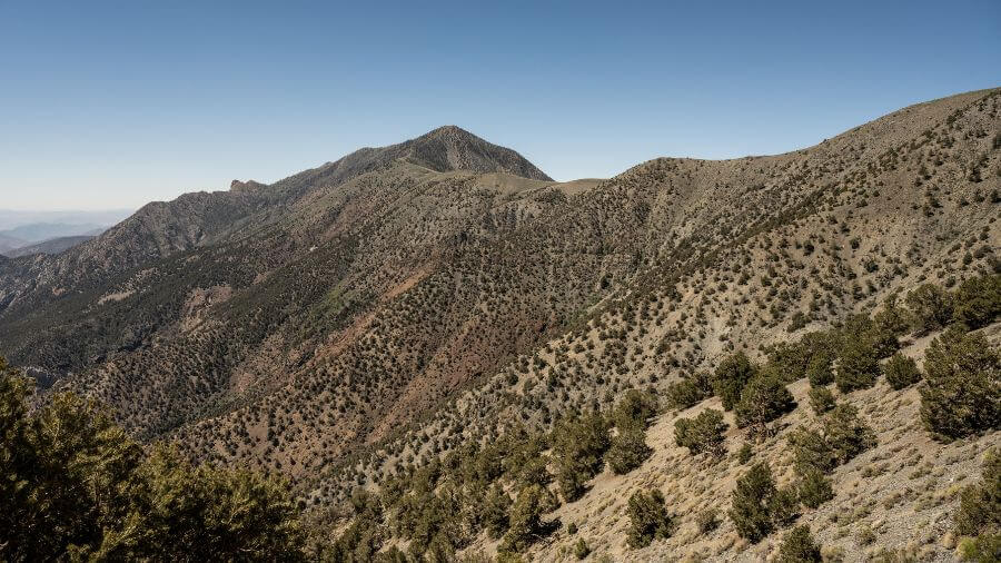
10. Telescope Peak Trail
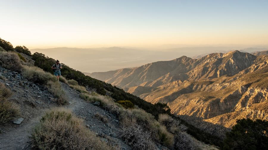
The Telescope Peak Trail is a fascinating hike located in Death Valley National Park.
This trail takes you to the top of Telescope Peak, the highest point in the park, standing at over 11,000 feet tall.
The hike is about 14 miles round trip and offers stunning views of the desert below, including the lowest point in North America, Badwater Basin.

As you climb, the scenery changes from desert to forest with ancient bristlecone pines near the top.
The trail starts at Mahogany Flat Campground, which is already at a high elevation, making the hike much cooler than the valley floor.
Hiking to Telescope Peak is challenging because of the distance and elevation gain but the path is well-marked and steady.
It’s important to bring plenty of water, sunscreen and snacks, and to wear layers since the temperature can change dramatically.
Starting early in the morning is a good idea to avoid afternoon winds or storms.
The trail is considered difficult so it’s best for those who have some hiking experience.
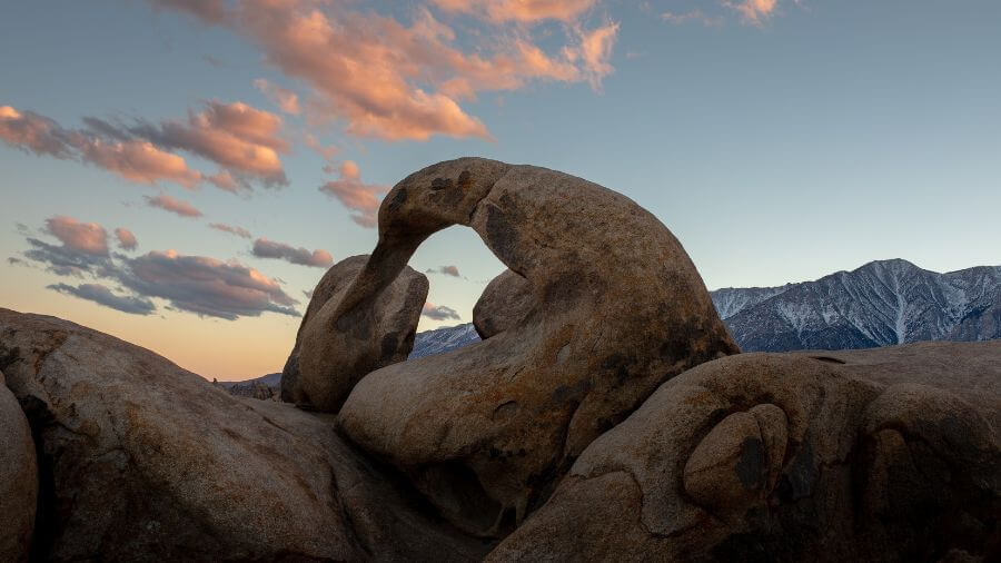
11. Mobius Arch Loop Trail

The Mobius Arch Loop Trail is a cool hike located in the Alabama Hills near Lone Pine.
This trail is famous for its natural rock arches, with the most well-known being Mobius Arch.
It’s a short loop, only about 0.6 miles long, making it a great choice for families and hikers of all levels.
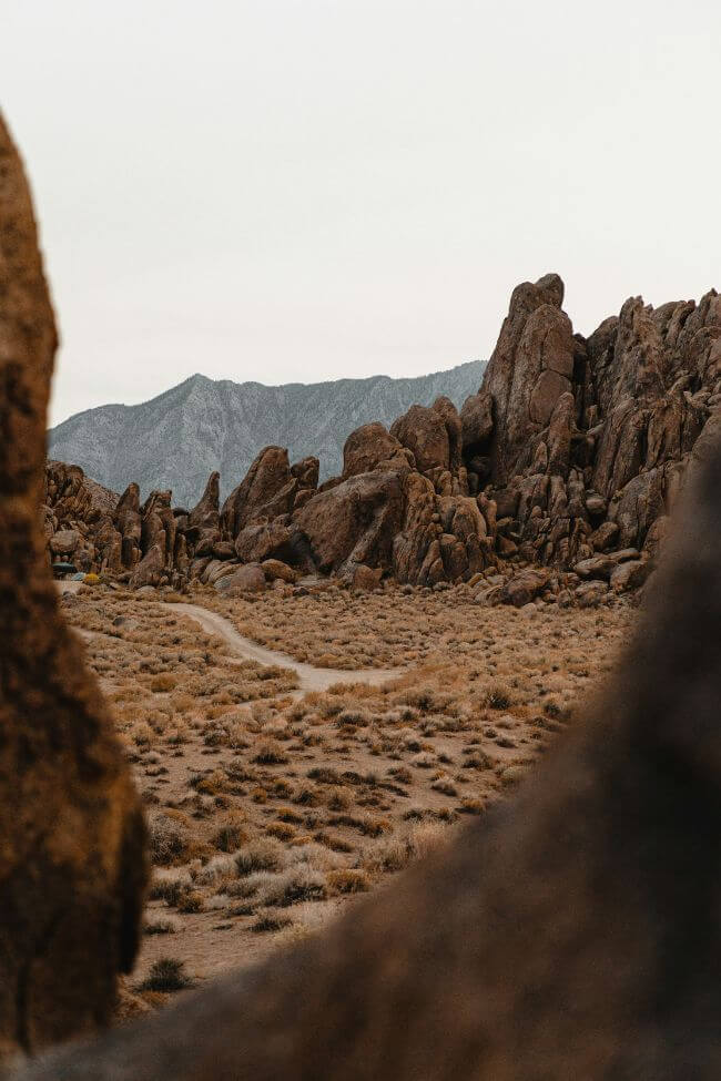
As you walk, you’ll see amazing views of the Sierra Nevada mountains, including Mount Whitney, the highest peak in the lower 48 states.
The Alabama Hills have been the backdrop for many movies so the scenery might look familiar!
The trail is easy to follow and mostly flat with numerous signs pointing out the different arches you can see along the way.
One tip is to visit during the early morning or late afternoon when the light is perfect for photos.
Don’t forget to bring water, wear sunscreen and have a camera ready to capture the stunning views.
The area is also great for stargazing at night because of the clear skies.
12. Trans-Catalina Trail

The Trans-Catalina Trail is a spectacular hike located on Catalina Island, which lies just off the coast of Southern California near LA.
This trail stretches on for about 38.5 miles from the island’s east end to its west end, offering hikers a unique adventure across the entire island.
It takes most people between 3 and 5 days to complete with 5 campgrounds located along the way.
Along the way, you’ll see breathtaking views of the Pacific Ocean, rugged hills and quiet canyons.
The trail also passes through the small towns of Avalon and Two Harbors, where you can stop for supplies or a rest.
Wildlife, like bison and foxes, can often be spotted along the route which adds to the excitement of the hike.
The trail varies in difficulty, with some steep climbs and descents, making it a moderate to challenging hike for most people.
It’s important to carry plenty of water, wear sunscreen and have good hiking shoes because some sections are quite exposed to the sun and the terrain can be rough.
Camping is available at designated spots along the trail so planning your stops in advance is also a good idea.
Additionally, starting early in the morning can help you avoid the heat and enjoy quieter trails.
And that’s it!
Those are the top 12 hiking trails in the whole of California. There’s something on this list for every type of hiker.