Ready for a Tennessee road trip packed with mountain views, hidden caves, waterfalls, sparkling lake water, and some seriously cool local history?
Franklin County squeezes all of that into one adventure, taking you from the shores of a huge lake to the Cumberland Plateau.
Along the way, you can hike beneath towering cliffs, follow old railroad stories, explore a historic college community, and stand at overlooks where the Tennessee hills stretch far into the distance.
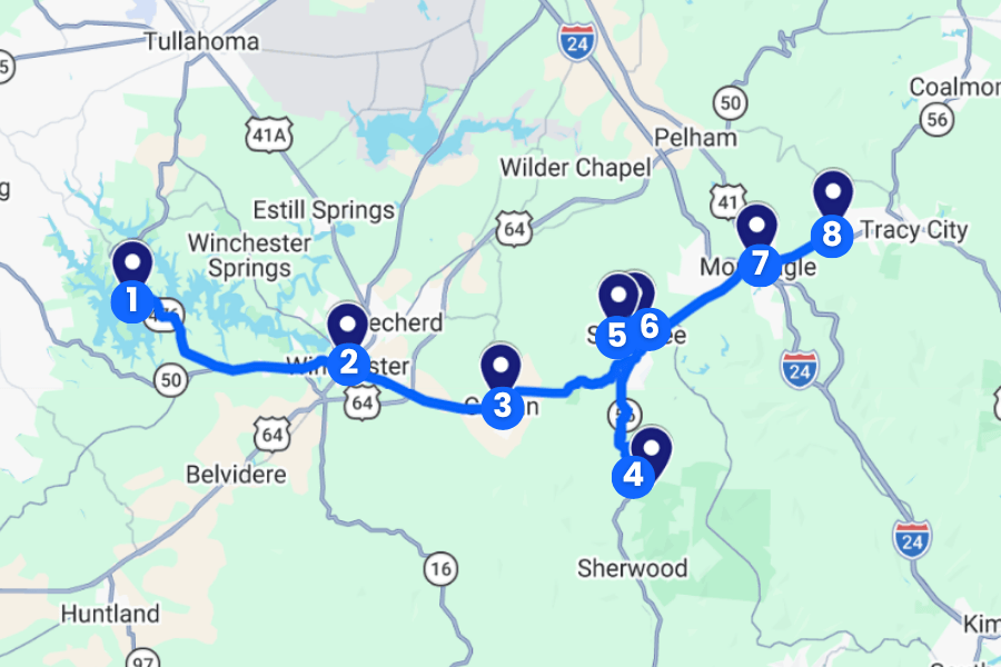
Best of all, the drives between stops are short, so you’ll spend more time exploring and less time staring at the highway.
Keep reading because this Franklin County road trip has a few surprises waiting around the next bend.
1. Tims Ford State Park
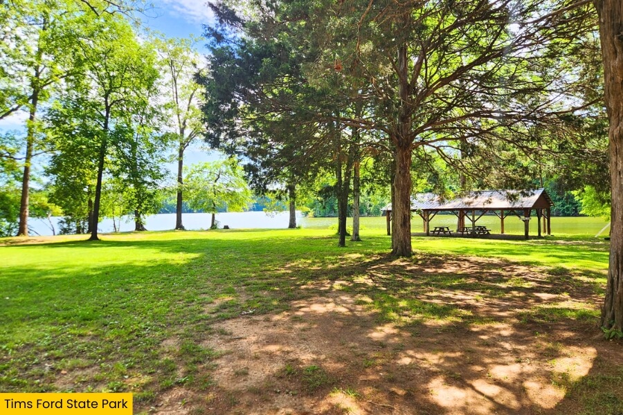
Tims Ford State Park covers 3,546 acres in Franklin County, surrounding the clear blue waters of 10,500-acre Tims Ford Lake near Winchester, Tennessee.
You can hike the 1.35-mile Lost Creek Overlook Trail, paddle quiet coves, swim in the park’s designated lake swimming area, or fish for smallmouth bass, largemouth bass, crappie, and catfish.
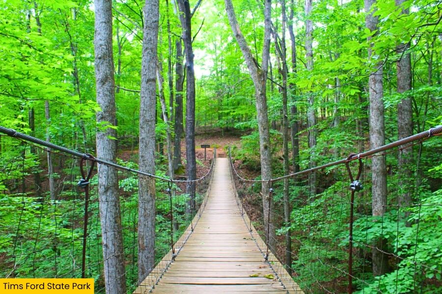
Golfers can tackle the 18-hole Bear Trace at Tims Ford, a Jack Nicklaus-designed course with lake views, while boaters can launch from the park and explore miles of shoreline.
Catch a lakeside sunset before continuing your Franklin County road trip through southern Tennessee.
2. Winchester
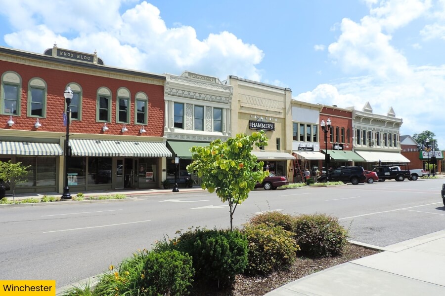
After all that lake time, head into Winchester, the Franklin County seat, where the historic downtown centers around the stately Franklin County Courthouse and its 1930s Art Deco design.
Music fans can learn about Winchester native Dinah Shore, the celebrated singer and television personality who became one of America’s biggest entertainers of the 20th century.
Grab a meal around the downtown square, browse local shops, and check out Oldham Theatre, a classic movie house that first opened in 1950.
3. Cowan Railroad Museum
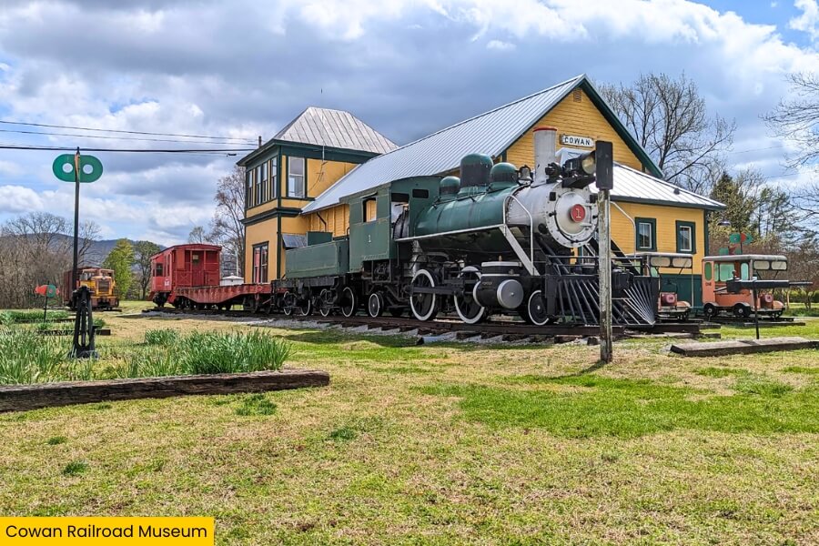
From Winchester, drive about 10 minutes to Cowan, where the Cowan Railroad Museum fills a restored 1904 Nashville, Chattanooga & St. Louis Railway depot beside the active railroad tracks.
Inside, you can check out railroad tools, photographs, equipment, communications gear, and other artifacts that explain how trains helped shape Cowan and Franklin County.
Outside, the collection gets even cooler with vintage railcars, a caboose, and a Porter steam locomotive that originally hauled six-car trains between a clay pit and the Cherokee Brick Company’s brick foundry in Macon, Georgia.
Cowan also sits near the base of Cumberland Mountain, where trains historically faced the steep climb toward the 2,200-foot-long Cowan Tunnel, making this little museum a fun stop before your road trip heads uphill.
4. Lost Cove Cave
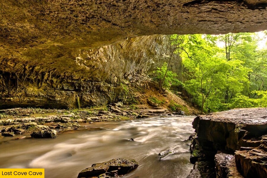
After learning why trains had to work so hard to cross Cumberland Mountain, head toward Lost Cove Cave, a huge natural opening hidden in the forest near Sewanee on the Cumberland Plateau.
Also called Buggytop Cave, its main entrance measures roughly 100 feet wide and 80 feet high, with Crow Creek flowing straight out of the dark limestone cavern.
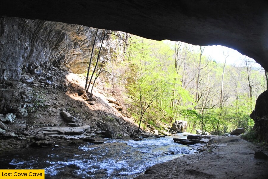
Reach it on the Buggytop Trail in Head of the Crow State Park, a roughly 4-mile round-trip hike that descends steeply through hardwood forest before reaching the cave.
You can admire the enormous entrance and cool creek from outside, but entering the cave requires proper caving gear, preparation, and extra care because water levels and underground conditions can change quickly.
5. Morgan’s Steep Overlook
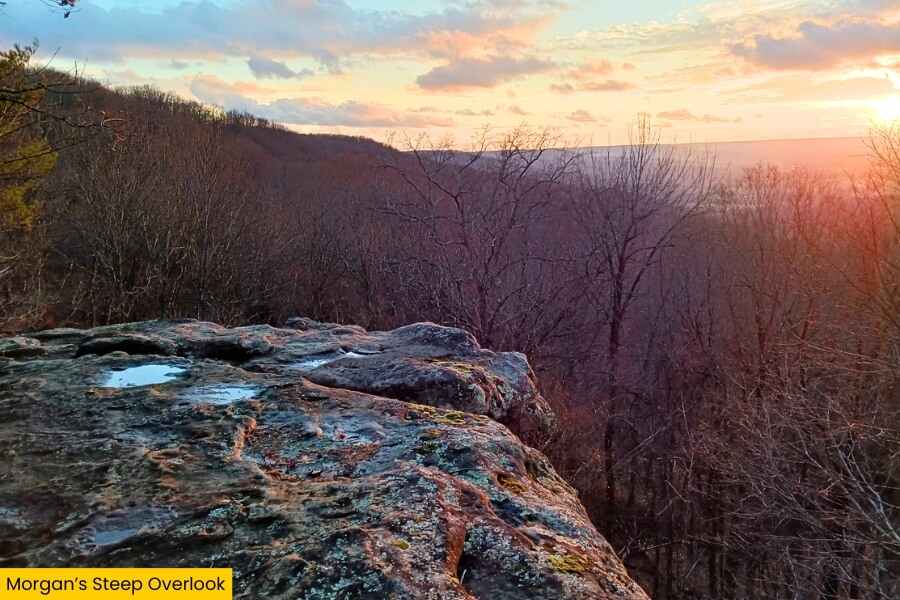
Once you climb back out of Lost Cove, trade the dark cave for a wide-open view at Morgan’s Steep Overlook on the University of the South’s campus in Sewanee.
This easy-to-reach overlook sits along the western edge of the Cumberland Plateau, over 1,800 feet above sea level, with sweeping views across forest-covered valleys toward the distant Tennessee hills.
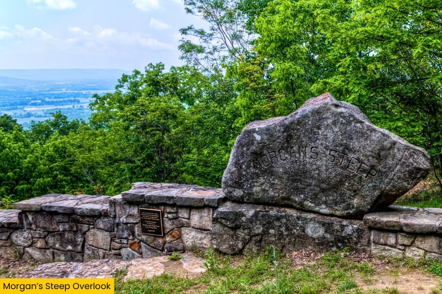
Morgan’s Steep is especially popular around sunset, when you can park nearby and reach the rocky viewpoint with only a short walk instead of tackling another long trail.
The overlook is part of Sewanee’s roughly 13,000-acre Domain, so it also makes a handy starting point for exploring the university’s extensive network of wooded hiking and biking trails.
6. Sewanee
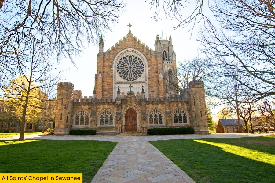
From Morgan’s Steep, keep exploring Sewanee, a tiny Cumberland Plateau community best known as the home of the University of the South, founded in 1857.
Explore the university’s 13,000-acre Domain to see Gothic-style stone buildings, including All Saints’ Chapel, with its soaring tower, stained-glass windows, and impressive Shapard Tower carillon.
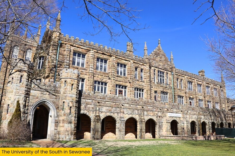
Stop by the Sewanee Village area for coffee or lunch, then follow part of the 20-mile Perimeter Trail, which loops around the Domain through forests, rocky bluffs, streams, and overlooks.
Sewanee sits at roughly 1,800 to 2,000 feet above sea level, giving you cooler mountain air and a completely different setting from Winchester and Tims Ford Lake earlier on your Franklin County road trip.
7. Monteagle
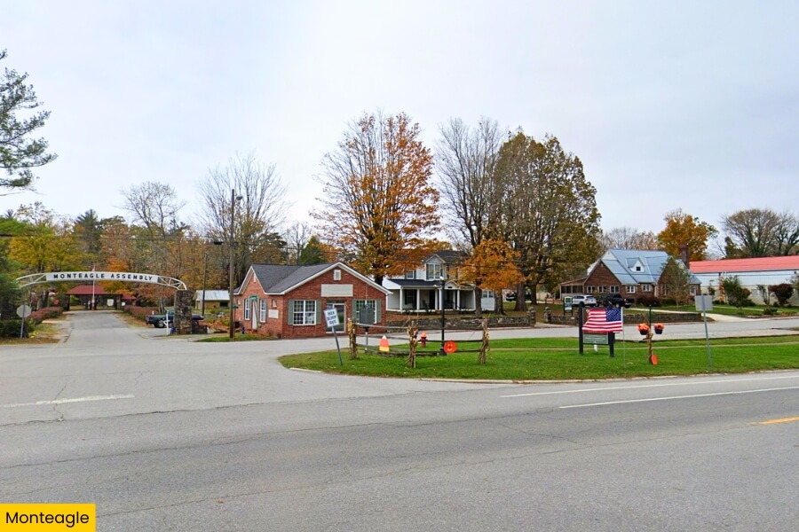
Just a few minutes from Sewanee, Monteagle brings you to a mountain town perched around 1,900 feet above sea level on Tennessee’s Cumberland Plateau.
The town is famous for the steep Monteagle Grade on Interstate 24, where the highway climbs roughly 1,300 feet between the valley and plateau and runaway truck ramps hint at just how serious the slope gets.
Stop at the historic Monteagle Sunday School Assembly, founded in 1882 and filled with colorful Victorian cottages, walking paths, and the historic Warren Chapel.
Monteagle also puts you close to South Cumberland State Park and the Fiery Gizzard Trail, a challenging 12.8-mile route packed with waterfalls, rocky gorges, creeks, and some of the area’s best overlooks.
8. Fiery Gizzard State Park (formerly known as South Cumberland State Park)
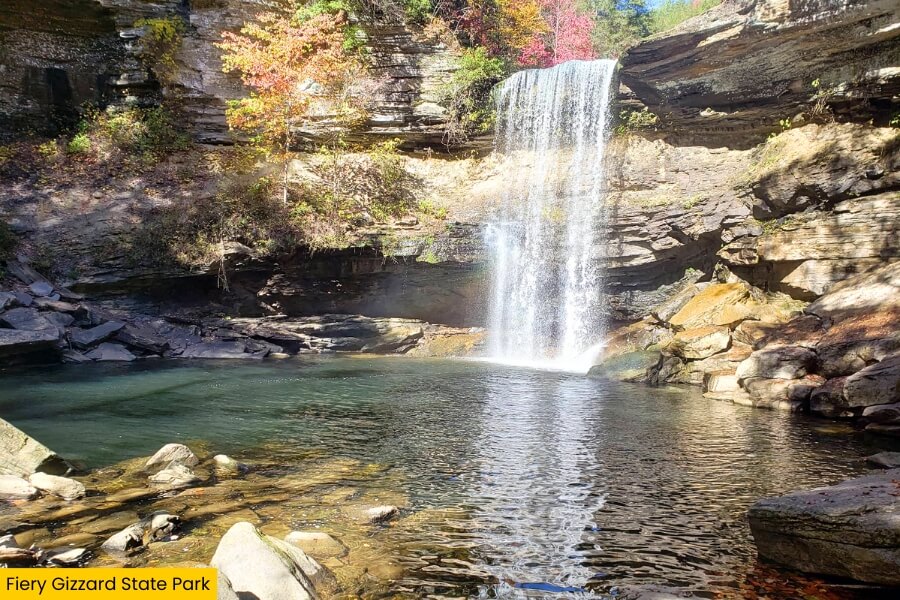
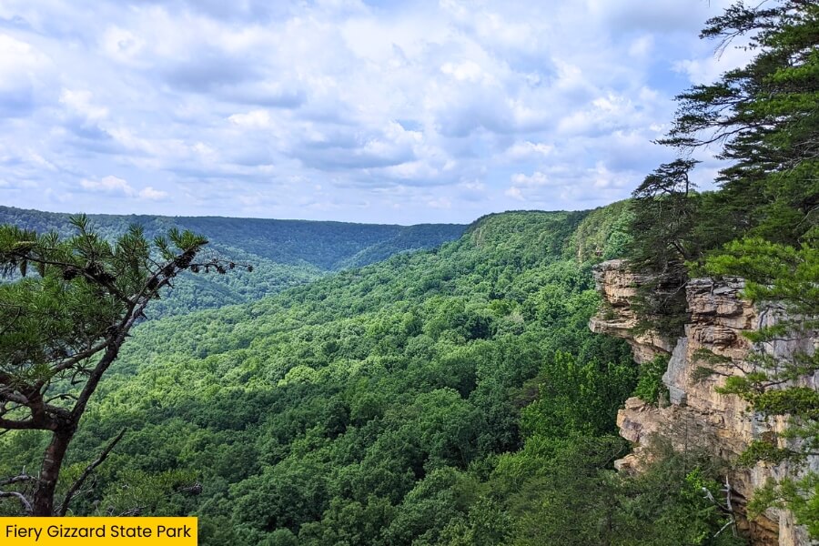
From Monteagle, keep the mountain adventure going at Fiery Gizzard State Park, the area formerly managed as part of South Cumberland State Park on Tennessee’s Cumberland Plateau.
The star attraction is the 12.8-mile Fiery Gizzard Trail, which runs between the Foster Falls and Grundy Forest areas through boulder fields, hemlock woods, rocky gorges, and creek crossings.
Start at Foster Falls for a shorter adventure to see a 60-foot waterfall plunging into a broad pool below towering sandstone cliffs popular with rock climbers.
For another quick stop, explore the Grundy Forest Day Loop, a roughly 2-mile trail beside Little Fiery Gizzard Creek, where cascades and swimming holes pack plenty into a relatively short hike.
Related Posts