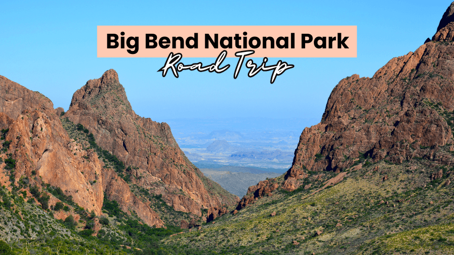
Big Bend National Park is the kind of place that makes you pull over every five minutes just to stare at the view.
One minute you’re driving through desert landscapes filled with cactus and rocky peaks, and the next you’re standing beside towering canyons or soaking in natural hot springs.
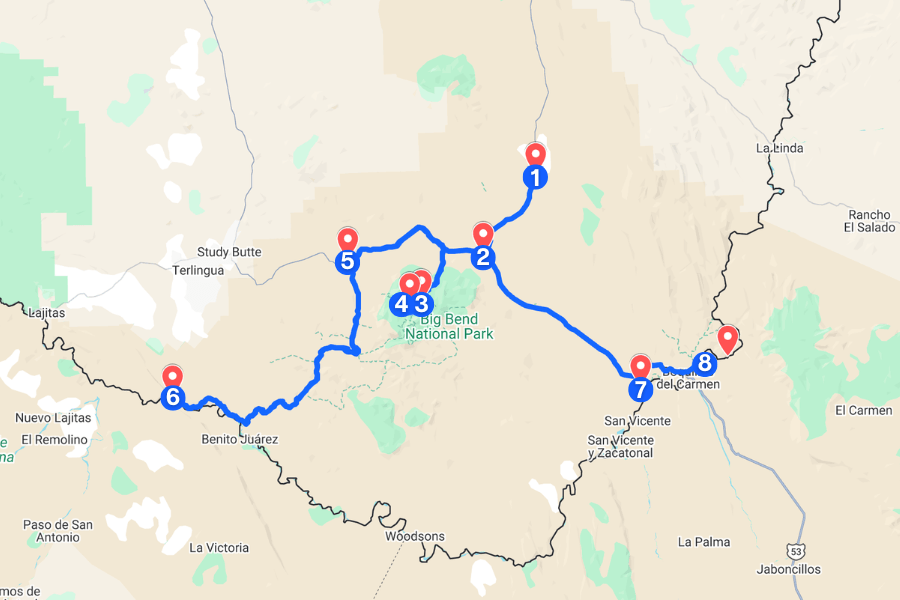
That’s what makes this road trip so unforgettable, with scenic drives, epic hikes, ancient fossils, and hidden historic spots around every corner.
If you’re ready for nonstop adventure across more than 800,000 acres of West Texas, this Big Bend itinerary is about to become your new favorite national park guide.
1. Fossil Discovery Exhibit
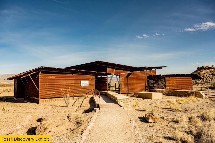
First up is the Fossil Discovery Exhibit, an open-air museum that offers a quick look at 130 million years of ancient history.
This stop is famous for its timeline displays, giant pterosaur display, and detailed fossil replicas that show what once lived across the region.
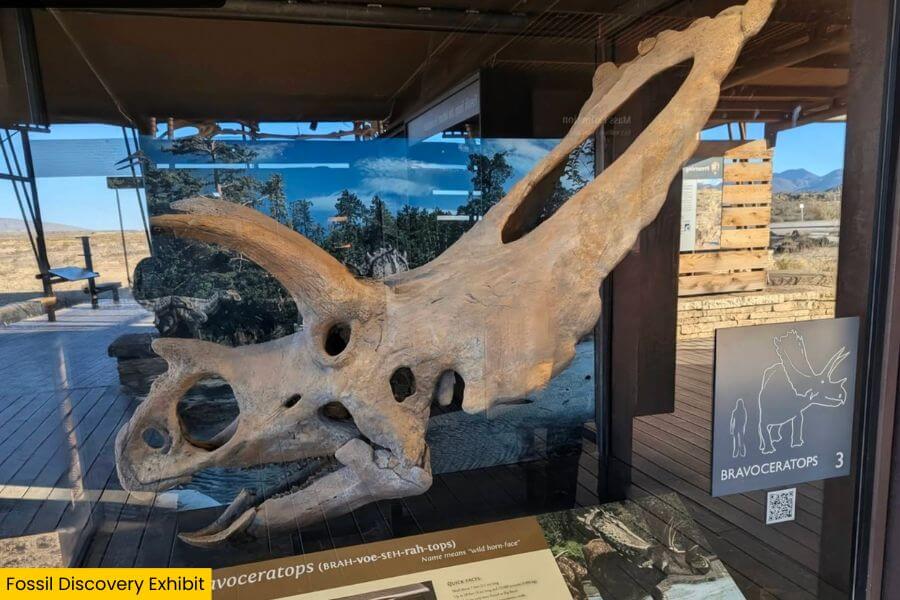
You’ll even come face-to-face with a life-size Quetzalcoatlus northropi, one of the largest flying animals ever discovered, with a wingspan reaching up to 36 feet.
After viewing the exhibits, you can explore a short trail which leads to panoramic views and geologic overlooks, making this one of the most interesting stops in Big Bend.
2. Panther Junction Visitor Center
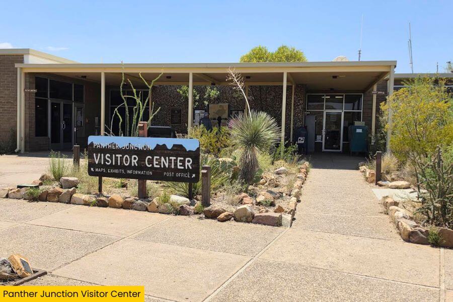
Just 10 minutes away is Panther Junction Visitor Center, the park’s main information hub in the heart of Big Bend.
Inside, you’ll find a massive topographic map, wildlife exhibits, and a 30-minute film that introduces the area in a fun and easy-to-understand way.
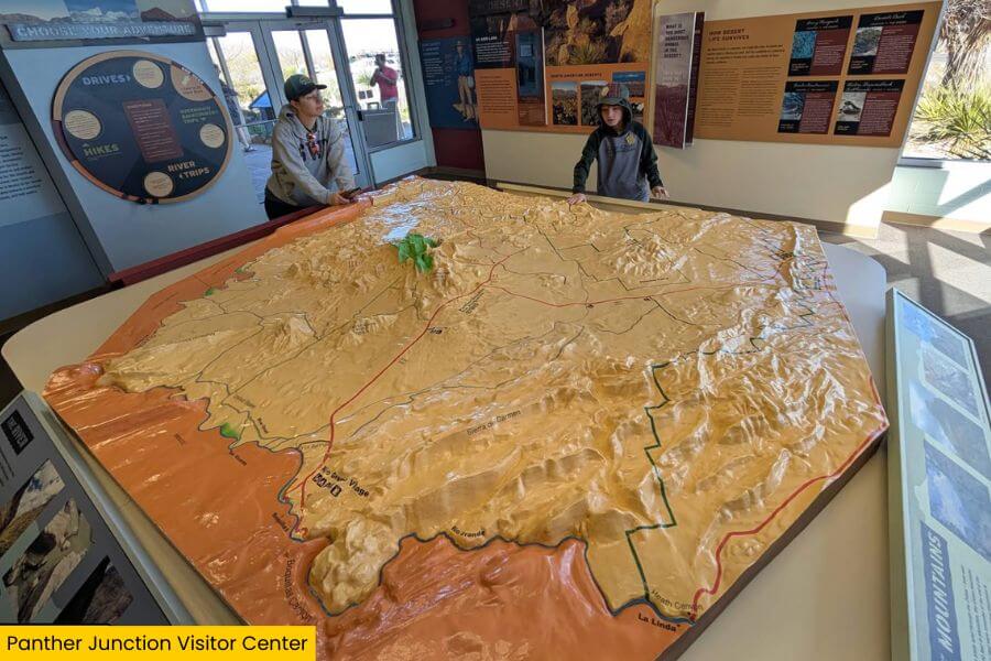
You can also speak with the friendly rangers here if you need trail suggestions, road updates, or help planning the rest of your trip.
Don’t skip the Big Bend Natural History Association bookstore for good reads, and take a quick walk along the plant trail near the entrance to see some desert plants.
3. Lost Mine Trail
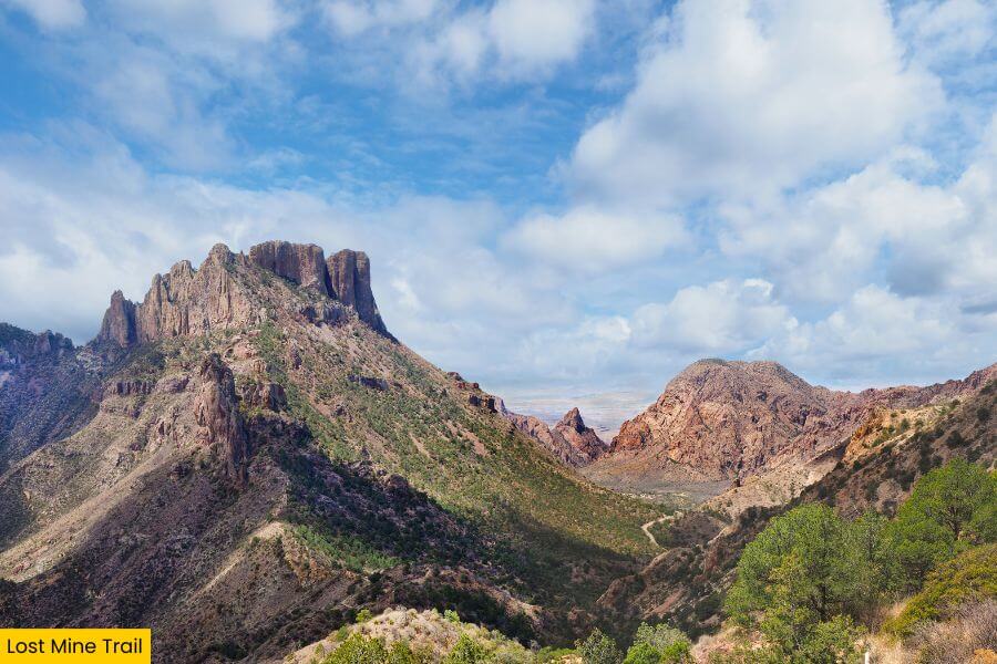
Once you’ve picked up trail maps, drive 15 minutes to the Lost Mine Trail, one of the most rewarding hikes in Big Bend National Park.
This 4.8-mile round-trip hike takes you through pine forests, rocky switchbacks, and scenic overlooks as you climb about 1,100 feet in elevation.
At nearly every turn, you’ll get nonstop views of Juniper Canyon, Casa Grande, and layers of desert mountains stretching across the horizon.
The final stretch brings you to incredible panoramas above Pine Canyon and the Sierra del Carmen mountains in Mexico, which look especially beautiful at sunset.
4. Window View Trail
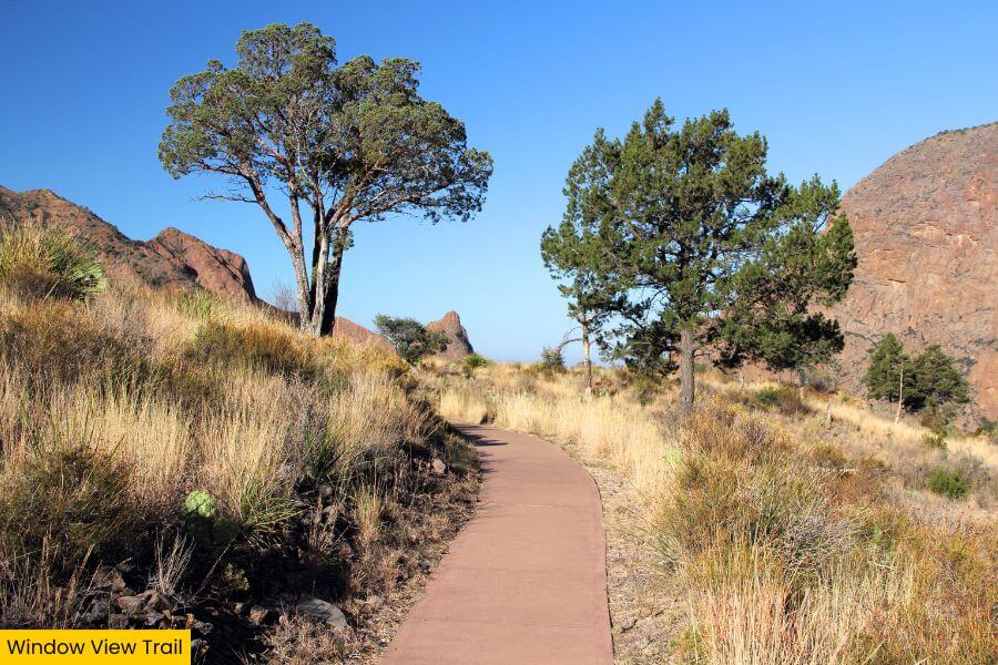
After conquering the steep Lost Mine Trail, slow things down with the Window View Trail, an easy paved loop near the Chisos Basin Visitor Center.
The short 0.3-mile trail takes you to one of Big Bend’s best viewpoints, where the V-shaped “Window” frames layers of desert scenery in the distance.
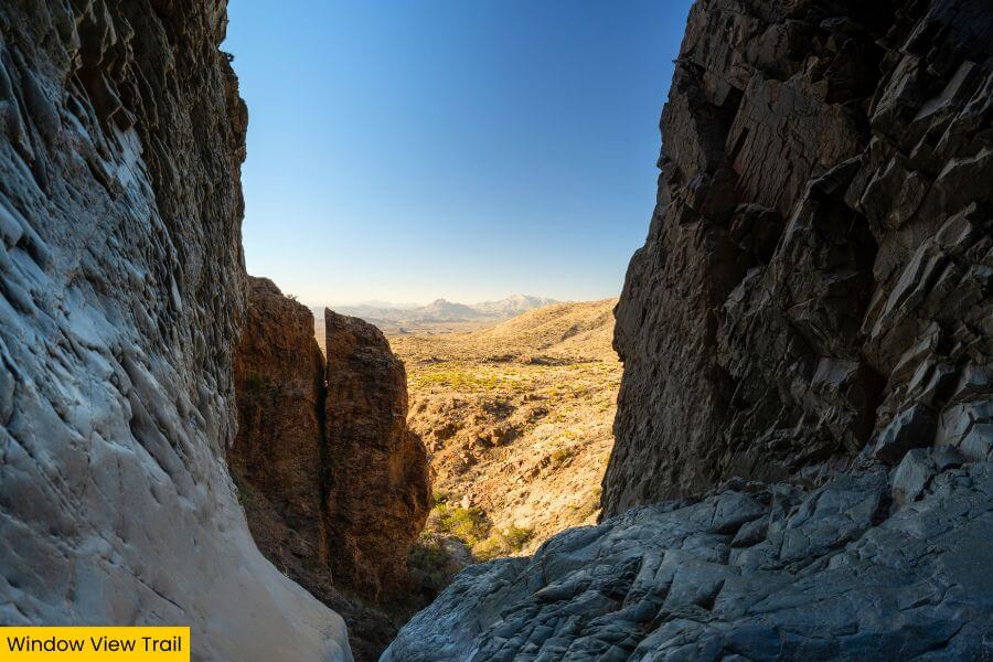
There are also benches along the path where you can relax and watch the sunset colors spread across the desert sky.
And because it’s wheelchair accessible, it’s a great stop for visitors of all ages and activity levels.
5. Ross Maxwell Scenic Drive
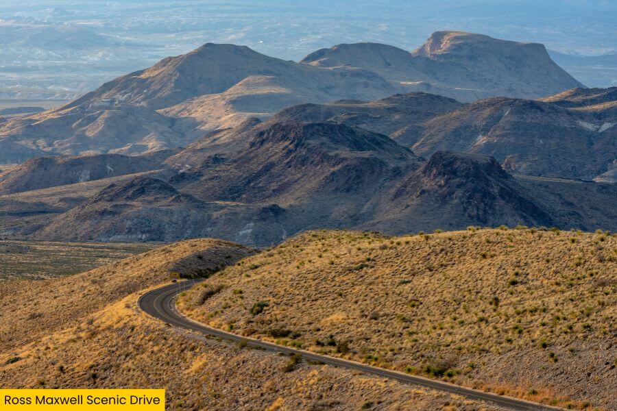
About 25 minutes from the Window is Ross Maxwell Scenic Drive, a 30-mile route known for its dramatic desert landscapes and scenic overlooks.
The road winds past massive canyons, with must-see stops like Sotol Vista Overlook, Mule Ears Viewpoint, and Castolon Historic District along the way.
You’ll also come across the Sam Nail Ranch, a historic homestead where an old windmill still pumps water and attracts wildlife like javelinas and mockingbirds.
Fun fact: This drive was named after Ross Maxwell, Big Bend’s first superintendent and geologist, who designed the route to highlight the park’s jaw-dropping geology.
6. Santa Elena Canyon
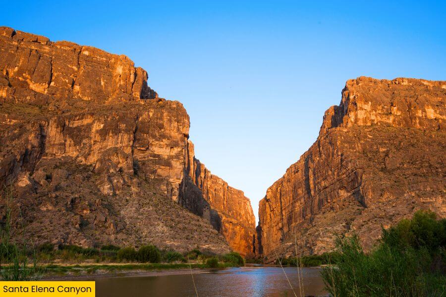
Ross Maxwell Scenic Drive eventually leads to Santa Elena Canyon, where the Rio Grande slices between massive canyon walls in Texas and Mexico.
Here, towering limestone cliffs rise 1,500 feet above the river, and you can follow the 1.7-mile Santa Elena Canyon Trail that winds down beside the canyon floor.
As you make your way deeper into the canyon, the temperature noticeably cools in the shade, which feels refreshing after the desert heat outside.
The best time to experience the canyon is at sunset, when the cliffs glow with golden light.
7. Hot Springs Historic District
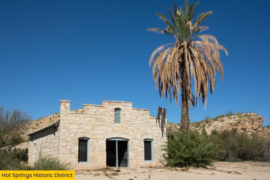
Next up is Hot Springs Historic District, one of the most relaxing stops in Big Bend, located about 1.5 hours from Santa Elena Canyon.
Set along the Rio Grande, this historic area features ancient pictographs, preserved buildings, and the remains of an early 1900s bathhouse.
You can also relax in the natural 105-degree hot springs surrounded by canyon scenery.
With its mix of history, beautiful views, and warm spring water, it’s a great place to slow down and take a break from the long desert drives.
8. Boquillas Canyon
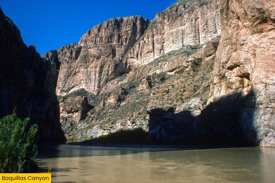
Then there’s Boquillas Canyon, where the Rio Grande forms the longest and deepest canyon in all of Big Bend.
The best way to explore it is along the 1.5-mile round-trip Boquillas Canyon Trail, which follows the river to the entrance of the massive limestone gorge.
Along the way, you can spot ancient fossils, smooth canyon rock shaped by floods, and sweeping views of the Sierra del Carmen.
This canyon feels completely different from Santa Elena, with wider views, gentler desert scenery, and peaceful riverside spots perfect for relaxing by the water.
Related Posts