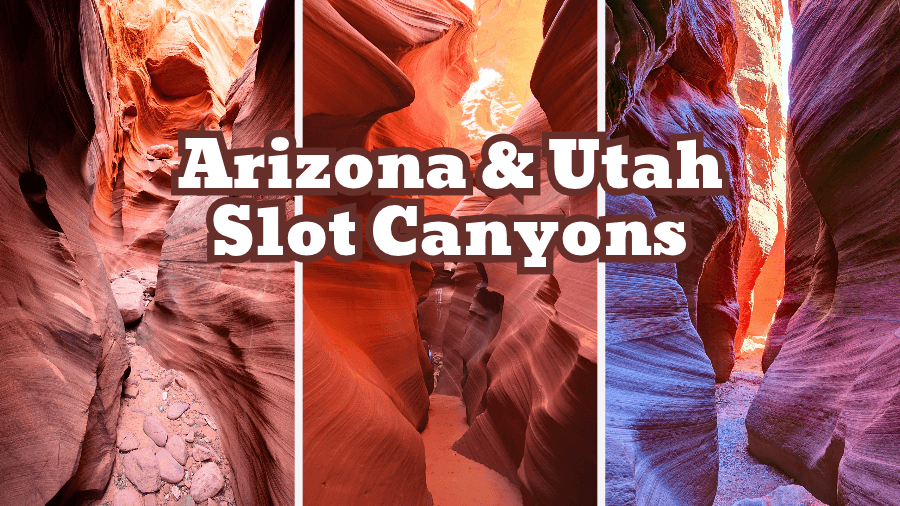
Imagine squeezing through narrow sandstone passages, walking between towering red rock walls, climbing ladders into hidden canyons, and wading through a rushing river between massive cliffs.
That’s exactly what you can expect on this epic Arizona and Utah slot canyons road trip.
Every stop brings something completely different, from twisting orange rock formations and glowing canyon walls to secret passageways carved by millions of years of flash floods.
Some of these canyons are world-famous, while others are tucked away down dusty dirt roads, far from the crowds, and getting to them is half the adventure.
Whether you’re looking for incredible photo spots, short hikes, or thrilling canyon adventures, this road trip packs some of the Southwest’s most unforgettable landscapes into one amazing journey.
So grab your hiking boots, charge your camera, and get ready to explore some seriously cool places!
1. Mountain Sheep Canyon (Arizona)
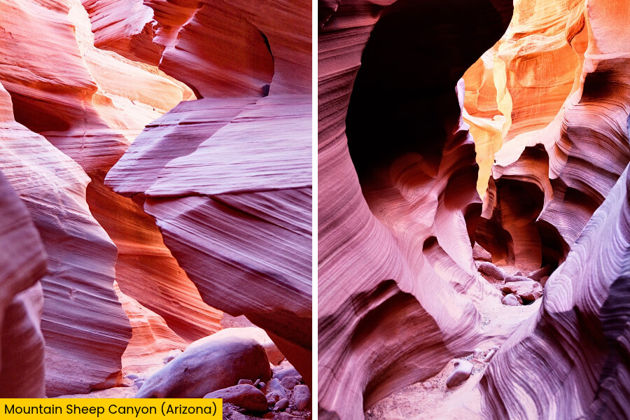
Mountain Sheep Canyon is a hidden gem near Page, Arizona, located on Navajo Nation land just a 35-minute drive from the famous Antelope Canyon.
It’s known for its narrow sandstone passages, twisting rock walls, and peaceful setting away from the crowds.
Unlike the busy Upper and Lower Antelope Canyons, Mountain Sheep Canyon offers a quieter adventure where you can explore narrow sandstone corridors and enjoy a more adventurous hike.
You can also photograph beautiful layers of orange, red, and pink sandstone carved by ancient rivers and flash floods.
Its winding corridors feature smooth curves, dramatic rock formations, and narrow openings that let sunlight create amazing patterns on the walls.
You’ll need to book a guided Navajo tour to explore this canyon, so bring sturdy shoes, a camera, and a sense of adventure.
2. Rattlesnake Canyon (Arizona)
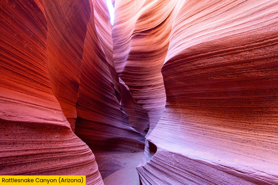
If you’re craving more slot canyon adventures, head to Rattlesnake Canyon, about 35 minutes from Mountain Sheep Canyon.
It’s another fantastic stop, famous for its phenomenal curves, narrow sandstone corridors, and incredible photo opportunities without the huge crowds of Antelope Canyon.
Located on Navajo Nation land near the Antelope Canyon area, this beautiful slot canyon gets its name from its winding sandstone corridors, which resemble the curves of a snake.
One of the coolest parts is climbing a few ladders to reach different sections of the canyon, where you can spot swirling rock patterns, unusual sandstone shapes, and glowing walls as sunlight filters through openings overhead.
You can only explore Rattlesnake Canyon with an authorized Navajo guide, and tours often combine it with nearby Owl Canyon for an extra dose of adventure.
3. Lower Antelope Canyon (Arizona)
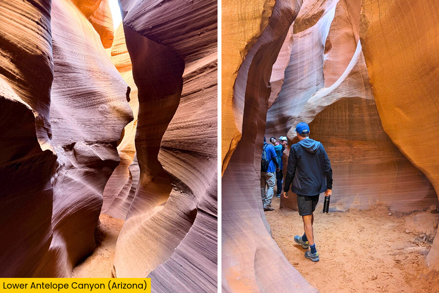
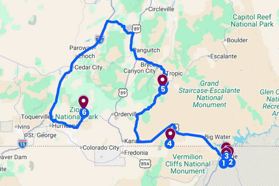
Next up, drive about 10 minutes from Rattlesnake Canyon to Lower Antelope Canyon.
Here, you’ll find one of the most photographed slot canyons in the Southwest, famous for its incredible wave-like sandstone walls and narrow, twisting passageways.
Known as Hasdestwazi in Navajo, meaning “spiral rock arches,” this stunning canyon stretches more than 1,300 feet.
It takes you underground through a maze of orange, red, and golden sandstone shaped by millions of years of rushing floodwater.
Unlike Upper Antelope Canyon, Lower Antelope Canyon requires you to descend steep metal stairs and climb several ladders as you explore its narrow V-shaped passages, making the roughly one-hour guided tour feel like a mini adventure.
You’ll need to book a tour with Ken’s Tours or Dixie’s Lower Antelope Canyon Tours, and midday is a great time to catch sunlight lighting up the canyon’s swirling rock walls.
4. Wire Pass (Utah)
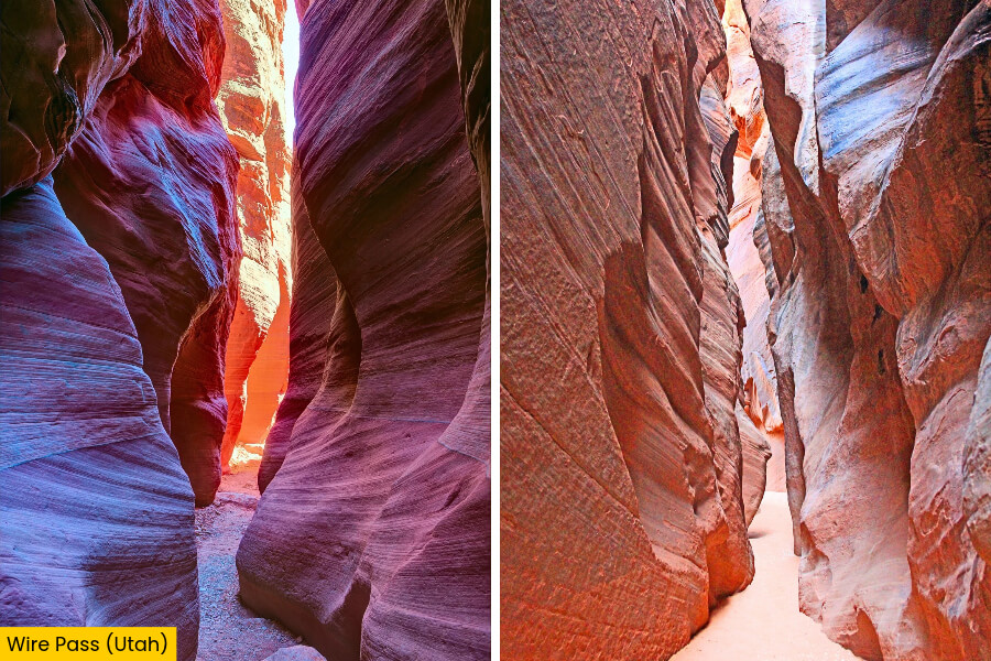
After exploring Lower Antelope Canyon, drive about 1 hour and 10 minutes toward the Utah border to hike Wire Pass.
It is a narrow slot canyon in the Paria Canyon-Vermilion Cliffs Wilderness that’s famous for its towering sandstone walls and easy access to the spectacular Buckskin Gulch.
The 3.4-mile round-trip hike starts at Wire Pass Trailhead along House Rock Valley Road, near US-89, and follows a sandy wash before squeezing between tall, reddish sandstone walls.
One of the coolest features is a short rock drop inside the canyon, where you may need to use a ladder to climb down, followed by a stunning junction with Buckskin Gulch, one of the longest slot canyons in the world.
Look for ancient petroglyphs near the junction, bring your $6 per-person day-use permit, and never enter when rain or flash floods are possible.
5. Willis Creek Slot Canyon (Utah)
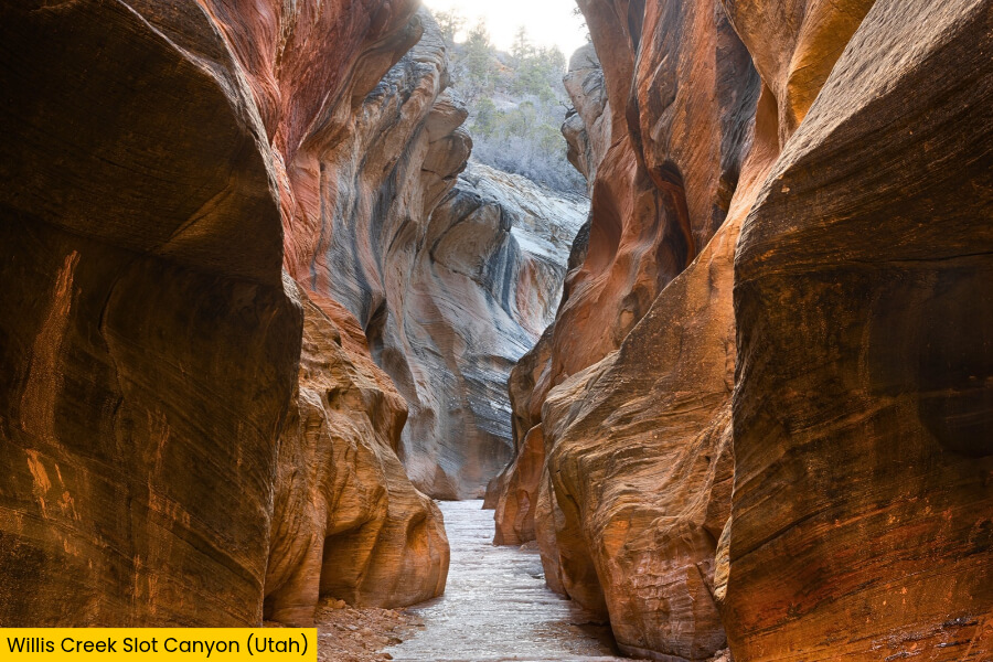
Next, drive about 2 hours and 10 minutes toward Willis Creek Slot Canyon, located in Grand Staircase-Escalante National Monument, where a shallow creek winds through beautiful layers of golden sandstone.
Unlike the dry, sandy passages of Wire Pass, this canyon lets you walk right alongside a gently flowing stream, with smooth, curved rock walls rising up to 100 feet above you in some sections.
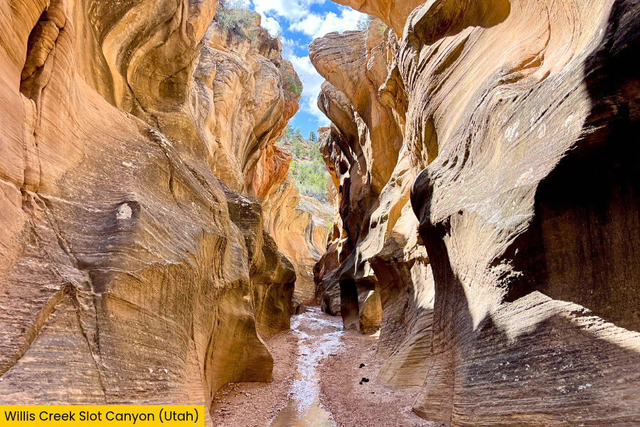
The 4.8-mile round-trip hike follows Willis Creek through several narrow slot sections, where you’ll find rippled sandstone walls and cool, shaded corridors that are perfect for escaping the desert heat.
Getting there requires driving along Skutumpah Road, a dirt road that can become impassable when wet, so check conditions before heading out and avoid hiking when flash floods are possible.
6. The Narrows, Zion National Park (Utah)
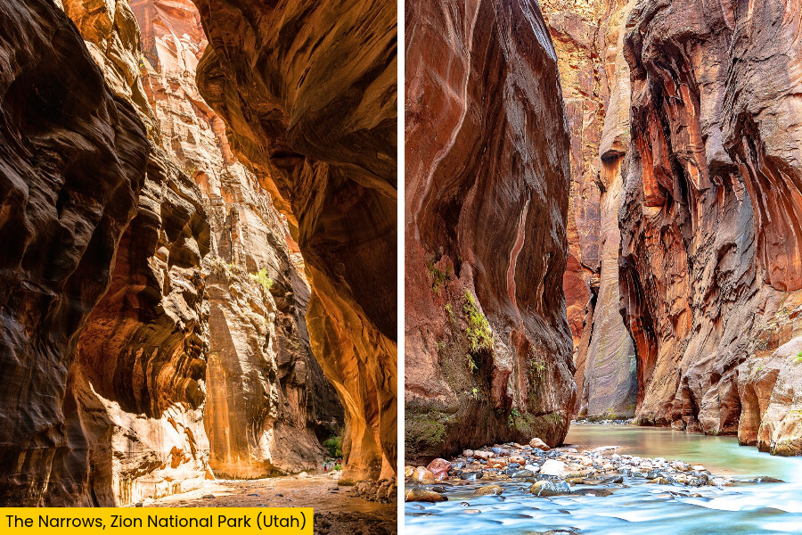
For the grand finale of your Arizona and Utah slot canyon road trip, head to Zion National Park to tackle The Narrows, one of the most famous hikes in the Southwest.
Here, you’ll wade through the Virgin River between massive sandstone cliffs reaching up to 1,000 feet high.
Unlike the smaller slots you’ve explored so far, The Narrows features a dramatic river-carved gorge, with towering orange and red walls, hanging gardens, and sections where the canyon narrows to just 20 to 30 feet wide.
The popular bottom-up hike starts at the Temple of Sinawava, after a 1-mile walk along the Riverside Walk, and you can hike up to 9.4 miles round trip to Big Spring without a wilderness permit.
Rent water shoes and a sturdy walking stick in Springdale, check river flow and flash flood forecasts before entering, and don’t miss Wall Street, the spectacular narrow sections farther upstream in The Narrows.
Related Posts