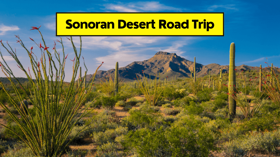
What if you could drive from a cactus-filled desert to cool pine forests to towering rock formations to mountain lakes, all on one epic adventure?
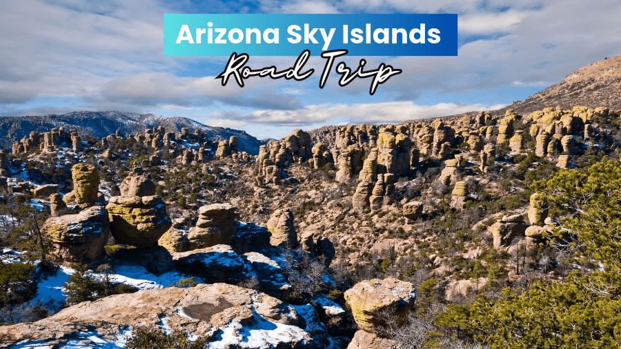
That’s exactly what makes the Arizona Sky Islands so special, with mountain ranges rising thousands of feet above the desert floor and creating completely different landscapes along the way.
One minute, you’re winding through dry desert valleys filled with saguaros, and the next, you’re climbing mountain roads where temperatures drop by 20 degrees.
Add in old mining towns, world-class stargazing, hidden hiking trails, and some of the best birdwatching spots in the country, and you’ve got a road trip packed with surprises.
The best part?
Many of these incredible places are overlooked by travelers heading to Arizona’s more famous attractions, so you can explore some seriously cool spots without the huge crowds.
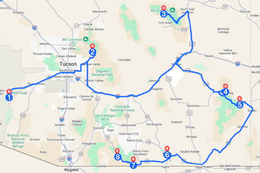
Here’s everything you need to plan the ultimate Arizona Sky Islands road trip, including all the unforgettable stops you won’t want to miss!
1. Kitt Peak National Observatory
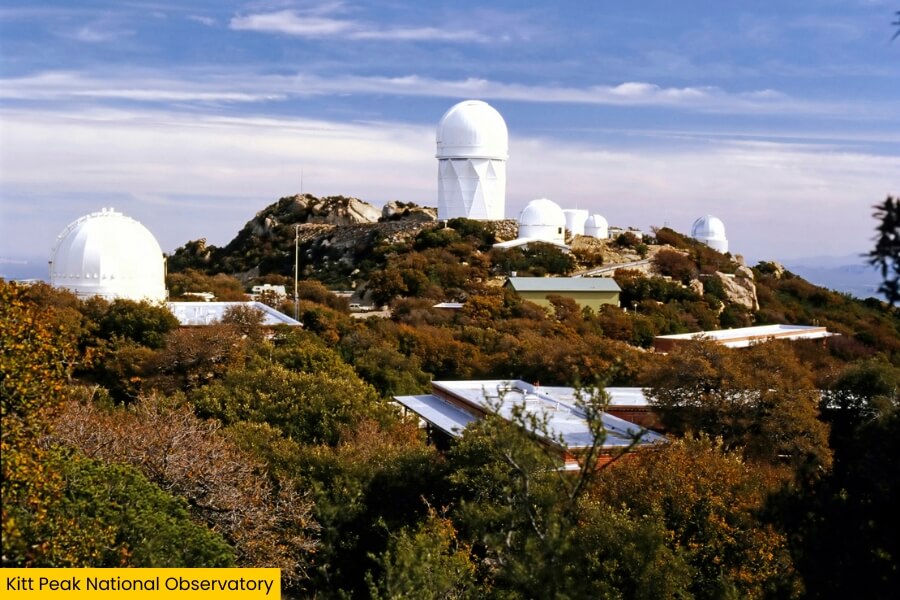
One of the coolest stops on this road trip is Kitt Peak National Observatory, located within the Tohono O’odham Nation, perched atop Kitt Peak in the Quinlan Mountains.
This famous astronomy center is home to more than 20 optical and radio telescopes, including the 4-meter Mayall Telescope, which hosts the Dark Energy Spectroscopic Instrument (DESI) and is so tall, you can see it from 50 miles away!
The mountain’s high elevation makes it one of America’s top astronomy spots, with sweeping views of the Sonoran Desert along the winding 12-mile mountain road.
You can explore the observatory on guided daytime tours or join nighttime stargazing programs where powerful telescopes reveal constellations, galaxies, and much more.
2. Windy Point Vista
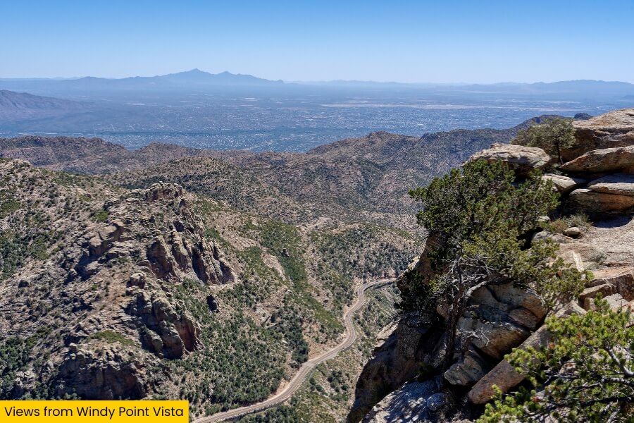
After exploring the stars at Kitt Peak, head to Windy Point Vista, a scenic overlook along the Sky Island Scenic Byway, sitting at an elevation of around 6,600 feet.
This roadside stop is famous for its incredible views of Tucson and the Santa Catalina Mountains, making it one of the best photo spots along the 27-mile drive along the Catalina Highway up Mount Lemmon.
You can scramble around the granite rock formations to catch a spectacular sunset as the desert below turns shades of orange and pink.
Keep an eye out for the area’s vegetation, including chaparral, ponderosa pine, and a variety of cacti and succulents!
3. Riggs Flat Lake
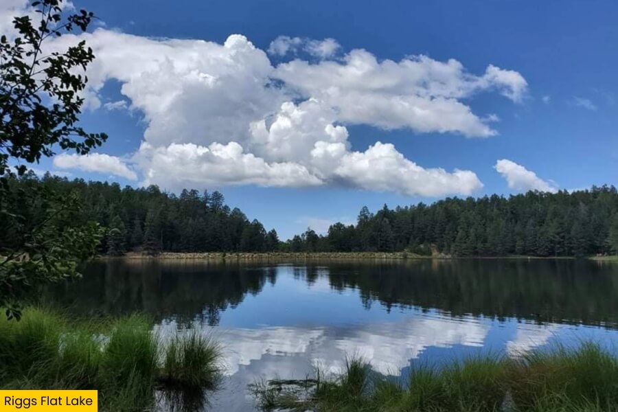
Trade the rocky cliffs of Windy Point Vista for the cool alpine forests of Riggs Flat Lake, an 11-acre mountain lake located in the Pinaleño Mountains.
Surrounded by towering ponderosa pines and Douglas firs, this peaceful lake sits near the top of Mount Graham and is a popular spot for motorized boating (trolling motors only), picnicking, and fishing, with rainbow and brown trout swimming beneath its waters.
After casting a line from the shoreline or cruising across the water, grab a spot at Riggs Flat Campground, where you can set up your tents or trailers (up to 22 feet) and use facilities such as campfire rings, grills, and toilets.
Getting here is part of the adventure, with the winding Swift Trail climbing from the desert floor into cool mountain forests, where summer temperatures can be 20 to 30 degrees cooler than in nearby Safford.
4. Massai Point
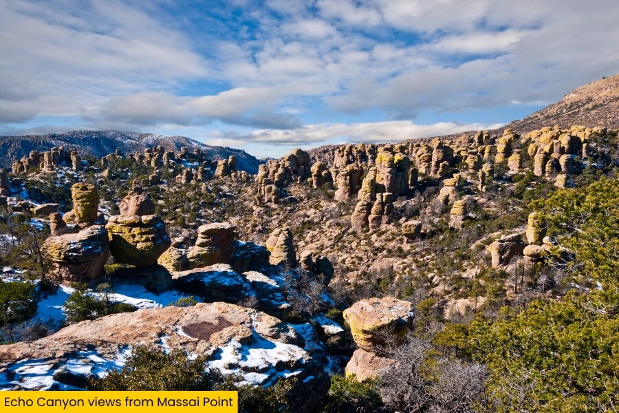
The alpine forests around Riggs Flat Lake give way to a whole different mountain scene at Massai Point, a spectacular overlook in Chiricahua National Park, a little over 3 hours away from the lake.
Sitting at roughly 6,870 feet, this viewpoint offers sweeping views of towering rhyolite rock columns stretching down a narrow canyon.
These formations are believed to have been created by a volcanic eruption around 27 million years ago!
You can walk the short 0.5-mile Massai Point Nature Trail, explore the observation tower, or tackle the 3.4-mile Echo Canyon Loop Trail to get a closer look at the monument’s best rock formations.
The 8-mile Bonita Canyon Scenic Drive takes you straight to the viewpoint, with other notable stops along the way including Erickson Cemetery, Faraway Ranch, and the park Visitor Center.
5. Cave Creek Canyon
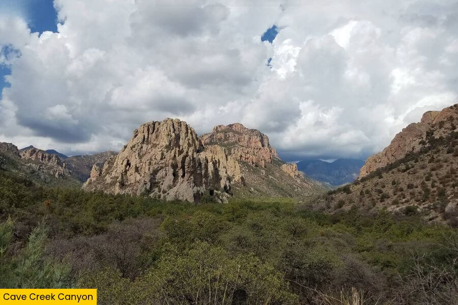
Around 2 hours from Massai Point, Cave Creek Canyon takes you into the eastern side of the Chiricahua Mountains, where you’ll be met with vast grasslands and desert landscapes at the base, and a variety of pine, fir, and spruce trees up top.
Known as the biggest and most biologically diverse canyon in the Chiricahua Mountains, this canyon attracts around 300 bird species, including elegant trogons, redstarts, and several types of hummingbirds that you can spot along its wooded trails.
Depending on what time of year you visit, you can hike the 7.2-mile South Fork Trail through shady forests, go birdwatching, or keep an eye out for wildflowers, butterflies, and reptiles.
For an overnight adventure, grab a campsite at Sunny Flat Campground, where dramatic rock formations tower above the campsites and the clear night skies are perfect for stargazing.
6. Bisbee
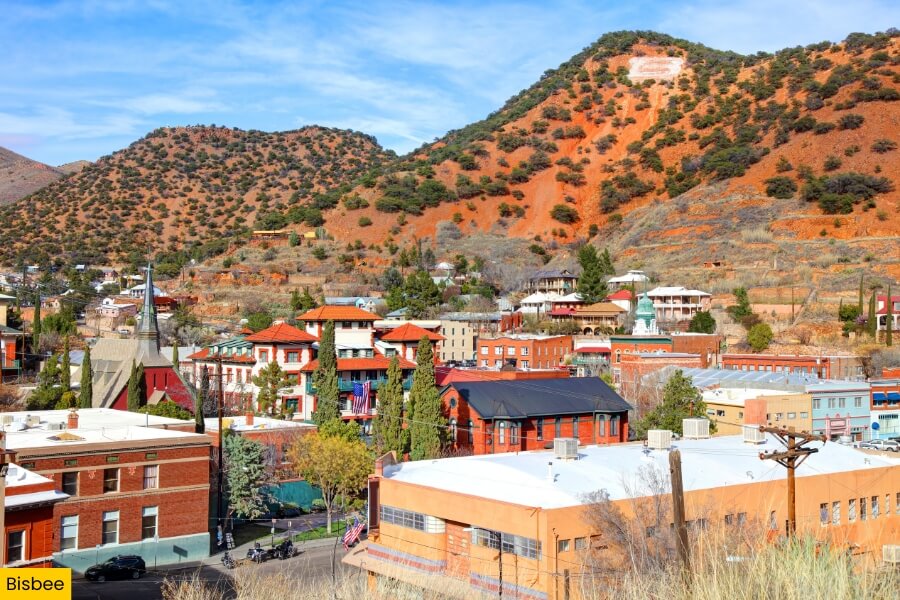
Victorian houses and old mining buildings make Bisbee one of the most interesting towns on this road trip, located about 1.5 hours from Cave Creek Canyon.
Once a booming copper mining town founded in 1880, Bisbee is now famous for its historic downtown, Old Bisbee, where you’ll find art galleries, antique shops, and 19th-century architecture.
You can head underground on the Queen Mine Tour, where expert guides will take you into old mining tunnels, or you can check out the massive Lavender Pit, an open-pit copper mine that spreads across 300 acres.
Don’t miss Bisbee’s historic stairways, including the nine staircases featured in the iconic Bisbee 1000 The Great Stair Climb, which turns a simple walk into a fun workout with incredible views.
7. Coronado Peak National Recreation Trail
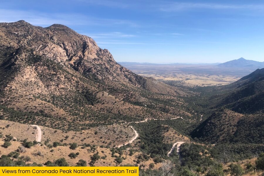
From Bisbee’s colorful mining streets, head to the Coronado Peak National Recreation Trail for a hike that will reward you with incredible views stretching across mountains and valleys, all the way to Sonora, Mexico.
The Coronado Peak National Recreation Trail is a short but steep 0.8-mile round-trip hike in Coronado National Memorial, starting from Montezuma Pass and climbing up to Coronado Peak.
You’ll tackle roughly 300 feet of elevation gain along a series of stone steps before reaching an incredible viewpoint overlooking the San Pedro and the San Rafael Valleys, with benches you can rest on along the way should you get tired.
Besides enjoying the views during your hike, you can also keep an eye out for interpretive signs that explain historic events, including the legacy of conquistador and explorer Francisco Coronado.
8. Parker Canyon Lake
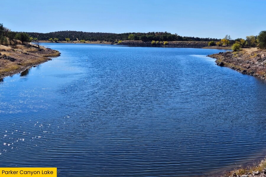
Wrap up your Arizona Sky Islands road trip at Parker Canyon Lake, a beautiful 130-acre reservoir tucked into the Canelo Hills, just a 45-minute drive away from Coronado Peak National Recreation Trail.
Sitting at an elevation of roughly 5,400 feet, this mountain lake is surrounded by rolling grasslands and oak woodlands, offering a completely different landscape from the steep mountain peaks and desert canyons you’ve explored along the way.
You can hike the almost 4.8-mile Parker Lakeshore Trail, rent a kayak or paddleboard from the marina, or try your luck fishing for rainbow trout, catfish, bass, and sunfish.
For a relaxing final night, take your pick from the 65 campsites at Lakeview Campground, where you can watch the sunset over the water and enjoy one last evening under southern Arizona’s star-filled skies.
Related Posts