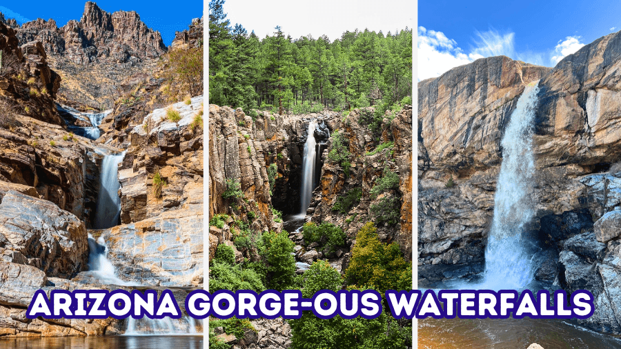
Hidden among Arizona’s canyon walls, rocky gorges, and pine-covered mountains are some seriously impressive waterfalls, including 80-foot drops, turquoise swimming holes, and cascades beneath natural rock bridges.
This Arizona waterfall road trip takes you from thundering seasonal falls to secret desert pools, with scenic hikes, winding canyon roads, and even a wild off-road adventure thrown into the mix.
Some waterfalls only come alive after heavy rain, while others flow year-round, so knowing when to visit makes all the difference.
Ready to discover a side of Arizona that most road trippers never see?
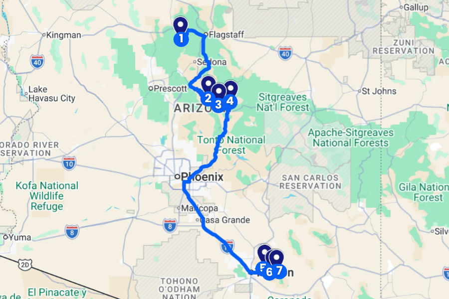
Here’s where to find seven incredible waterfall stops, what makes each one special, and how to reach them!
1. Sycamore Falls
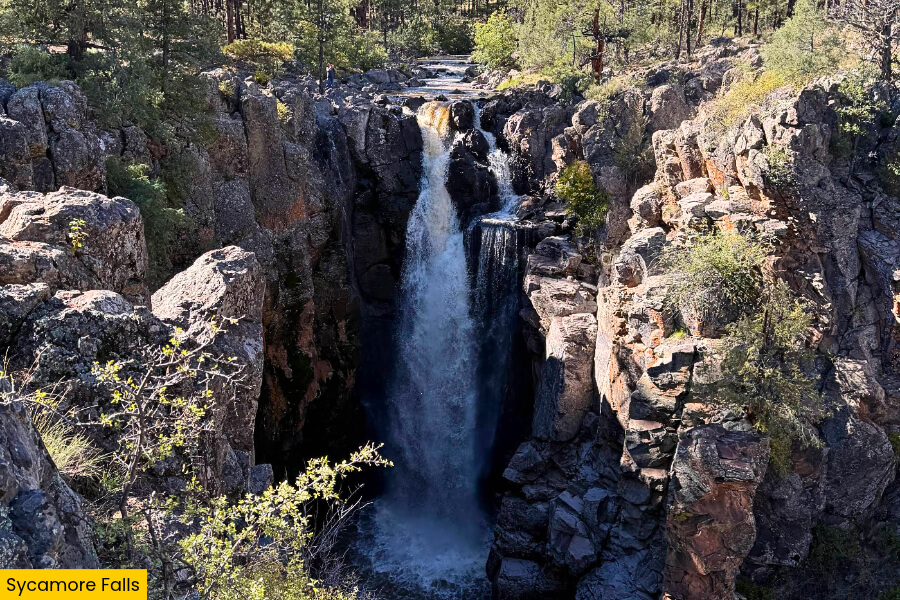
Sycamore Falls is a stunning seasonal waterfall in northern Arizona, located about 30 minutes from Williams in the Kaibab National Forest, where snowmelt and heavy rain send water crashing over a 70-foot cliff into Sycamore Canyon.
The waterfall sits at the head of the 21-mile-long Sycamore Canyon, Arizona’s second-largest canyon, where steep basalt cliffs form a dramatic gorge surrounded by ponderosa pine trees.
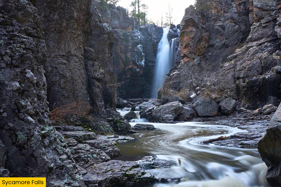
You can reach the falls from the Sycamore Falls Trailhead, where a short walk leads to rocky overlooks with fantastic views of the waterfall, deep canyon walls, and massive boulders scattered below.
For the best chance of catching Sycamore Falls flowing, plan your road trip for spring snowmelt or right after heavy rain, since the waterfall often runs dry during Arizona’s hotter months.
2. Fossil Creek Waterfall
While Sycamore Falls depends on rain and snowmelt, Fossil Creek Waterfall puts on a much more reliable show.
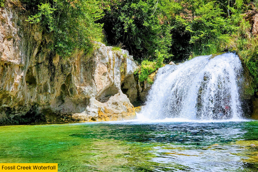
Bright turquoise water spills over a roughly 25-foot drop into a beautiful swimming hole in central Arizona, near Camp Verde.
Located in the Fossil Creek Wild and Scenic River area, this waterfall is fed by mineral-rich springs that release around 20,000 gallons of water per minute, keeping the creek flowing even during Arizona’s dry summers.
The waterfall drops into a rocky gorge lined with limestone cliffs, where you can swim in clear blue-green water, explore the creek, and admire the small cascades flowing over moss-covered rocks.
To reach this popular swimming spot, you’ll need to hike the roughly 2-mile round-trip Dixon Lewis Trail (formerly Waterfall Trail).
If you’re visiting during the spring-to-fall permit season, make sure to reserve a parking permit in advance.
3. Tonto Natural Bridge State Park
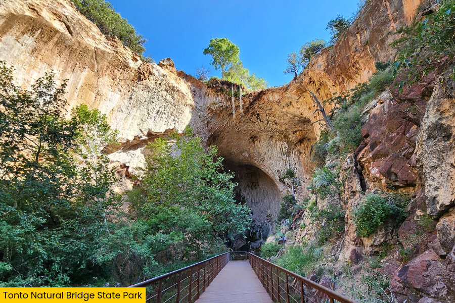
Just when you think Arizona’s waterfalls can’t get any more interesting, Tonto Natural Bridge State Park near Payson surprises you with a massive natural travertine bridge towering 183 feet above a narrow creek canyon.
Forming a 400-foot-long natural tunnel that measures 150 feet at its widest point, this incredible rock formation is considered the world’s largest natural travertine bridge.
Small waterfalls trickle down its moss-covered walls into the gorge below.
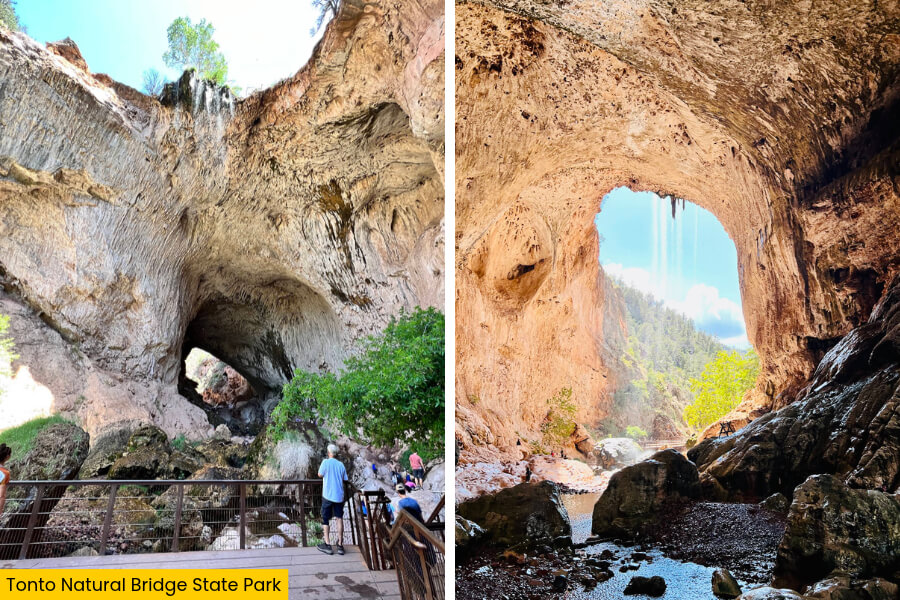
You can admire the bridge from four viewpoints or tackle the roughly half-mile-long Gowan Trail, which leads to an observation deck overlooking the rocky creek bed beneath the giant arch.
For a closer look at the waterfalls, check out the Waterfall Trail, a short but steep path leading to a viewing area where water spills over fern-covered cliffs and travertine formations.
4. Ellison Creek Cascades
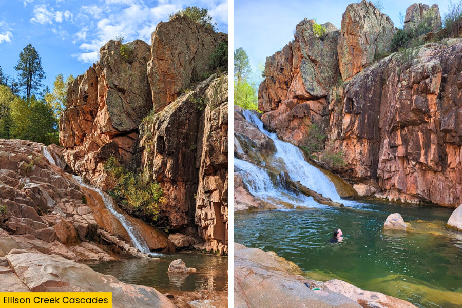
Just a 30-minute drive from Tonto Natural Bridge State Park, Ellison Creek Cascades offers another gorgeous waterfall stop near Payson, with clear mountain water tumbling over smooth rock ledges into a series of natural pools.
Located in the Ellison Creek drainage near the Water Wheel recreation area, these cascades are surrounded by dramatic rock walls, scattered boulders, and shady pine trees that make this stretch of Arizona’s Mogollon Rim especially scenic.
The creek cuts through a narrow, rocky gorge, creating small waterfalls, slippery rock slides, and deep swimming holes where you can cool off during the warmer months.
To explore the cascades, start at the Water Wheel recreation area and follow the creekside route upstream, passing Water Wheel Falls before branching toward Ellison Creek.
Avoid the gorge whenever rain threatens because flash floods can sweep through quickly.
5. Seven Falls
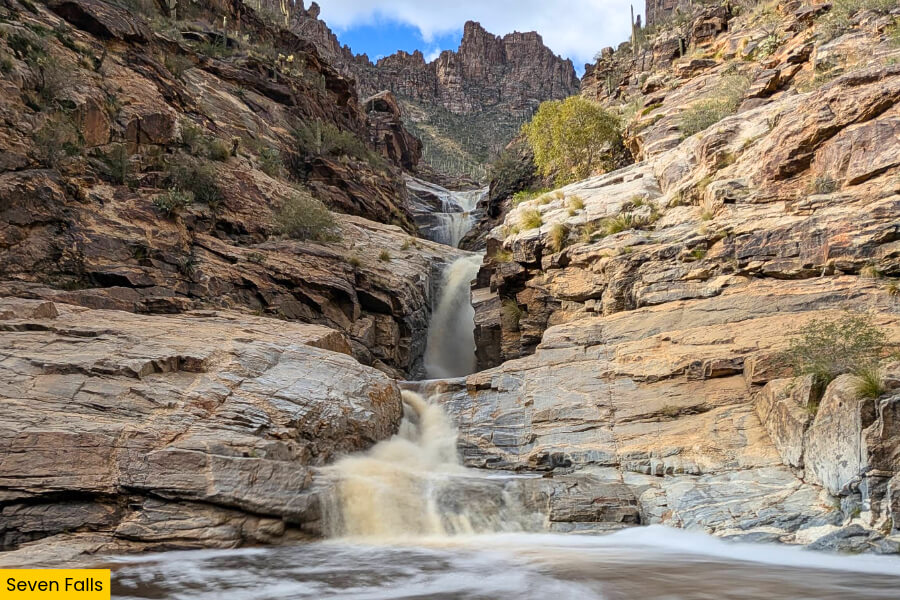
Leaving the pine-covered creeks near Payson behind, drive about 3 hours and 50 minutes to Seven Falls in Tucson’s Sabino Canyon Recreation Area.
Here, a series of waterfalls tumbles down rocky steps in Bear Canyon, surrounded by towering saguaro cacti and steep desert cliffs.
Located in the Santa Catalina Mountains of Coronado National Forest, these seasonal cascades flow strongest after winter rains and spring snowmelt, filling natural rock pools beneath smooth boulders.
The roughly 8.5-mile round-trip Seven Falls Trail takes you through a beautiful desert gorge, crossing Bear Creek several times before reaching the waterfalls tucked between massive canyon walls.
You can shorten the hike by taking the Sabino Canyon shuttle to the Bear Canyon Trailhead, but bring plenty of water, wear sturdy shoes, and avoid hiking when heavy rain threatens flash floods.
6. Tanque Verde Falls
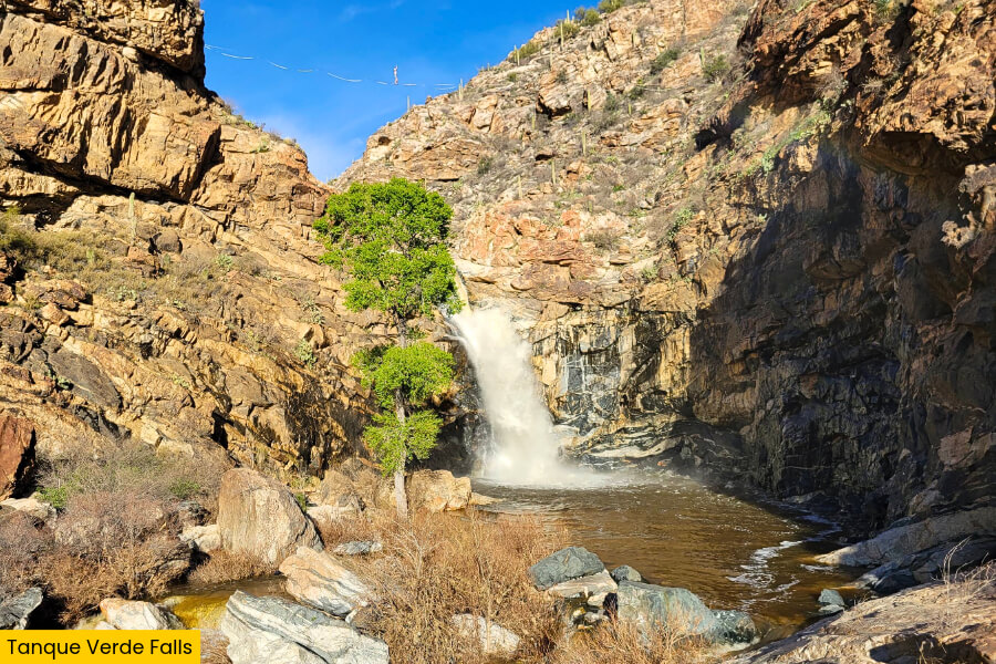
After exploring Seven Falls, head to the eastern edge of Tucson for Tanque Verde Falls, a spectacular 80-foot seasonal waterfall hidden in a rocky desert canyon near the Rincon Mountains, just 20 minutes from Saguaro National Park.
Unlike the stepped cascades of Seven Falls, this waterfall plunges down a steep granite cliff into a deep pool, surrounded by towering canyon walls, giant boulders, and smooth rock formations shaped by years of rushing water.
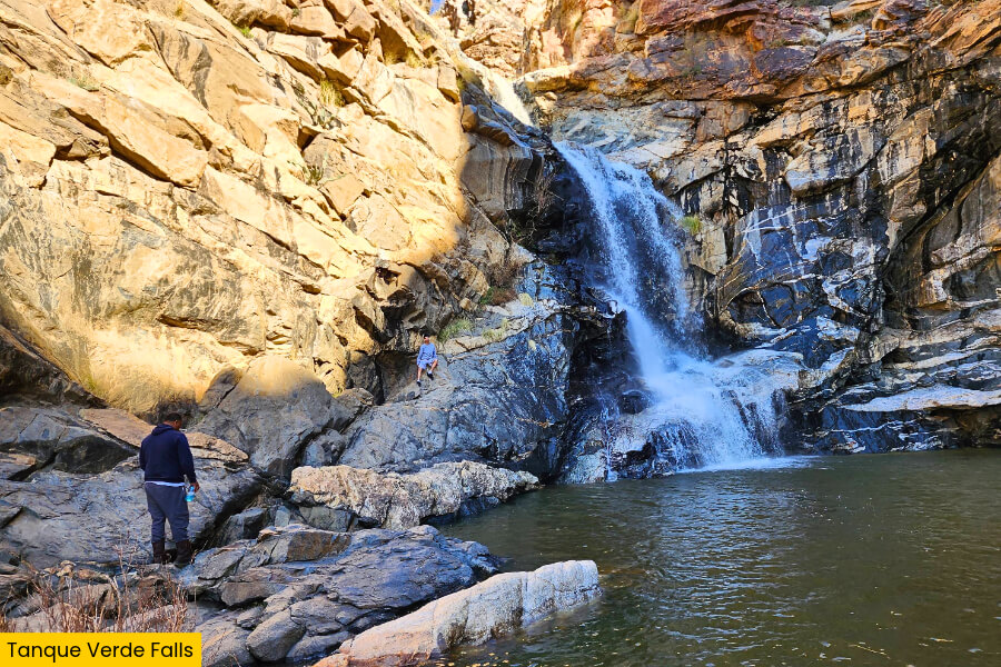
The easy 1-mile round-trip Tanque Verde Falls Overlook Trail follows the rim and offers spectacular views of Tanque Verde Falls without the need to venture into the canyon.
Visit after winter or spring rains for the best water flow, but avoid the canyon during storms because flash floods can turn this beautiful spot dangerous within minutes.
7. Chiva Falls
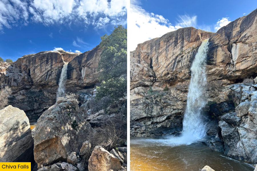
For the final stop on your Arizona waterfall road trip, make your way to Chiva Falls, a remote seasonal waterfall in the Redington Pass area near the foothills of the Rincon Mountains.
Here, water drops between 75 and 95 feet over a rocky desert cliff.
Unlike Tanque Verde Falls, which you can reach on foot, Chiva Falls is best known for its challenging off-road route.
The route has about 8.5 to 8.6 miles of rough dirt tracks, rocky climbs, and sandy washes that require a high-clearance four-wheel-drive vehicle.
The waterfall spills into a steep-sided desert gorge surrounded by towering rock formations, scattered saguaro cacti, and rugged canyon walls, creating an impressive sight when heavy rains send water rushing over the cliff.
Plan your visit after recent rainfall for the best views, but check road conditions before heading out, since deep ruts, loose rocks, and flash floods can make this remote adventure especially tricky.
Related Posts