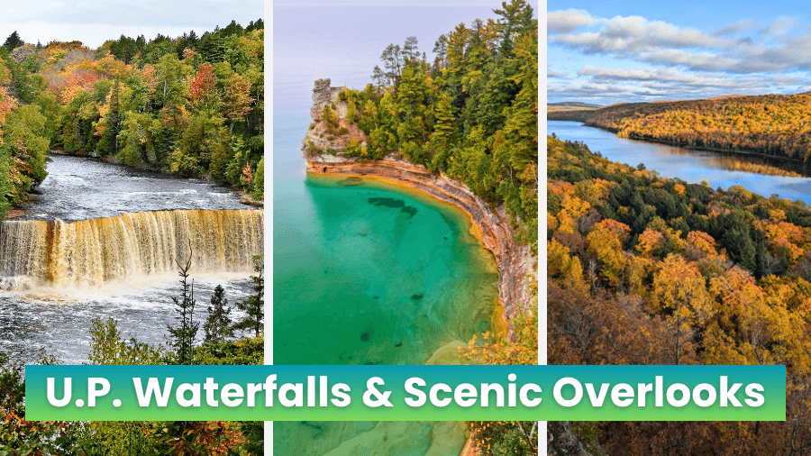
Michigan’s Upper Peninsula was practically made for road trips, especially if crashing waterfalls, lake views, and forest-covered cliffs are your kind of adventure.
This route takes you across the U.P. from roaring falls that stretch nearly 200 feet across to overlooks perched hundreds of feet above the water, with plenty of short hikes, rocky gorges, beaches, and winding forest roads along the way.
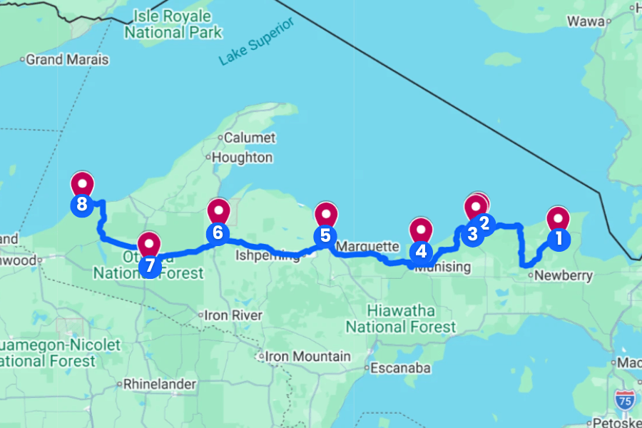
Some stops require only a quick walk from the car, while others send you up staircases or along trails to viewpoints that make the extra steps completely worth it.
Pack comfortable shoes and leave room in your schedule because the best part of this road trip is seeing just how dramatically the scenery changes from one stop to the next.
1. Tahquamenon Falls
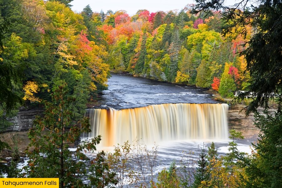
Tahquamenon Falls State Park sits near Paradise in Michigan’s eastern Upper Peninsula, where the Tahquamenon River tumbles through thick forest on its way toward Lake Superior.
The star is Upper Falls, a 200-foot-wide waterfall that drops nearly 50 feet and can send up to 50,000 gallons of water per second roaring over the edge during spring runoff.
About 4 miles downstream, Lower Falls features five smaller cascades wrapping around an island, and you can explore the area by hiking, paddling, or crossing the pedestrian bridge to the island.
The falls are famous for their unusual amber-colored water, which gets its tea-like color from tannins released by decaying vegetation in the surrounding swamps and forests.
2. Sable Falls
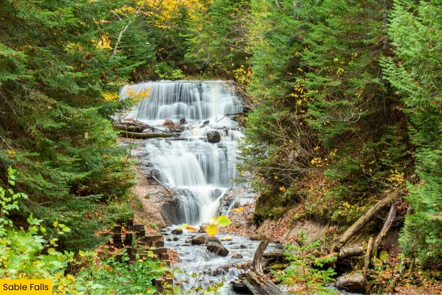
Next up, Sable Falls brings you to Pictured Rocks National Lakeshore near Grand Marais, where Sable Creek drops about 75 feet over several rocky tiers just before reaching Lake Superior.
From the parking area, a short trail leads to a wooden staircase with roughly 168 steps, where viewing platforms put you surprisingly close to the rushing water.
Keep going past the falls for about 0.25 miles and you’ll reach Sable Beach, a quiet Lake Superior shoreline that’s a mix of rock and sand and backed by the towering Grand Sable Dunes.
This stop packs a waterfall, forest walk, beach, and dune views into one quick adventure, and it’s especially handy if you’re also driving nearby H-58 or visiting the Grand Sable Dunes overlook.
3. Grand Sable Lake Scenic Overlook
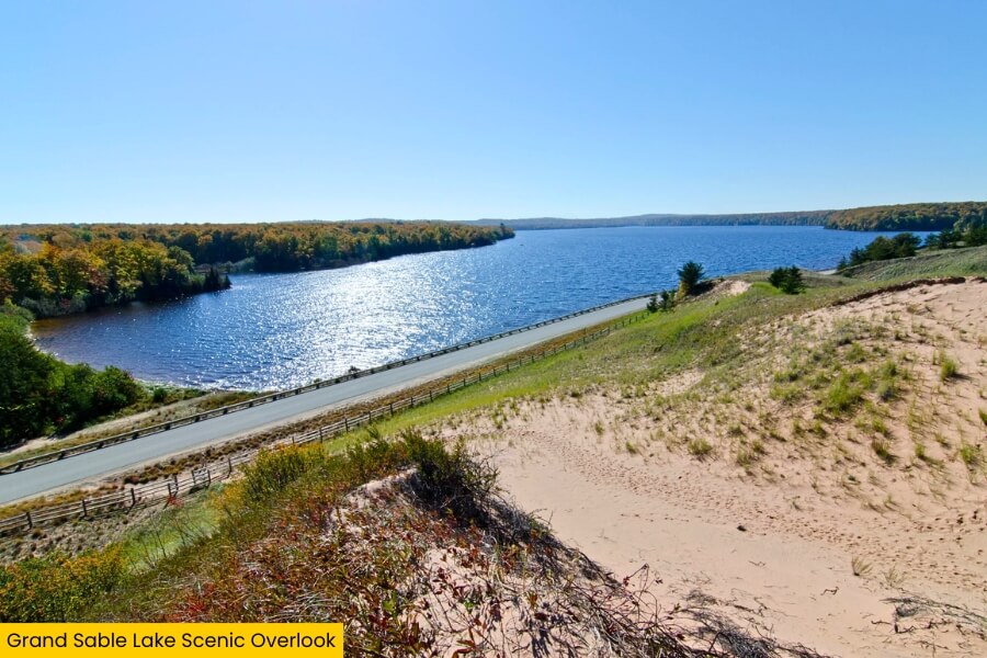
After exploring Sable Falls, head just a few minutes to the Grand Sable Lake Scenic Overlook, a roadside stop along H-58 in Pictured Rocks National Lakeshore.
From the elevated viewing area, you can look across Grand Sable Lake, a long blue lake separated from Lake Superior by the massive Grand Sable Dunes.
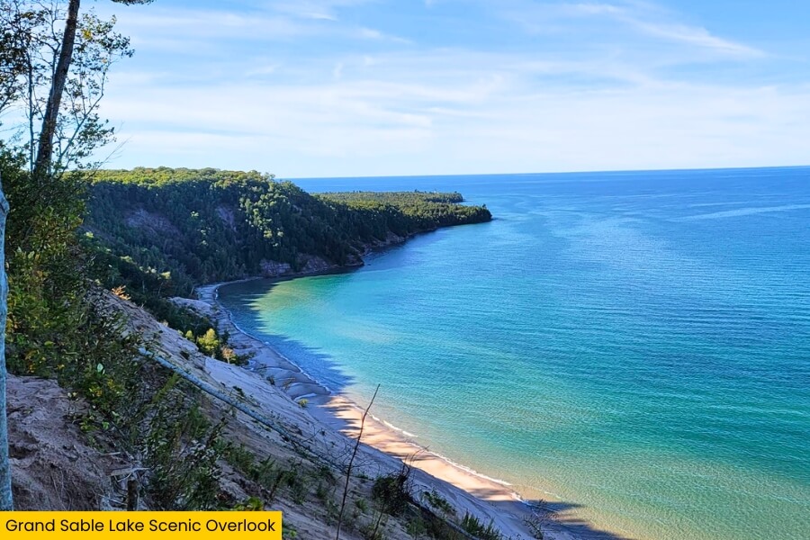
The overlook is easy to reach with only a short walk from the parking area, making it a great breather between the waterfalls, beaches, and longer trails along this road trip.
For an even bigger view, continue to the nearby Log Slide Overlook, where the Grand Sable Banks and dunes rise about 300 feet above Lake Superior and tell the story of logging crews who once slid timber down the steep sand slopes.
4. Miners Castle
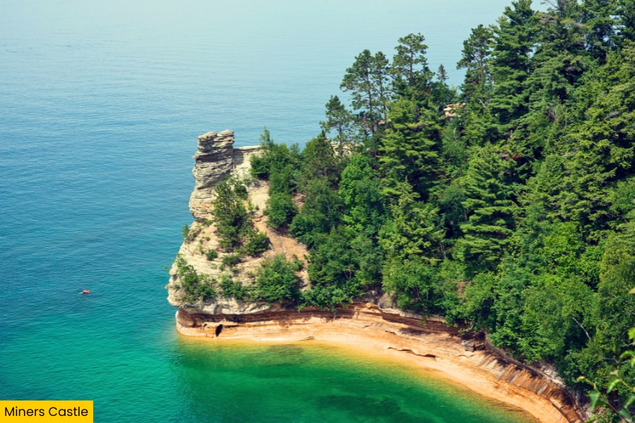
From Grand Sable Lake, follow Pictured Rocks National Lakeshore for about 1 hour to Miners Castle, one of the park’s most famous overlooks and an easy place to see Lake Superior’s colorful sandstone cliffs without a long hike.
A short paved path from the parking area leads to overlooks above the water, where you can spot the castle-shaped rock formation, forest-covered cliffs, and the deep blue lake stretching toward the horizon.
Miners Castle gets its name from the stone turrets carved by wind, waves, freezing, and thawing, although one of its two main turrets collapsed into Lake Superior in 2006.
Before leaving, make the short drive to nearby Miners Beach, where a nearly one-mile-long sandy shoreline gives you a completely different view of the Pictured Rocks cliffs from water level.
5. Sugarloaf Mountain Observation Decks
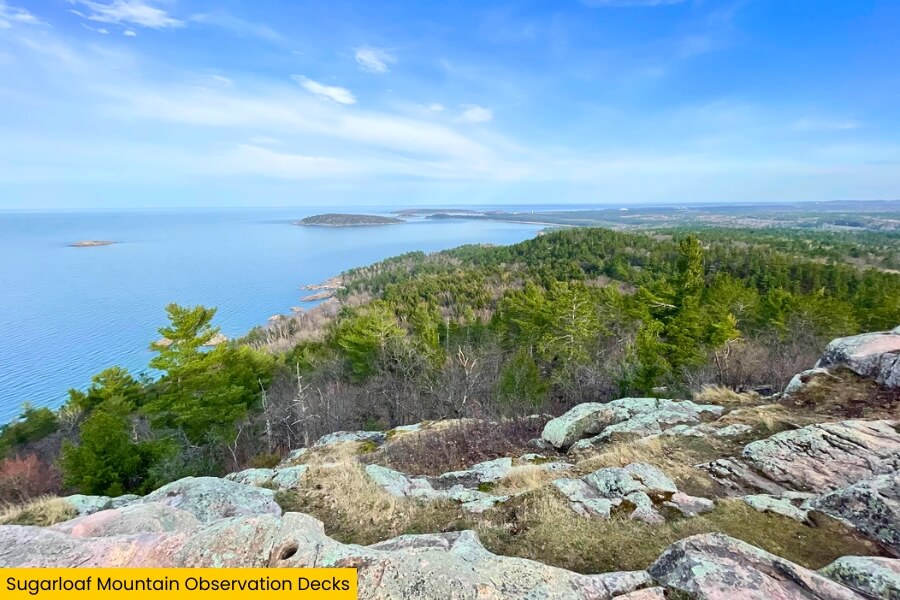
Leaving the Pictured Rocks cliffs behind, continue about an hour to Marquette and climb Sugarloaf Mountain, which rises about 470 feet above Lake Superior.
The roughly 1-mile round-trip hike is short but steep in spots, with staircases and rocky sections leading to several observation decks near the summit.
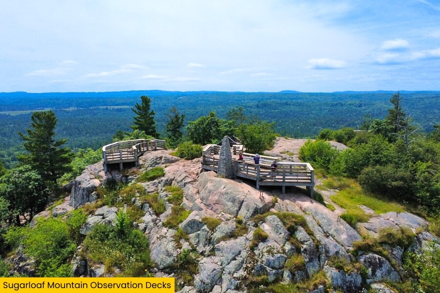
From the top, you can pick out Presque Isle Park, the forested Lake Superior shoreline, nearby Hogsback Mountain, and Marquette in the distance, making this one of the best wide-open panoramas on the road trip.
Look for the stone monument honoring local World War I soldier Bartlett King before heading back down, and try visiting near sunrise or fall color season when the surrounding forests put on an especially impressive show.
6. Canyon Falls Roadside Park
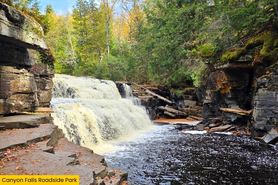
Next, it’s only an hour’s drive along US-41 to Canyon Falls Roadside Park, located about 15 minutes from L’Anse along the Sturgeon River.
A nearly 1-mile round-trip trail to the falls follows the river through shady woods, passing smaller rapids before reaching Canyon Falls, where the water drops about 15 feet into a narrow gorge carved into dark rock.
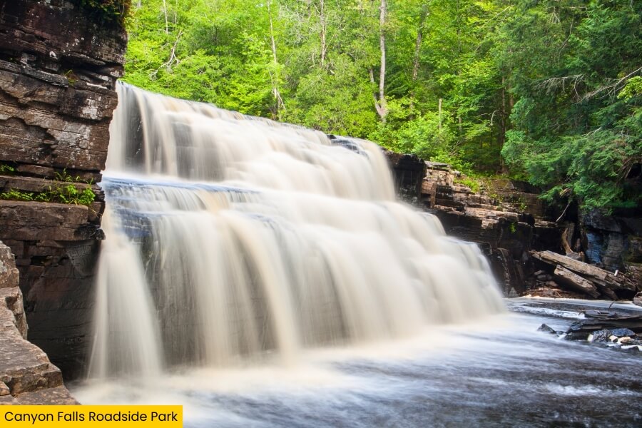
Keep walking beyond the main viewing area to see the canyon walls rise around the rushing river, with several rocky viewpoints giving you different angles of the falls and gorge.
The park is also a handy roadside break with parking, picnic tables, and restrooms, so you can stretch your legs and squeeze in a surprisingly scenic hike.
7. Bond Falls
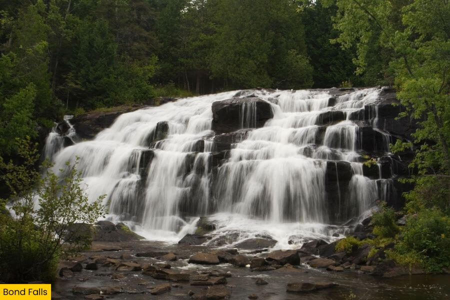
Continue driving for around 45 minutes to Bond Falls near Paulding, where the Middle Branch of the Ontonagon River spills about 50 feet over a broad staircase of fractured rock.
Instead of one straight plunge, the water splits into numerous rushing channels and cascades, creating a roughly 100-foot-wide curtain that looks especially impressive after heavy rain or during spring snowmelt.
A short accessible path and boardwalk lead from the parking area to viewing platforms near the base, while additional paths let you wander beside the river for different angles of the falls.
Bond Falls is controlled by a nearby hydroelectric dam, and its easy access, picnic area, and close-up viewpoints make it one of the simplest big-waterfall stops on this road trip.
8. Lake of the Clouds Overlook
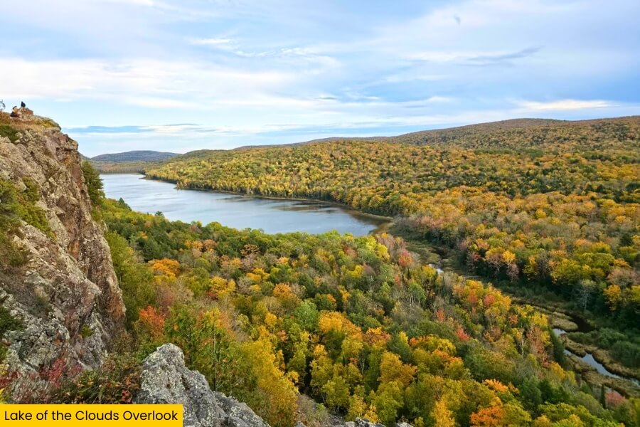
It’s just a 1 hour drive to Porcupine Mountains Wilderness State Park for a totally different scene at the Lake of the Clouds Overlook.
A short paved path from the parking area leads to a viewing deck high on the Escarpment, where you can look down over the long, narrow lake surrounded by thousands of acres of forest.
For more viewpoints, hike part of the Escarpment Trail, an 4.3-mile route that follows the ridge above the lake and delivers sweeping views across the Porkies toward Lake Superior.
Come in late September or early October and the maples can turn brilliant red and orange, creating one of Michigan’s most photographed fall views, but summer’s endless green forest is pretty spectacular too.
Related Posts