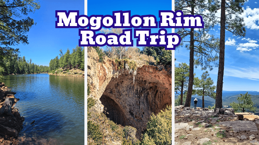
Think Arizona is all scorching deserts, giant cacti, and endless stretches of red rock?
Think again, because the Mogollon Rim is about to show you a whole different side of the Grand Canyon State.
Stretching roughly 200 miles across Arizona, this cliff-lined region is packed with towering ponderosa pine forests, mountain lakes, and jaw-dropping viewpoints.
And the best part? You can experience some of its coolest sights on one unforgettable road trip.
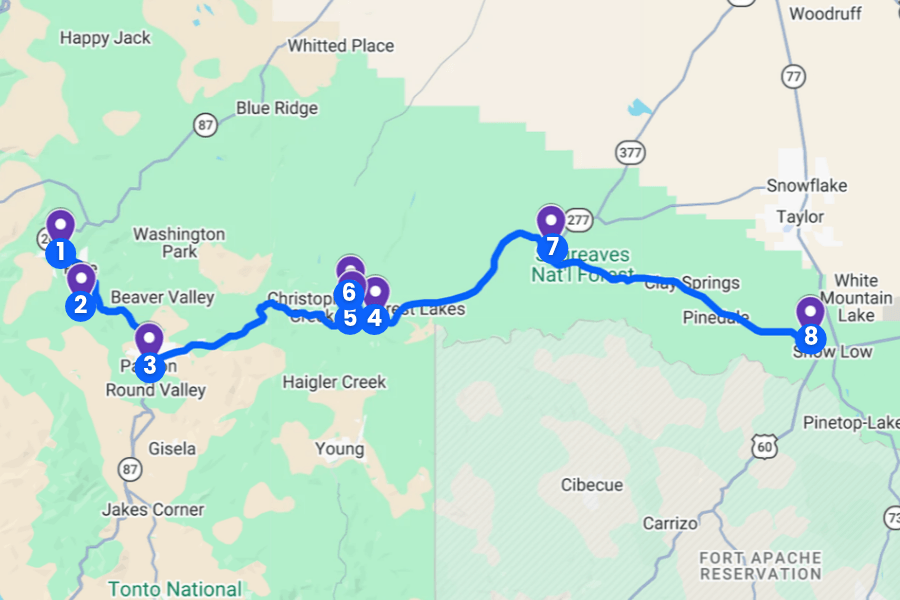
Whether you’re dreaming of hiking along dramatic cliffs, kayaking across crystal-clear lakes, or spotting elk wandering through the forest, this Mogollon Rim road trip itinerary has you covered.
Keep reading to discover the best stops, scenic drives, and must-see attractions along the way!
1. Pine & Strawberry
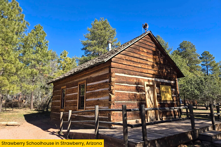
Located along Highway 87, the neighboring mountain towns of Pine and Strawberry are surrounded by towering ponderosa pines, cool mountain air, and beautiful views of Arizona’s Mogollon Rim.
One of the biggest attractions is the Strawberry Schoolhouse, built in 1885 and considered Arizona’s oldest standing schoolhouse, where you can peek inside a one-room classroom from the pioneer days.
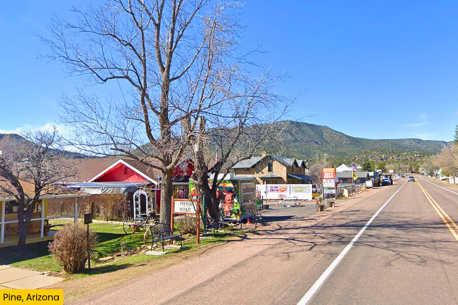
For outdoor fun, explore the scenic hiking trails around Pine, including sections of the Arizona Trail.
Before hitting the road again, grab a sweet treat at Pine Creek Fudge & Espresso, browse Pine’s antique shops, or enjoy a hearty meal at the historic Pinewood Tavern.
2. Tonto Natural Bridge State Park
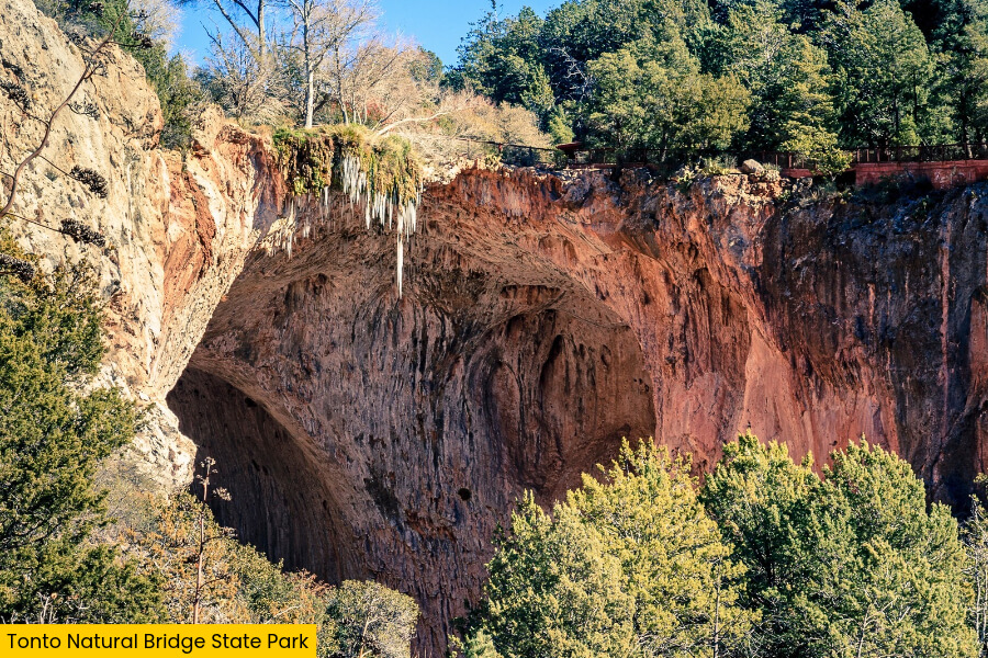
Just 15 minutes from Pine, Tonto Natural Bridge State Park is home to one of Arizona’s coolest natural wonders, a massive travertine bridge that stands 183 feet tall and stretches 150 feet across Pine Creek.
You can admire this giant rock formation from four viewpoints along the canyon rim, but the real adventure begins when you hike down to the creek and see the bridge towering above you.
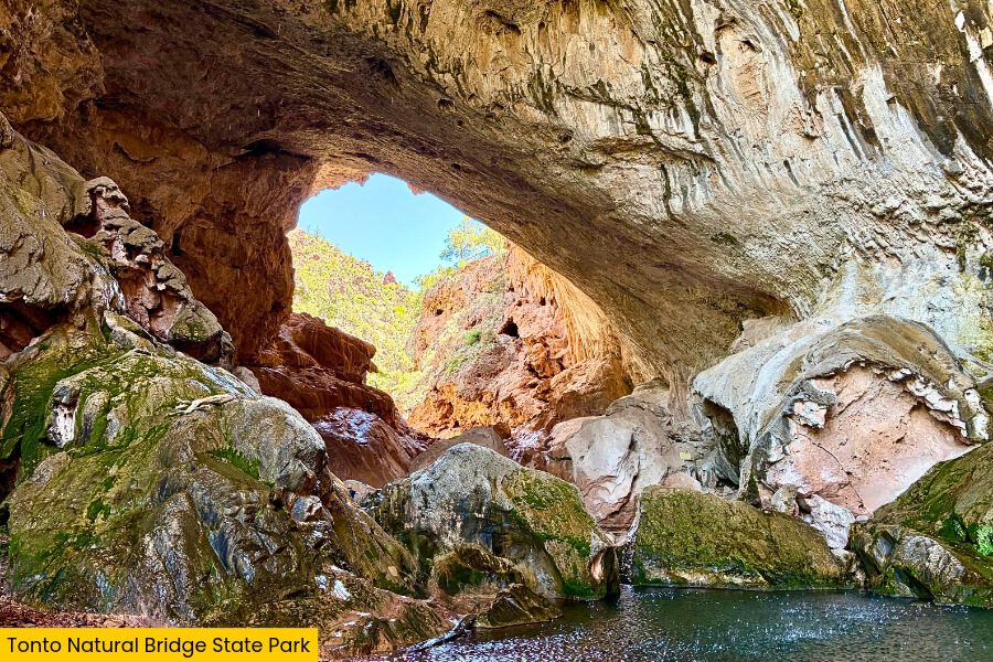
The roughly half-mile Gowan Trail takes you to an observation deck near the creek, while the 0.5-mile Pine Creek Trail offers a more challenging scramble over slippery rocks and uneven ground.
Keep an eye out for waterfalls trickling down moss-covered cliffs, explore the park’s historic Goodfellow Lodge, and pack sturdy shoes because these short trails are surprisingly steep.
3. Payson

After exploring Tonto Natural Bridge, head about 20 minutes to Payson, a mountain town sitting at 5,000 feet elevation and known as the “Heart of Arizona” thanks to its central location beneath the Mogollon Rim.
Start at the Rim Country Museum and Zane Grey Cabin, where you can learn about the area’s cowboy past and see a replica of the famous Western author’s original cabin.
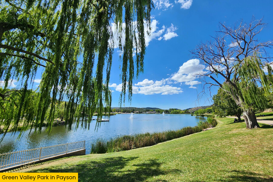
If you’re craving more outdoor fun, head to Green Valley Park, where three lakes offer fishing for rainbow trout, peaceful walking paths, and grassy picnic spots with mountain views.
Payson also hosts the World’s Oldest Continuous Rodeo, dating back to 1884, so if you’re visiting in August, you might catch bull riding, barrel racing, and plenty of cowboy action.
4. Mogollon Rim Visitor Center
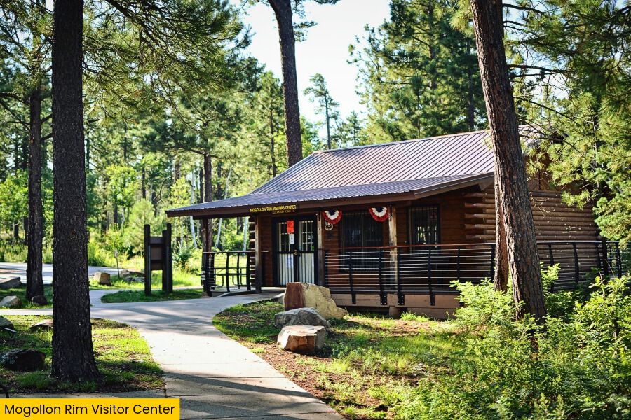
Leaving Payson behind, drive about 35 minutes along Highway 260 to the Mogollon Rim Visitor Center, located near the junction with Forest Road 300, where you’ll get jaw-dropping views of the massive 200-mile-long Mogollon Rim.
Sitting at around 7,500 feet above sea level, this scenic stop overlooks a dramatic cliff edge that drops nearly 2,000 feet into the forested valleys below, with views stretching for miles across central Arizona.
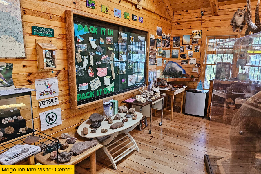
Drive farther along Forest Road 300 to access Rim Lakes Vista Trail for incredible photo opportunities, or check out the visitor center’s exhibits to learn about the area’s geology, wildlife, and towering ponderosa pine forests.
Keep your camera ready for sweeping mountain views, and watch for elk grazing among the trees, especially during the early morning or late afternoon hours.
5. Rim Lakes Vista
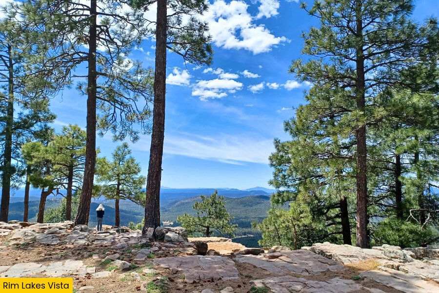
From the Mogollon Rim Visitor Center, continue to Rim Lakes Vista, where part of the trail is paved and follows the edge of the Mogollon Rim, serving up some of the best panoramic views in Arizona.
The Rim Lakes Vista Trail stretches about 4.3 miles one way, with several scenic overlooks where you can gaze across the thick pine forests, deep canyons, and mountains of the Tonto National Forest.
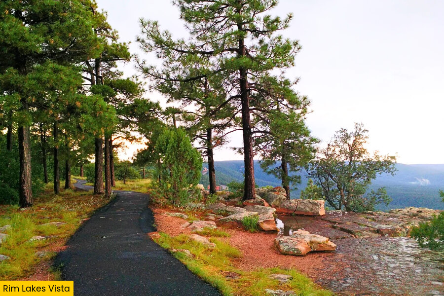
At roughly 7,500 feet above sea level, you’ll find dramatic drop-offs, towering ponderosa pines, and plenty of spots to snap photos without tackling a tough mountain hike.
You don’t have to walk the entire trail to enjoy the scenery, so pick a viewpoint, watch for hawks soaring above the cliffs, and bring a jacket because temperatures can be surprisingly chilly up here.
6. Woods Canyon Lake
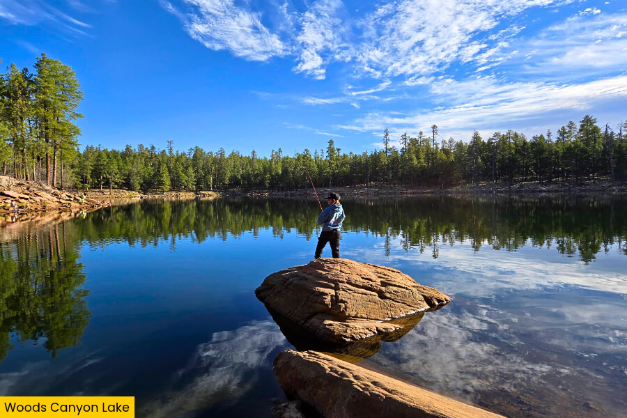
After soaking up the views at Rim Lakes Vista, head to Woods Canyon Lake, a beautiful 55-acre mountain lake located at 7,500 feet elevation, just off Forest Road 300 in the Apache-Sitgreaves National Forest.
Surrounded by towering ponderosa pines, this popular spot is perfect for kayaking, canoeing, paddleboarding, or fishing for rainbow trout, with boat rentals available at the Woods Canyon Lake Store and Marina during the warmer months.
If you’d rather stay on dry land, follow the Woods Canyon Lake Trail around the shoreline, where you’ll pass rocky coves, quiet fishing spots, and forested sections with beautiful views across the water.
You can also enjoy a lakeside picnic, watch for bald eagles soaring overhead, or spend the night at Woods Canyon Lake Group Campground, where you’ll find campsites just a short walk from the water.
7. Heber-Overgaard
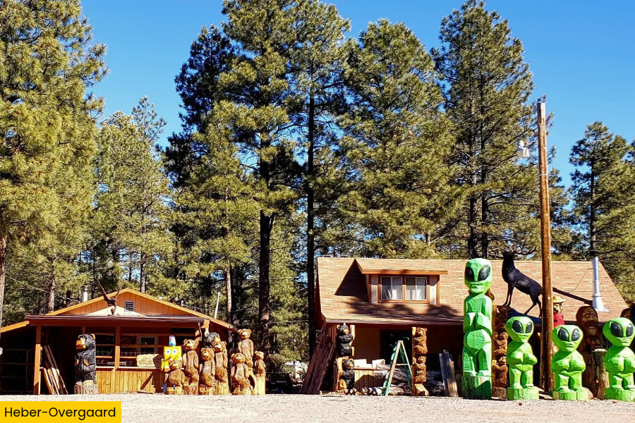
After enjoying Woods Canyon Lake, continue for about 40 minutes along Highway 260 to Heber-Overgaard, a pair of small mountain communities sitting at around 6,000 feet elevation in Arizona’s Apache-Sitgreaves National Forest.
If you’re ready for an outdoor adventure, head to Black Canyon Lake, a 78-acre reservoir surrounded by pine forests where you can fish for rainbow trout, enjoy a peaceful picnic, or watch for elk wandering through the trees.
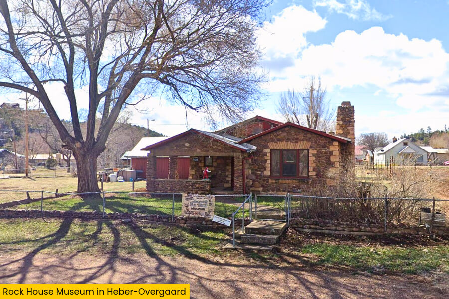
Before leaving town, stop by the Rock House Museum, an unusual stone building dating back to the 1930s, or grab a bite at one of the local diners along Highway 260.
8. Fool Hollow Lake
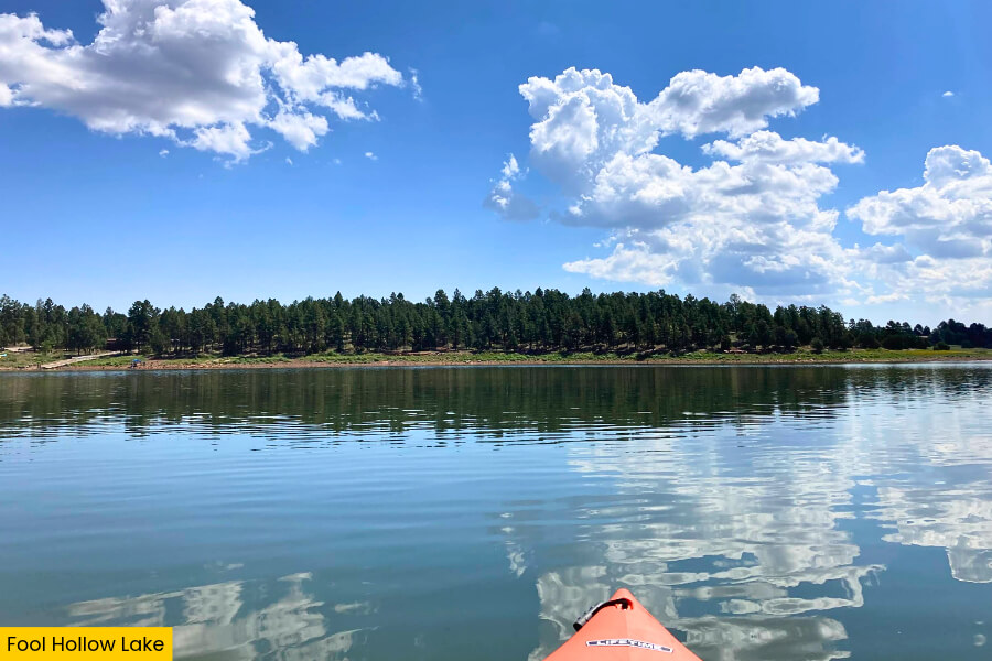
Wrap up your Mogollon Rim road trip at Fool Hollow Lake Recreation Area in Show Low, about 45 minutes from Heber-Overgaard, where a beautiful 150-acre lake sits surrounded by ponderosa pines at roughly 6,300 feet elevation.
This peaceful spot is famous for its excellent fishing, with rainbow trout, largemouth bass, smallmouth bass, and channel catfish swimming beneath the surface, plus plenty of opportunities for kayaking, canoeing, and paddleboarding.
If you’re up for one last adventure, explore the 1.5-mile walking trail along the shoreline, where you can spot ducks, great blue herons, and other wildlife while enjoying gorgeous lake views.
For the perfect ending to your road trip, grab a picnic table near the water, watch the sunset light up the pine-covered hills, or stay overnight at one of the park’s lakeside campsites.
Related Posts