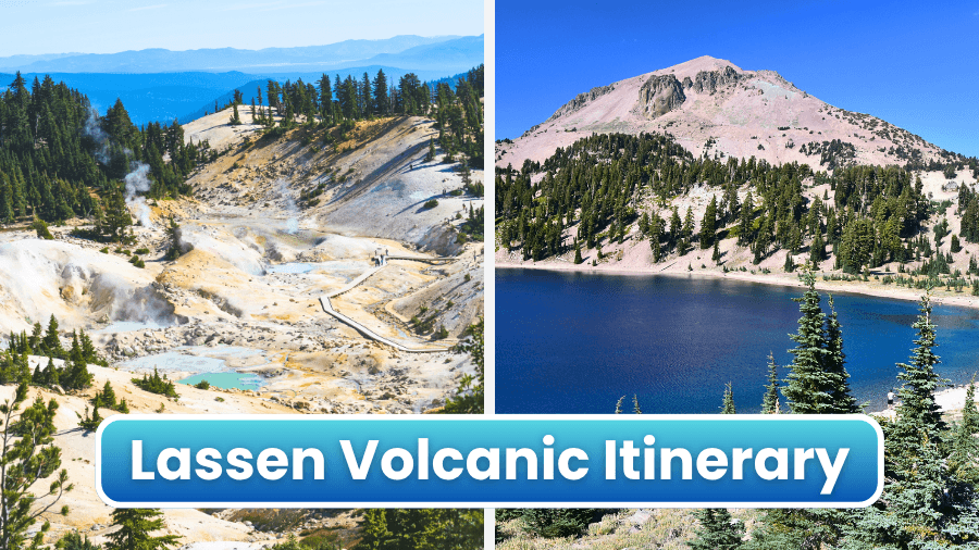
If you’re craving steaming geothermal landscapes, volcanic peaks, roaring waterfalls, and clear mountain lakes, this Lassen Volcanic National Park road trip is about to be your dream drive.
This incredible route winds through one of the most unique national parks in California, where boiling mud pots sit just minutes from peaceful forests and dramatic volcanic scenery.
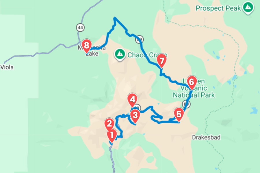
You’ll cruise along scenic Highway 89, stop at jaw-dropping viewpoints, walk through landscapes shaped by real volcanic eruptions, and discover some of the coolest hydrothermal features in the entire United States.
From easy roadside stops to unforgettable hikes with massive panoramic views, this itinerary packs a ton of adventure into one seriously beautiful drive through Northern California’s wild volcanic landscapes.
1. Kohm Yah-mah-nee Visitor Center
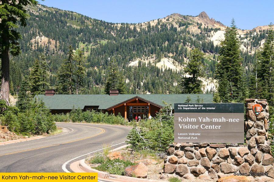
Kohm Yah-mah-nee Visitor Center sits at the southwest entrance of Lassen Volcanic National Park, and it’s the perfect first stop before exploring the park’s steaming fumaroles, lava fields, and alpine lakes.
Inside the center, you’ll find interactive volcano exhibits, a giant map of the park, trail guides, and huge windows with jaw-dropping views of 10,457-foot Lassen Peak.
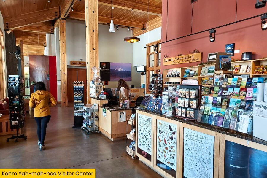
You can grab maps, check trail and road conditions, join ranger programs, and fuel up at the Lassen Café before heading to spots like Bumpass Hell, Sulphur Works, and Manzanita Lake.
The building’s name comes from the Mountain Maidu language and means “Snow Mountain,” which fits perfectly since this area often gets up to 40 feet of snow each winter.
2. Sulphur Works

Just a few minutes up the road from the visitor center, Sulphur Works gives you a front-row seat to Lassen’s volcanic power with bubbling mud pots, hissing steam vents, and sulfur-colored mineral deposits right beside Highway 89.
This is the easiest hydrothermal area in the entire park to visit because you can pull into the parking area and walk a short boardwalk loop past steaming pools that smell strongly like rotten eggs.
The landscape here was once a busy sulfur mining site in the early 1900s.
Hot water heated deep underground rises through the earth at extremely high temperatures, creating one of the most active geothermal spots in Lassen Volcanic National Park.
3. Bumpass Hell
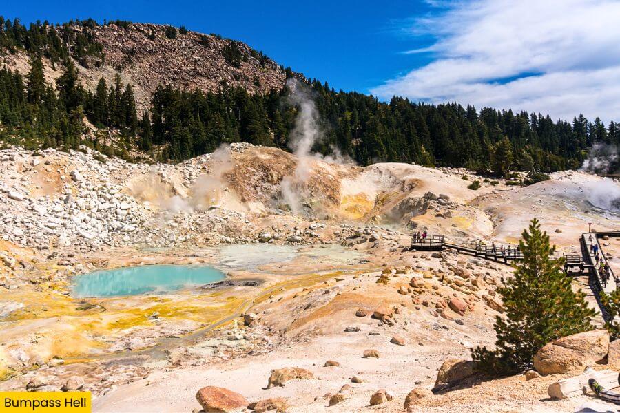
Keep driving about 25 minutes on Highway 89 and you’ll reach Bumpass Hell, the park’s largest hydrothermal area, where the ground bubbles, steams, and spits across an otherworldly 16-acre basin packed with boiling springs and roaring fumaroles.
The adventure starts with a 3-mile round-trip hike that drops about 200 feet into the basin, and the trail delivers huge views of Lassen Peak, Brokeoff Mountain, and scattered wildflower fields along the way.
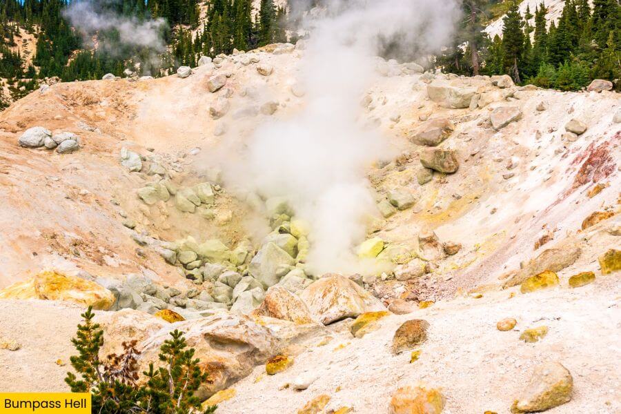
Down on the boardwalk, you’ll pass famous features like Big Boiler, the park’s hottest fumarole, where steam blasts out at temperatures close to 322 degrees Fahrenheit.
The area is named after Kendall Bumpass, an early explorer who accidentally broke through thin crust here in the 1860s and badly burned his leg while showing the geothermal basin to a newspaper reporter.
4. Lassen Peak Trailhead
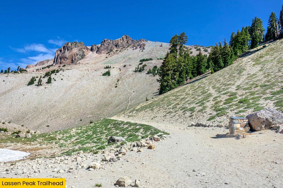
After exploring the park’s bubbling geothermal areas, the drive climbs higher into the mountains until you reach the Lassen Peak Trailhead, home to one of the most famous hikes in Lassen Volcanic National Park.
The 5-mile round-trip trail gains nearly 2,000 feet in elevation and winds up the side of 10,457-foot Lassen Peak, the southernmost active volcano in the Cascade Range.
As you climb above the tree line, the views open up fast, with shattered lava rock slopes, snow patches that often last into July, and sweeping panoramas stretching across Northern California and even into Oregon on clear days.
Lassen Peak last erupted between 1914 and 1917, and the summit trail lets you stand on top of a volcano in one of the few places in the world where all four major volcano types can be found nearby.
5. Kings Creek Falls
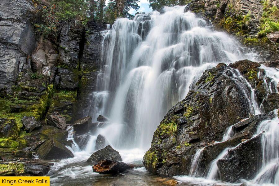
Back on Highway 89, the road rolls past wide mountain meadows and lava rock cliffs before you reach the Kings Creek Falls trailhead, one of the best waterfall hikes in the entire park.
The 2.3-mile round-trip trail follows Kings Creek through open volcanic landscapes, crosses wooden footbridges, and passes bright green marshes filled with wildflowers during the short summer season.
Near the end, a steep staircase descends beside dark lava walls to Kings Creek Falls, where water crashes 30 feet into a narrow canyon surrounded by polished black rock.
This area sits near the base of Lassen Peak at more than 7,000 feet in elevation, so you’ll often spot lingering snow patches here well into early summer even when lower parts of the park are completely dry.
6. Summit Lake
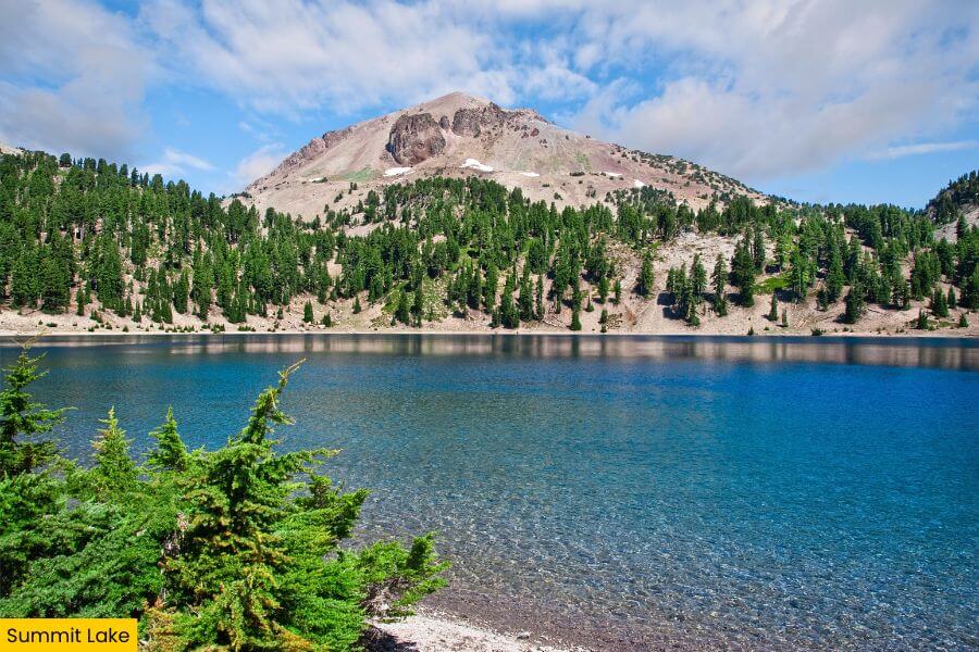
After the waterfall stop, Highway 89 curves toward Summit Lake, a sparkling high-elevation lake surrounded by pine forests, volcanic peaks, and some of the prettiest picnic spots in Lassen Volcanic National Park.
The lake sits at about 6,700 feet and is split into North and South Summit Lake, with calm water that’s perfect for kayaking, canoeing, fishing, and cooling off on warm summer afternoons.
You can stretch your legs on the easy Summit Lake Loop Trail, which circles the shoreline with constant views of Lassen Peak and glassy reflections across the water.
This area is also one of the park’s best places for camping, and if you stay after sunset, the dark skies here are incredible for stargazing because there’s almost no nearby city light pollution.
7. Devastated Area
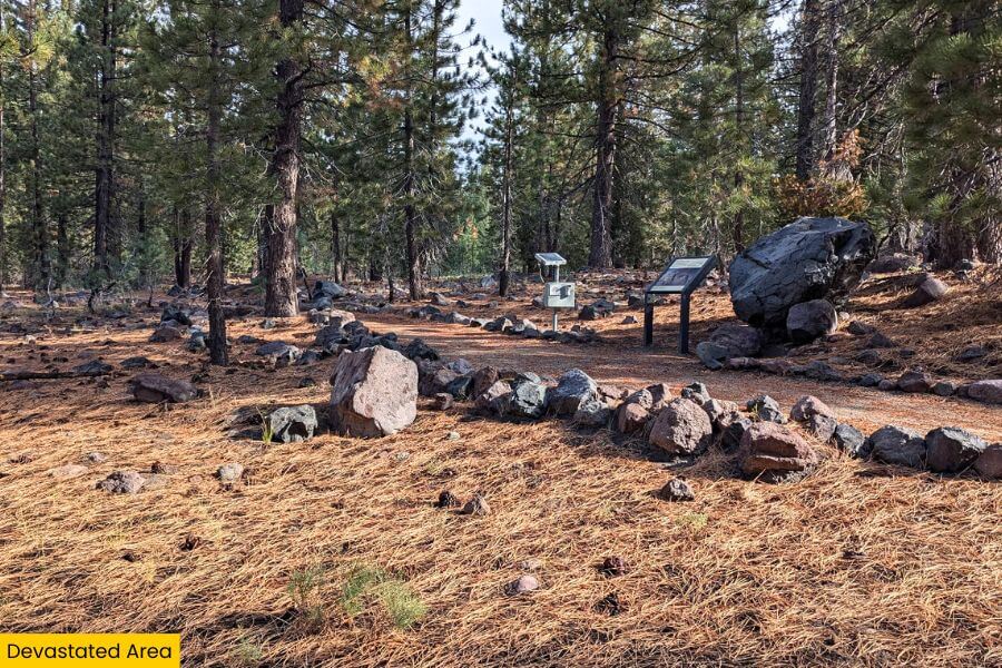
Continuing north through the park, the scenery suddenly changes at the Devastated Area, where massive volcanic eruptions from Lassen Peak between 1914 and 1917 blasted forests flat and buried the landscape under rock, ash, and mudflows.
The easy 0.5-mile Devastated Area Interpretive Trail loops through giant lava boulders and damaged terrain while signs explain how explosions and avalanches reshaped this entire section of the park more than a century ago.
From the trail, you’ll get fantastic views of Lassen Peak rising above the debris field, making it easy to picture the powerful eruption cloud that once shot more than 30,000 feet into the sky.
This stop is especially fascinating because it feels like an outdoor geology museum, with visible volcanic damage still covering the ground even after 100+ years of forest recovery.
8. Manzanita Lake
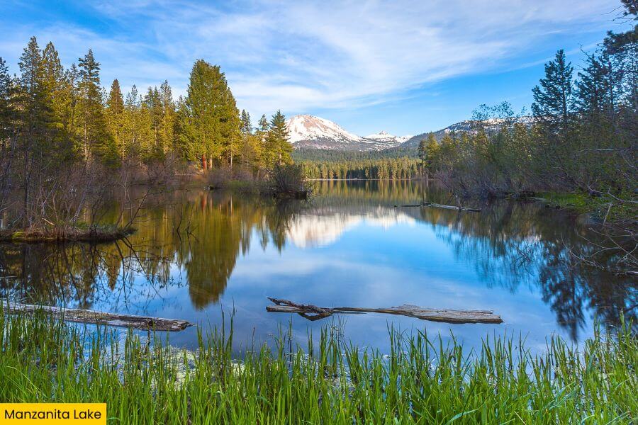
As the road trip nears the park’s northern entrance, Manzanita Lake delivers one last showstopper with crystal-clear water reflecting Lassen Peak so perfectly that it looks like a mirror on calm mornings.
The 1.7-mile lakeside trail is mostly flat and easy, making it a great spot for biking, walking, fishing, kayaking, or spotting songbirds, deer, and Douglas squirrels.
Manzanita Lake was actually formed centuries ago when a rock avalanche from Chaos Crags blocked nearby Manzanita Creek, forming the 175-acre lake that visitors enjoy today.
You can rent kayaks near the Loomis Museum, grab a campsite steps from the water, or stick around for sunset when the glowing orange light on Lassen Peak creates one of the most famous photo spots in the entire park.
Related Posts