
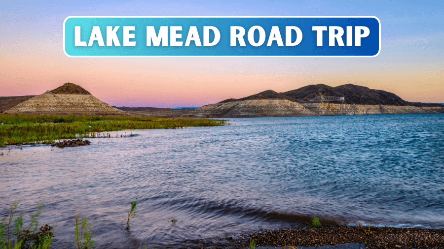
Think Lake Mead is just a giant lake in the middle of the desert? Think again!
This incredible corner of Nevada and Arizona is packed with hidden coves, red rock formations, scenic desert roads, and even an entire ghost town that spent years underwater.
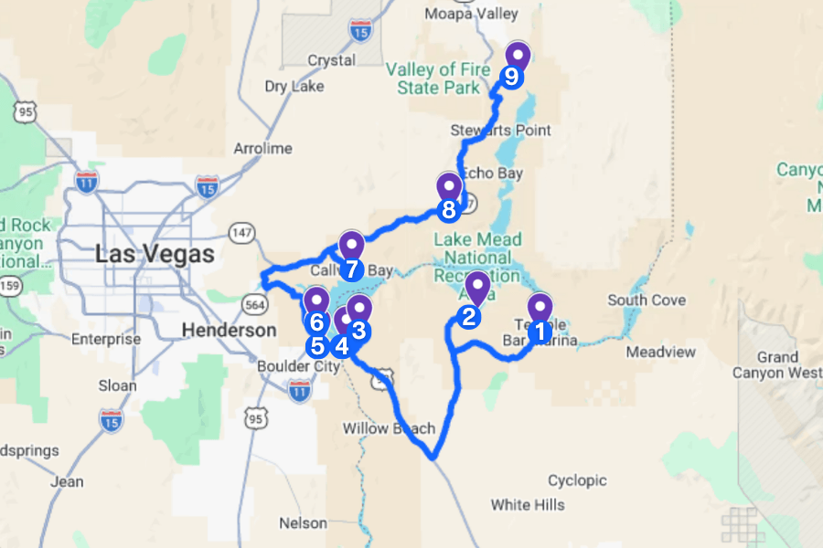
The best way to explore it is on this road trip, where you can cruise past bright blue water, hike through old railroad tunnels, discover secret swimming spots, and see one of America’s most impressive engineering wonders.
And here’s the kicker: Despite it being a lake, you don’t need a boat to experience its coolest attractions!
Here’s how to plan the ultimate Lake Mead road trip, including the best stops, hidden gems, and tips to make the most of your drive.
1. Temple Bar Marina
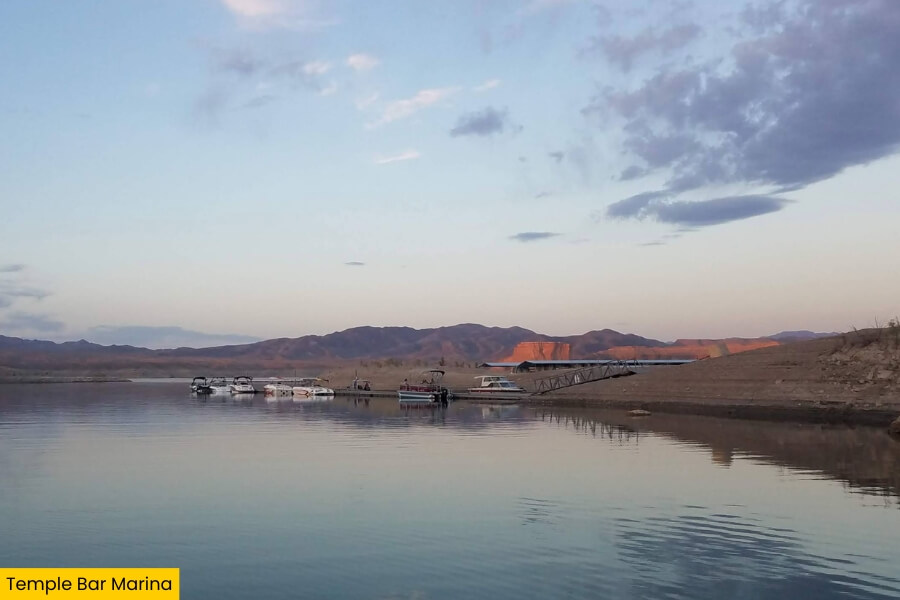
Temple Bar Marina is one of Lake Mead’s most remote spots, located on the Arizona side of Lake Mead, and accessible after a scenic drive along Temple Bar Road from US Highway 93.
This quiet marina is known for its boat launch, fishing opportunities (specifically striped bass and largemouth bass), and access to the eastern side of the lake, where you can cruise past rocky coves and explore beautiful beaches.
You’ll also find a marina store, boat slips, a campground, and the Temple Bar Resort, making it a handy stop for an overnight adventure.
The surrounding desert landscape and wide-open lake views are especially beautiful at sunset, so bring your camera!
2. Bonelli Bay
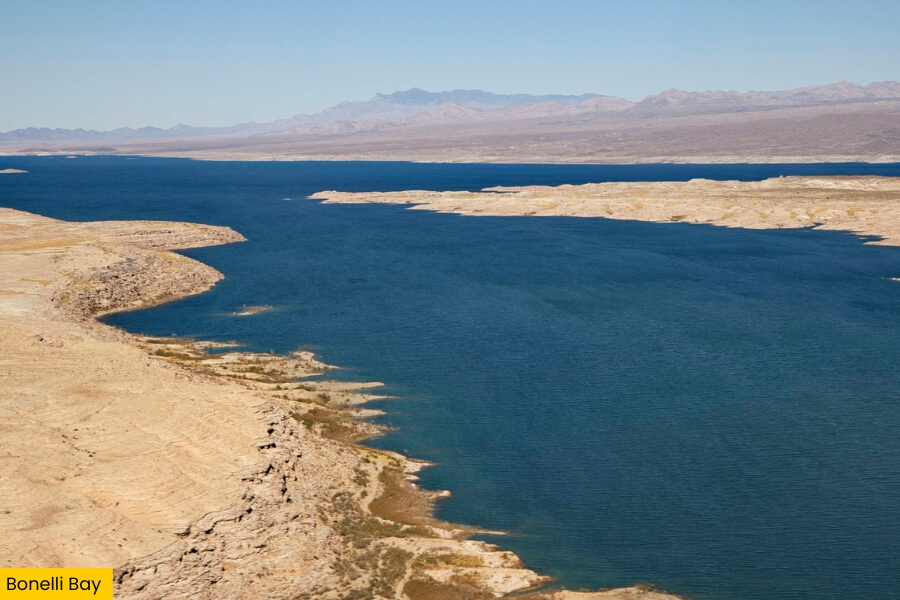
In a remote region near Temple Bar, Bonelli Bay offers a peaceful escape with rugged scenery, rocky shorelines, and a quieter atmosphere than the lake’s developed recreation areas.
The nearby Bonelli Landing can be reached by a maintained gravel road, although you should check for conditions and access to the bay’s shoreline before your visit, both of which are dependent on the weather.
Here, you can enjoy the desert scenery, take photographs, have a picnic, fish for striped bass with a valid fishing license, and hop on kayaks and paddleboards.
The bay is located in a quiet, primitive area of the lake, meaning no stores or developed visitor facilities, so do bring all the water and supplies you need!
3. Kingman Wash
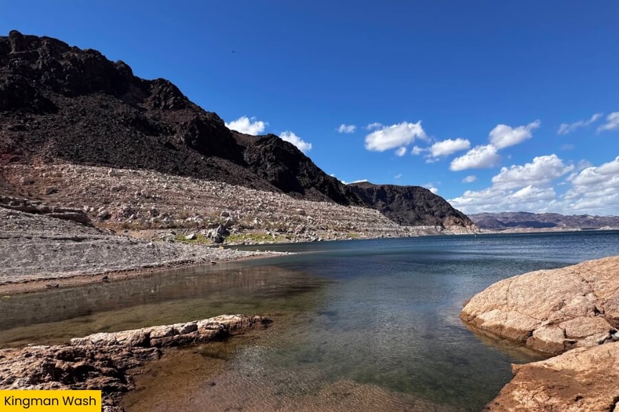
Kingman Wash is another awesome Lake Mead detour, especially if you want to be close to the water and camp beneath the stars with incredible views of the surrounding desert mountains.
Located on the Arizona side of Lake Mead National Recreation Area, this scenic shoreline can be accessed via Kingman Wash Road, a roughly 3.6-mile dirt road branching off US Highway 93.
The area is known for its primitive camping in designated areas, plus kayaking, fishing, and swimming in permitted shoreline areas.
Although basic vault toilets are available, there aren’t many developed campground amenities here, so don’t forget your drinking water and supplies!!
4. Hoover Dam Lookout
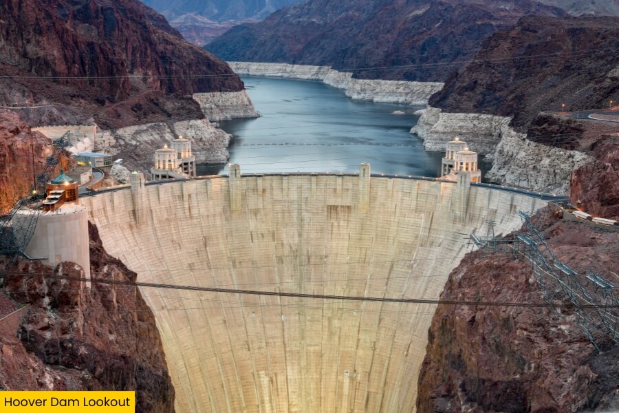
After the bumpy drive to Kingman Wash, head to the Hoover Dam Lookout for one of the most jaw-dropping views on your Lake Mead road trip, with the massive concrete dam stretching across Arizona and Nevada.
Completed in 1936, Hoover Dam stands 726 feet tall and holds back the Colorado River to create Lake Mead, the largest reservoir in the United States by water capacity.
From designated lookout areas along the dam’s approach roads, you can photograph the high concrete walls, the bright blue water of Lake Mead, and the Mike O’Callaghan–Pat Tillman Memorial Bridge, which rises about 900 feet above the Colorado River.
For an even better look, walk across the dam itself, where you can stand with one foot in Nevada and the other in Arizona!
5. Historic Railroad Hiking Trail
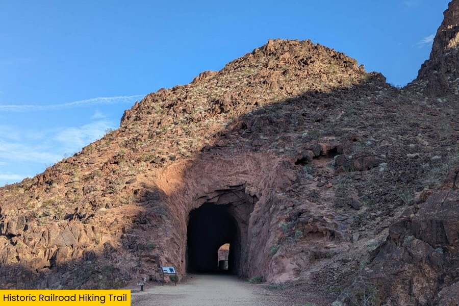
Once you’ve admired Hoover Dam, stretch your legs on the Historic Railroad Hiking Trail, a 7.5-mile round-trip hike that follows an old railroad route once used to transport construction supplies to the dam in the 1930s.
Starting near the Lake Mead Visitor Center in Boulder City, Nevada, this mostly flat, gravel trail takes you through five railroad tunnels, each measuring around 25 feet wide.
Along the way, you’ll enjoy incredible views of Lake Mead’s blue water, Boulder Basin, and the surrounding desert and possible wildlife, promising plenty of photo opportunities!
The trail doesn’t have any shade for the first 1.5 miles, so bring plenty of water, wear sunscreen, and try hiking early in the morning to beat the desert heat.
6. Boulder Beach
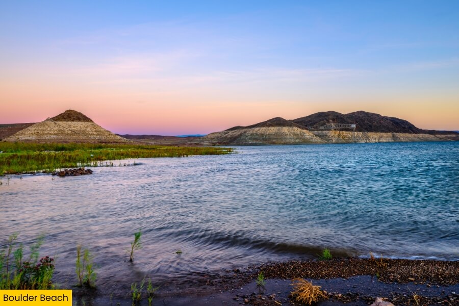
If you’re ready to cool off after hiking through those railroad tunnels, Boulder Beach is one of the most popular swimming spots at Lake Mead, located near Boulder Basin on the Nevada side of the lake.
Unlike a typical sandy beach, this shoreline is covered in small rocks and pebbles, so bring water shoes if you plan to wade into the lake for a refreshing swim.
You can also enjoy kayaking, jet-skiing, picnicking, or simply relaxing beside the water, with beautiful views of the surrounding desert terrain and boats cruising across Boulder Basin.
The nearby Boulder Beach Campground has 140 campsites, making this a great spot to spend the night, not to mention the beach is especially pretty when you stick around for the sunset!
7. Callville Bay
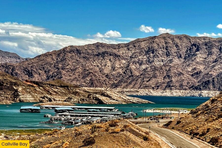
The road winds deeper into Lake Mead National Recreation Area toward Callville Bay, a popular boating destination on the Nevada side of the lake, about 30 minutes away from Boulder Beach.
This scenic marina is best known for its houseboat rentals, making it a fantastic place to explore Lake Mead’s hidden coves, towering rock formations, and secluded swimming spots without having to rush back to shore.
And, if you ever find yourself in need of a top-up of supplies, snacks, and souvenirs, drop by the seasonal Gift Shop & Grill – Topside, open daily from May through September.
For a little history, Callville Bay takes its name from the nearby settlement of Callville, established in 1864 as a Colorado River port before the rising waters of Lake Mead eventually submerged its remains.
8. Redstone Dune Trail
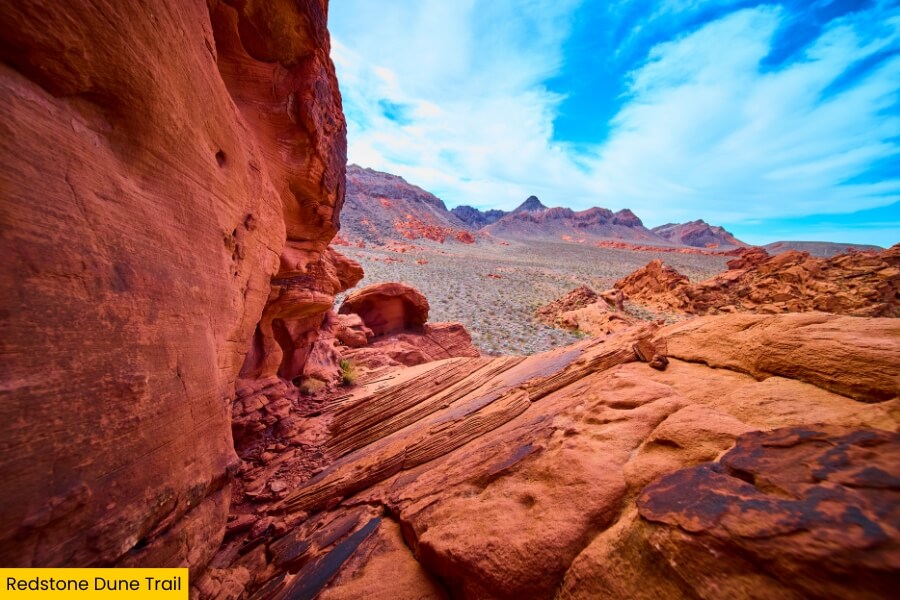
Trade Callville Bay’s blue water for fiery red sandstone at the Redstone Dune Trail, a short but must-visit stop along Northshore Road, at marker 27.
This easy 0.5-mile trail takes you through a collection of bright red sandstone formations, where ancient dunes hardened into rock roughly 140 million years ago, creating swirling patterns, rounded boulders, and narrow passages that are incredibly fun to photograph.
Follow the trail to see the rock formations, spot tiny desert plants growing in the cracks, and admire the striking contrast between the rusty-red sandstone and the pale desert mountains.
The trail starts at the Redstone Picnic Area, which has shaded picnic tables and restrooms, making it a convenient place to stop for lunch while exploring this scenic part of Lake Mead!
9. St. Thomas
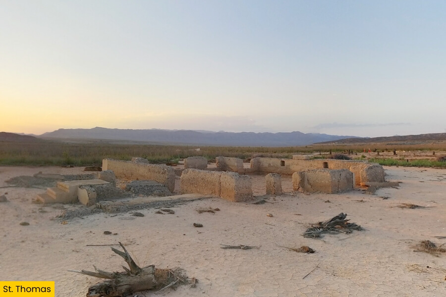
From the ancient red rocks of Redstone Dune Trail, continue along Northshore Road to your last stop, St. Thomas, a fascinating ghost town that disappeared beneath Lake Mead for decades before its ruins resurfaced after years of receding water levels.
Founded by Mormon settlers in 1865, this once-busy farming community had homes, a school, a post office, and even an ice cream parlor before residents abandoned it in 1938 as the rising waters of Lake Mead swallowed the town.
Today, you can explore the remains along the 2.5-mile round-trip St. Thomas Loop Trail, which takes you past crumbling concrete foundations, old roads, and scattered ruins.
Bring plenty of water and visit early in the morning, since the exposed lakebed offers almost no shade and summer temperatures can be brutal!
Related Posts