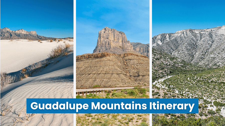
If you’re planning a trip to Guadalupe Mountains National Park, get ready for some seriously big adventures in one of the most surprising corners of West Texas.
Across more than 86,000 acres, towering limestone peaks, bright desert landscapes, narrow rock corridors, shady springs, and challenging trails offer plenty to explore.
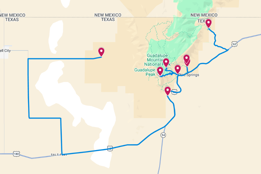
With so much to see, having a solid plan can help you spend less time figuring out where to go and more time enjoying the adventure.
Keep reading for a Guadalupe Mountains National Park itinerary packed with incredible hikes, historic stops, beautiful scenery, and helpful tips along the way.
1. Salt Basin Dunes
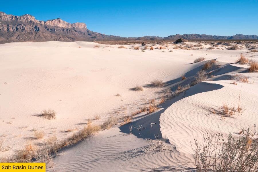
Salt Basin Dunes sits on the park’s western side, where bright white gypsum dunes spread across roughly 2,000 acres beneath the Guadalupe Mountains.
Some dunes rise about 60 feet high, shaped over thousands of years as wind carried gypsum left behind after an ancient lake dried up.
To see the area up close, hike the 3- to 4-mile Salt Basin Dunes Trail, wander across soft sand, photograph mountain views, and look for lizard tracks along the way.
2. El Capitan Viewpoint
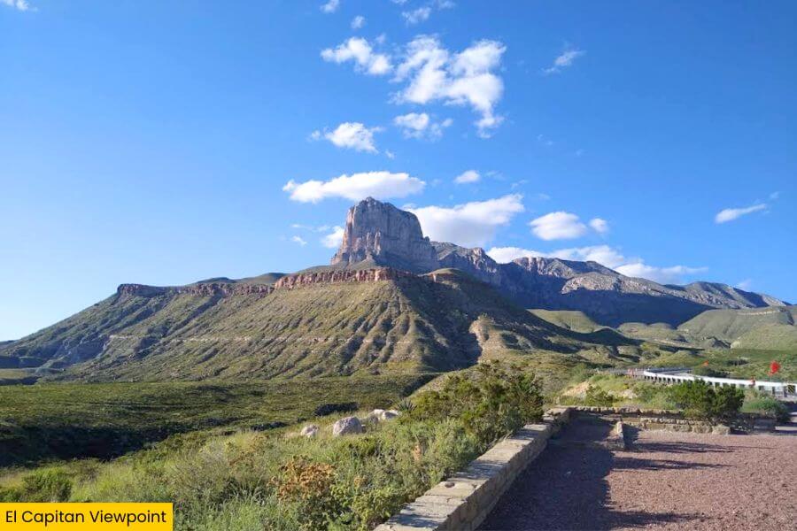
After exploring the white dunes, drive about 55 minutes along U.S. Highway 62/180 to El Capitan Viewpoint for one of the park’s most famous views.
The star here is El Capitan, a massive limestone cliff that rises to 8,085 feet and once served as an important landmark for travelers crossing the surrounding desert.
You can take gorgeous photos of it from the roadside pull-off, with Guadalupe Peak, the highest point in Texas, rising nearby, without tackling a single steep trail.
It’s especially scenic near sunset when the rocky slopes glow orange, pink, and purple, so if you have time later, consider coming back for another look.
3. Pine Springs Visitor Center
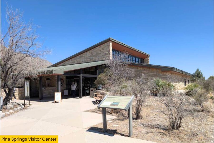
Once you’ve snapped your El Capitan photos, continue for 10 minutes to Pine Springs Visitor Center, one of the park’s most important visitor areas.
Located just off U.S. Highway 62/180, the center has park maps, trail information, exhibits on the area’s geology and wildlife, restrooms, and a small park store.
This is also a good place to talk with a friendly ranger before hiking Guadalupe Peak, helping you prepare and know what to expect along the way.
Before leaving, take a few minutes to fill your water bottles at the filling station, grab a few snacks, and get everything ready for the stops ahead.
4. Guadalupe Peak Trail
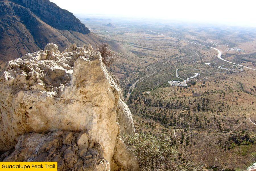
With your water bottles filled at Pine Springs, head to the nearby Guadalupe Peak Trail, the park’s signature hike to the state’s highest point.
This challenging 8.4-mile round-trip route gains about 3,000 feet, taking you up steep switchbacks, across desert slopes, and through a forest of pine and fir.
At the 8,751-foot summit, you’ll find a stainless-steel pyramid monument and sweeping views of El Capitan, the Chihuahuan Desert, and distant mountains.
Plan six to eight hours to complete the trek and start early to avoid the midday heat, but check the weather forecast since strong winds can make the trail dangerous.
5. Devil’s Hall Trail
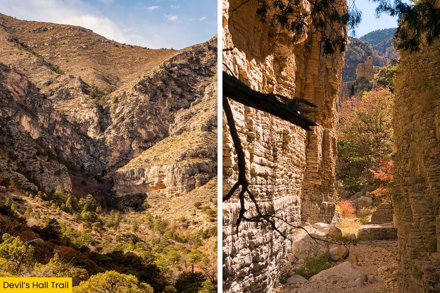
Next, trade the steep summit climb for the rocky Devil’s Hall Trail, which begins near Pine Springs Trailhead and takes you through a completely different landscape.
It’s about 4.2 miles round trip and gains roughly 548 feet, leaving the maintained trail before continuing through a wash filled with loose rocks and boulders.
One of the coolest sections is the natural rock staircase you scramble up before reaching Devil’s Hall, a narrow passage framed by towering canyon walls.
Allow about three to five hours, wear shoes with solid grip, and pause near the end to take in the dramatic view looking back through the winding route.
6. Frijole Ranch Museum
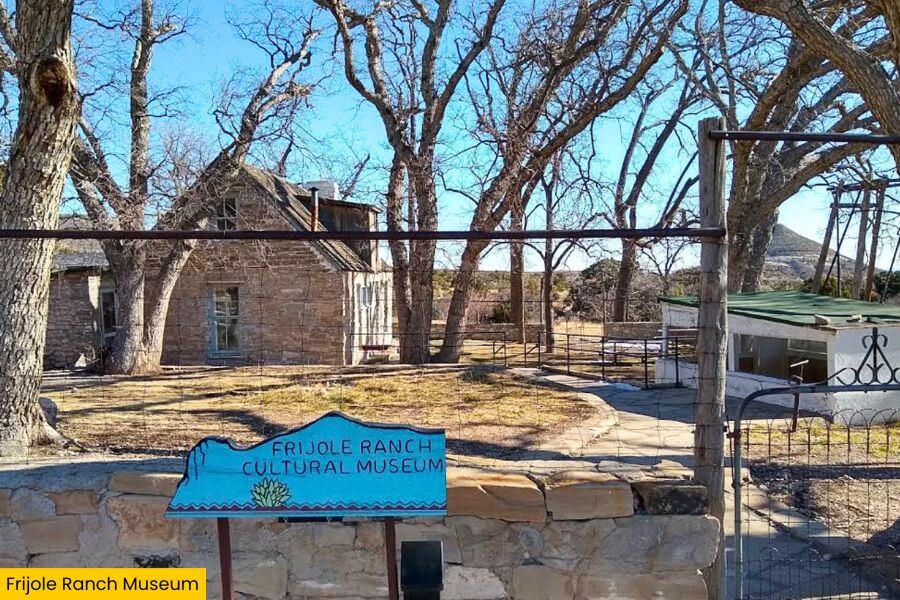
Now give your legs a well-earned break and drive about 10 minutes from Devil’s Hall Trail to Frijole Ranch Museum for a slower change of pace.
It dates back to 1876, when the Rader brothers built the ranch, and the Smith family later expanded it into a working farm where they grew crops and raised livestock.
Today, it serves as a museum with exhibits exploring the area’s Native American history, early ranching days, and how the land became a national park.
Outside, you can see the one-room schoolhouse and spring house, then enjoy the shady grounds where fresh spring water still flows through the courtyard.
7. Smith Spring Trail Loop

From Frijole Ranch Museum, keep exploring on foot with the 2.3-mile Smith Spring Loop, an easy-to-moderate trail that offers a refreshing escape into nature.
The route gains 402 feet and passes Manzanita Spring on the way to Smith Spring, where ponderosa pines, Texas madrones, and big-toothed maples create a shady oasis.
While you’re here, keep watch for mule deer, birds, and other wildlife that gather around the spring, especially during the cooler morning and evening hours.
With its towering trees, shady woodland, peaceful scenery, and nearby ranch history, the area offers a welcome change from Guadalupe’s rockier hikes.
8. McKittrick Canyon
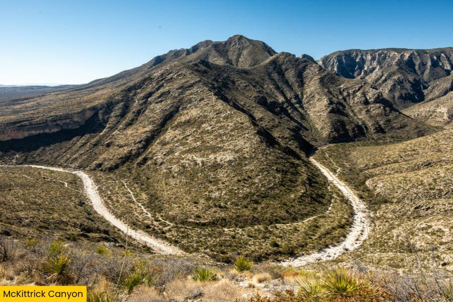
For your final stop, drive about 20 minutes from Smith Spring Loop to McKittrick Canyon, where a longer hike takes you deep between massive canyon walls.
Once you arrive, follow the McKittrick Canyon Trail 2.3 miles one way to the historic Pratt Cabin, a stone summer home built for geologist Wallace Pratt in the 1930s.
Continue another 1.1 miles to the Grotto, a shady cave-like spot with interesting limestone formations, and visit the nearby Hunter Line Shack before turning around.
Don’t overlook the canyon itself as you explore, with its colorful foliage, desert plants, and crystal-clear blue skies creating unforgettable scenery.
Related Posts