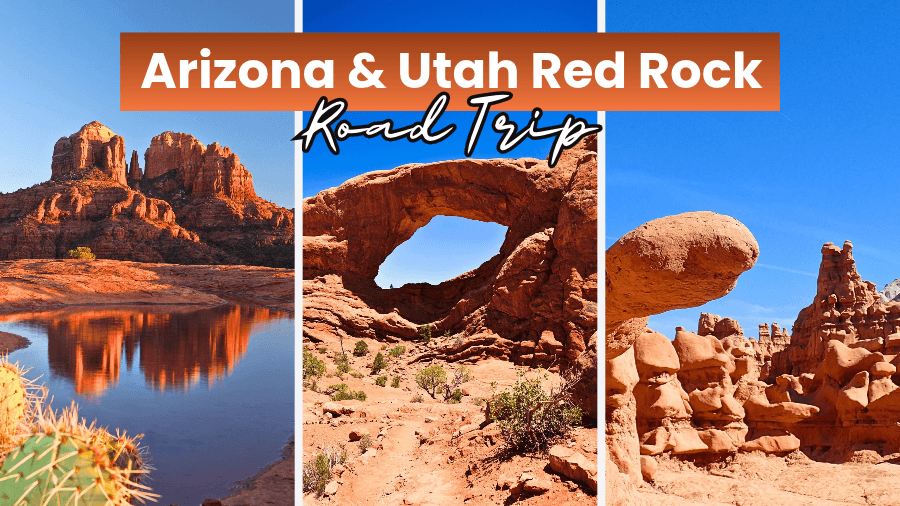
Imagine driving past towering red rock cliffs, giant sandstone arches, and strange mushroom-shaped formations that look like they belong on Mars instead of Earth.
That’s exactly what you’ll find on this incredible road trip through Arizona and Utah, where every turn reveals something even more bizarre than the last.
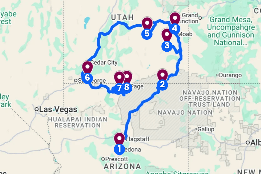
If you’ve ever dreamed of exploring another planet without leaving Earth, this Arizona and Utah red rock road trip might be the closest you’ll ever get!
1. Sedona, Arizona
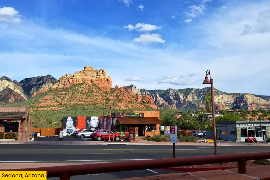
Sedona is a jaw-dropping desert town in northern Arizona, less than an hour’s drive from Flagstaff, famous for its massive red sandstone formations, towering rock spires, and stunning scenery.
One of its most famous landmarks is Cathedral Rock, a massive red rock formation that rises above the desert, while the Devil’s Bridge Trail takes you to Arizona’s largest natural sandstone arch.
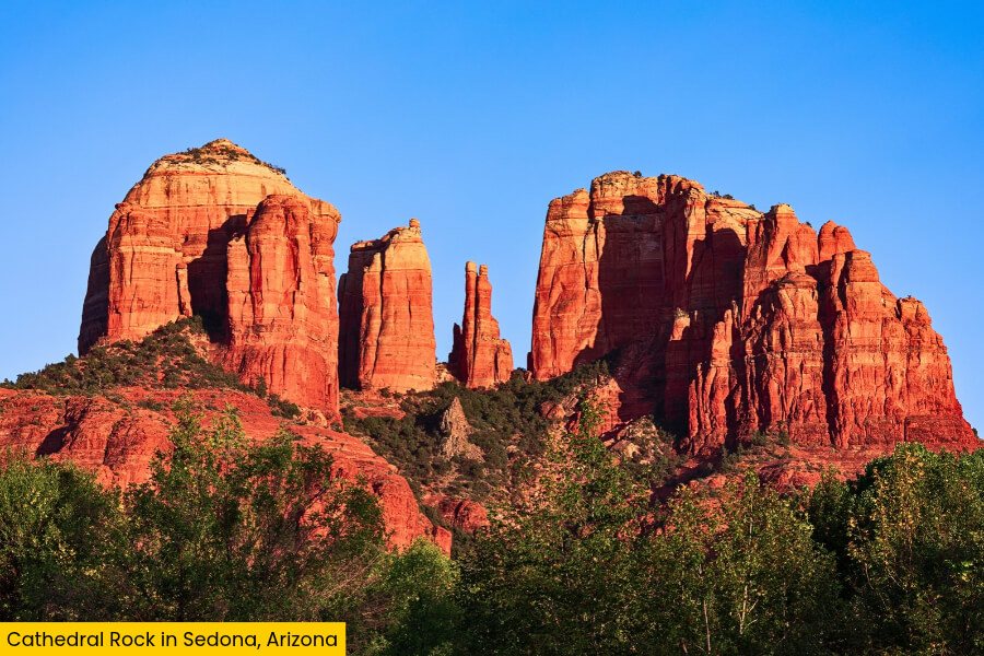
You can also hike the 3.7-mile round-trip Bell Rock Pathway, explore the ancient cliff dwellings at nearby Palatki Heritage Site, or drive the scenic 7.5-mile Red Rock Scenic Byway for incredible views.
Sedona is also famous for its four main energy vortex sites, including Airport Mesa and Boynton Canyon, where people come to meditate, watch sunsets, and soak up the incredible scenery.
2. Monument Valley, Arizona–Utah
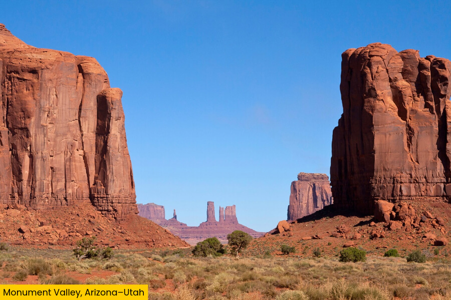
Crossing into the Arizona-Utah border, Monument Valley takes the red rock scenery to a whole new level with its giant sandstone buttes rising up to 1,000 feet above the flat desert floor, creating one of the most famous landscapes in the American Southwest.
Located within the Navajo Nation, Monument Valley Navajo Tribal Park is best known for its three towering formations called the Mittens and Merrick Butte, which you might recognize from classic Western movies like Stagecoach and The Searchers.
The best way to explore is along the 17-mile Valley Drive, a bumpy dirt road that winds past massive rock formations and famous viewpoints like John Ford’s Point and Artist’s Point.
For something extra special, book a Navajo-guided tour to explore restricted areas like Mystery Valley and learn about the land’s cultural importance.
3. Canyonlands National Park, Utah
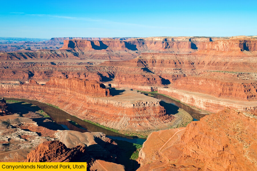
Continue your road trip with a 2.5-hour drive from Monument Valley to Canyonlands National Park.
Here you’ll see a massive maze of deep canyons, flat-topped mesas, and winding rivers carved by the Colorado and Green Rivers over millions of years.
Located about 30 miles southwest of Moab, this 337,598-acre park is divided into four districts, with Island in the Sky being the easiest to explore thanks to its paved scenic roads and incredible viewpoints.
Don’t miss the 0.6-mile round-trip Mesa Arch Trail, where a natural stone arch frames spectacular views of the canyon landscape below, or Grand View Point, which offers sweeping views of the canyon-filled desert stretching for miles.
For an even bigger adventure, drive the 100-mile White Rim Road, a remote four-wheel-drive route that circles below the towering cliffs of Island in the Sky.
4. Arches National Park, Utah
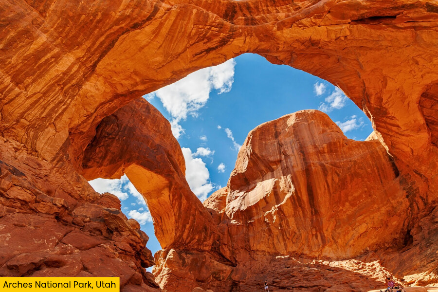
Just 30 minutes from Canyonlands, Arches National Park takes Utah’s red rock scenery in a completely different direction, with more than 2,000 natural sandstone arches scattered across 76,679 acres of desert near Moab.
Its most famous landmark is Delicate Arch, a freestanding arch that you can reach on a 3-mile round-trip hike with 480 feet of elevation gain.
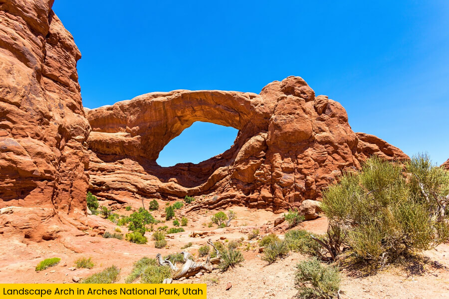
For more incredible sights, check out Landscape Arch, one of the longest natural arches in the world at 306 feet, or walk the easy 0.6-mile round-trip trail to Double Arch, where two massive sandstone arches share the same rock foundation.
You can also drive the Arches Scenic Drive, stopping at Balanced Rock, the Windows Section, and Park Avenue to see giant rock towers, narrow fins, and gravity-defying formations.
5. Goblin Valley State Park, Utah
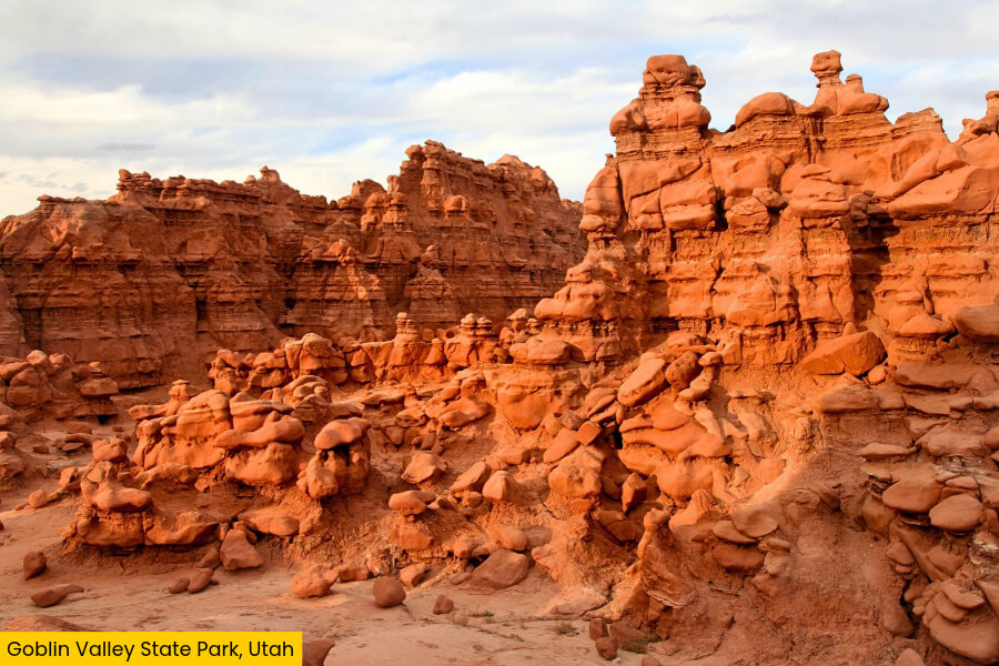
Leaving the famous arches behind, Goblin Valley State Park takes things in a seriously weird direction with thousands of mushroom-shaped sandstone rocks called hoodoos, which look like tiny aliens scattered across the desert.
Located about 1 hour and 35 minutes from Moab in central Utah, this park is famous for its three valleys of goblins, where you can wander freely among bizarre rock formations shaped by millions of years of wind and water erosion.
For an unforgettable adventure, hike the 1.5-mile round-trip Goblin’s Lair Trail to discover a massive sandstone chamber hidden inside the cliffs, or explore the 1.5-mile Carmel Canyon Loop for sweeping views of the valley.
The park is also an International Dark Sky Park, making it an incredible spot to see the Milky Way after sunset.
6. Zion National Park, Utah
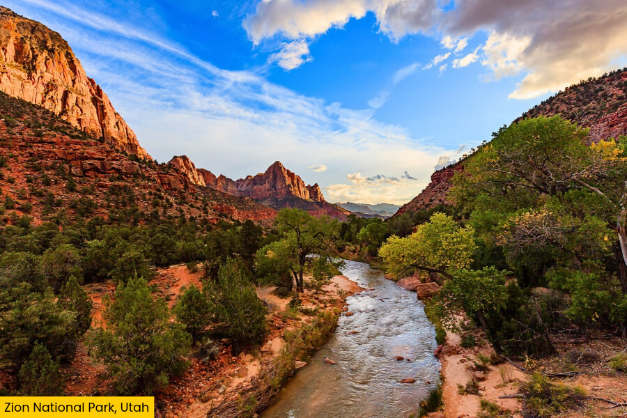
After exploring Goblin Valley’s strange rock formations, Zion National Park brings a dramatic change of scenery with massive red and cream-colored sandstone cliffs rising up to 2,000 feet above a narrow canyon carved by the Virgin River.
Located near Springdale in southwestern Utah, this 148,000-plus-acre park is famous for Angels Landing, a thrilling 5.4-mile round-trip hike featuring steep drop-offs, metal chains, and jaw-dropping views that require a permit to complete.
Another must-do is The Narrows, where you can wade through the Virgin River between towering canyon walls that squeeze to just 20 feet apart in some sections.
For something easier, drive along the scenic Zion-Mount Carmel Highway to see Checkerboard Mesa and pass through a 1.1-mile tunnel carved straight through the sandstone cliffs.
7. Vermilion Cliffs National Monument, Arizona
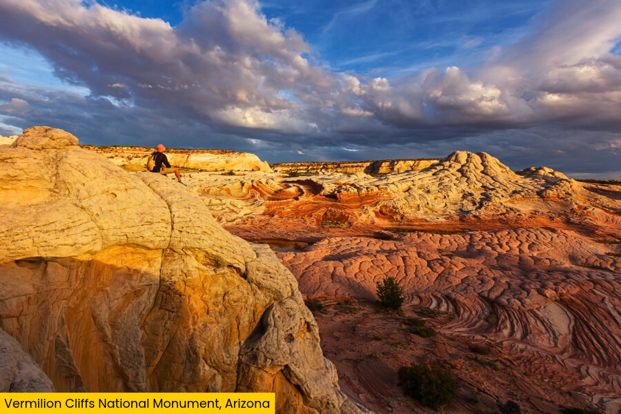
Crossing back into northern Arizona, Vermilion Cliffs National Monument cranks up the color with swirling sandstone hills, striped rock formations, and towering red cliffs stretching across 280,000 acres of remote desert near the Utah border.
Its biggest attraction is The Wave, a stunning sandstone formation in Coyote Buttes North, where smooth layers of orange, red, and yellow rock twist into patterns that look like they belong on another planet.
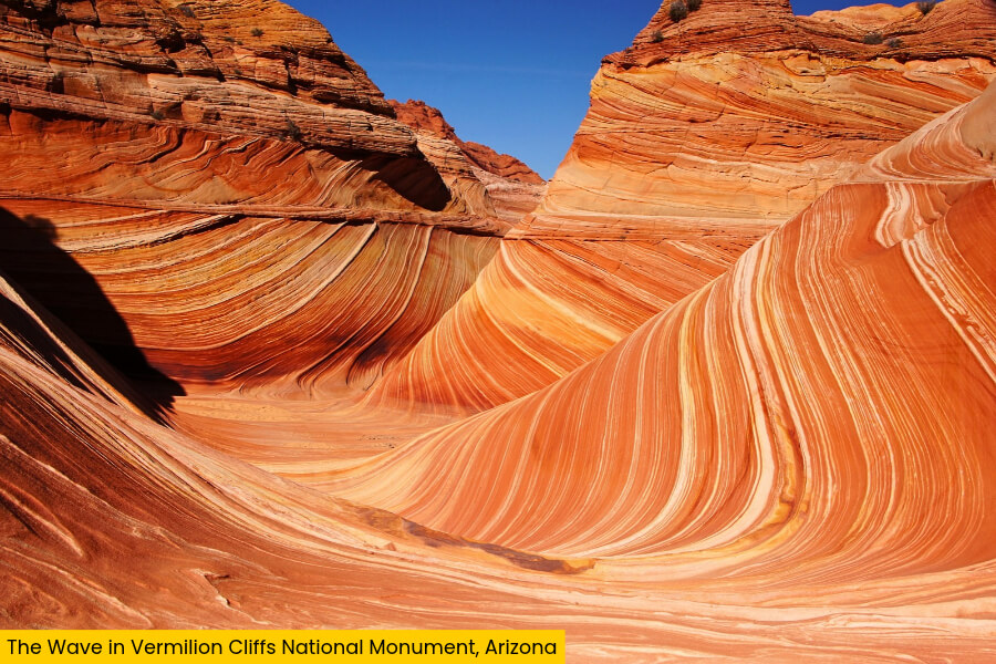
Reaching this incredible spot requires a highly competitive permit and a challenging 6.4-mile round-trip hike across unmarked desert terrain, but the reward is one of the most photographed rock formations in the Southwest.
You can also explore the colorful sandstone formations of White Pocket, spot endangered California condors near the Vermilion Cliffs, or admire the 3,000-foot-tall cliffs along House Rock Valley Road.
8. Horseshoe Bend, Arizona
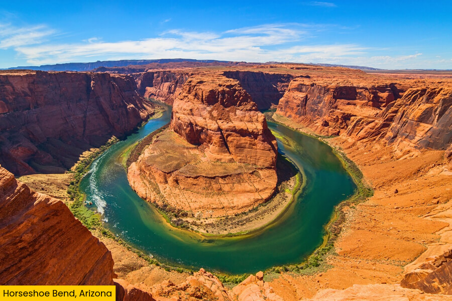
To wrap up this incredible red rock road trip, Horseshoe Bend delivers one last jaw-dropping sight: a giant horseshoe-shaped curve in the Colorado River, surrounded by towering sandstone cliffs that plunge roughly 1,000 feet to the water below.
Located just 10 minutes from Page, Arizona, this famous landmark is part of Glen Canyon National Recreation Area and features a massive river bend carved through ancient Navajo Sandstone over millions of years.
Getting to the overlook is easy thanks to a 1.5-mile round-trip trail from the parking lot, where you’ll find sweeping views of the emerald-green Colorado River wrapping around a giant sandstone formation.
For the best photos, visit around sunset when the surrounding cliffs glow orange and red, creating an unforgettable final view of Arizona’s otherworldly desert landscape.
Related Posts